
Twenty kilometers west of Jerusalem lies the No Man's land, which is a 50-km2 area that separated Israel from the West Bank before the 1967 war. On the borders of this area there used to be three Palestinian villages: Imwas, Beit Nuba, and Yalu. According to the Bible, Imwas (Emaeus in the Bible) is the site of the second appearance of Jesus after the resurrection and 3 km west of it lies the famous monastery of Al-Latrun. The area used to be a buffer zone separating the Israeli and Arab forces in the aftermath of the 1948 war. Immediately following the 1967 war, Israeli forces completely destroyed the villages and evicted the residents. Few of the villagers managed to return later and settle in the areas close to where their houses used to be.
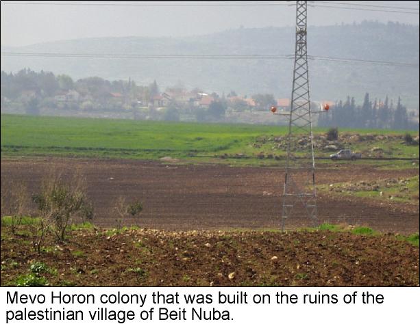
Successive Israeli governments had considered the Latrun area as an area of strategic importance that needed to be firmly in their control. Therefore, demolishing the villages and depopulating them was not enough. A military outpost was erected in 1969 on the ruins of the village of Beit Nuba and in 1974 it was transformed into a settlement called Mevo Horon (see photo). Moreover, in 1976, and on the relics of Yalu and Imwas, a recreational area called Canada Park was established by the Jewish National Fund. Over 20 km2 were reserved for Canada Park for planting trees while the Palestinian farmers who returned to their destroyed villages were denied the right to work their land. . Moreover, in 1976, and on the relics of Yalu and Imwas, a recreational area called Canada Park was established by the Jewish National Fund. Over 20 km were reserved for Canada Park for planting trees while the Palestinian farmers who returned to their destroyed villages were denied the right to work their land.
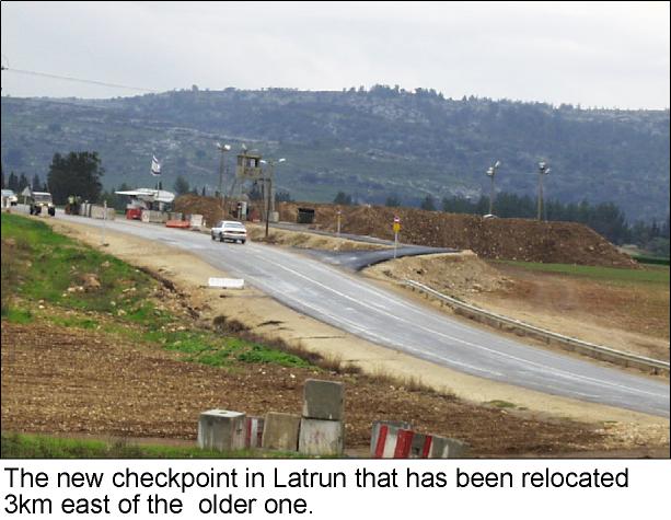
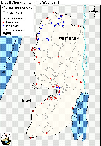
With the advent of the Oslo agreements, Israel erected checkpoints all over the West Bank and Gaza to control the movement of Palestinians into Israel, see map. One such checkpoint was erected east of Canada Park on the main highway linking Jerusalem to Al-Ramlah. However, on the 15th of January 2000, the Israeli authorities moved it 3.5 km east (see photo). This move sparked strong protest from the Palestinians because of the implications it entails. First, the new checkpoint bares the Palestinian farmers from reaching some of their lands. The old checkpoint also was an obstacle but the new one makes the prohibited area larger (see map). Secondly, and more importantly, the relocation of the checkpoint can be interpreted as an attempt at annexing the western part of the area to Israel. As mentioned earlier, Israel considers the Latrun area strategic and moving the checkpoint eastwards is like declaring that the border between it and the West Bank is further east than it actually is. As a consequence, Israel contemplates the annexation of Canada Park and Mevo Horon in the final status negotiations. It is worth mentioning here that Burger King, the famous fast-food chain, has refused to permit its Israeli fanchisee to open a restaurant in the Latrun area.
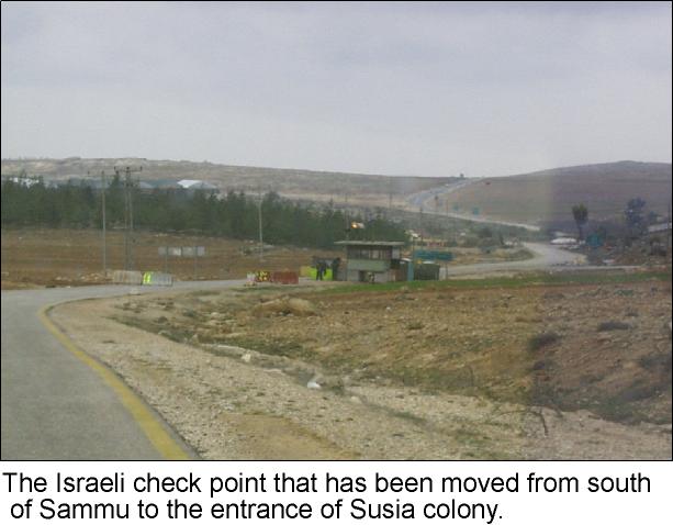
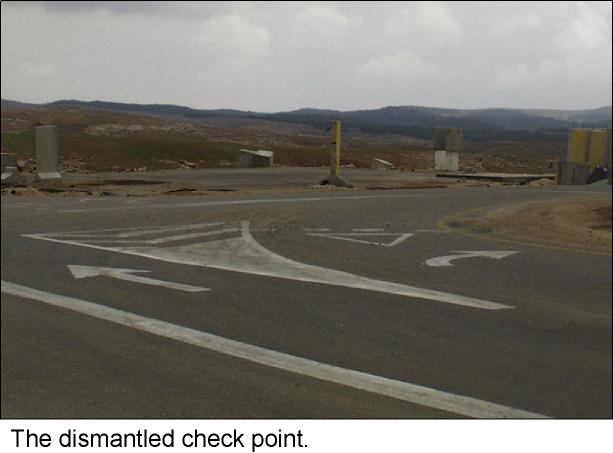
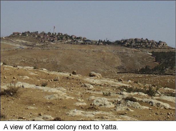
On the 14th of February 2000, another attempt at redrawing the boundary between Israel and the West Bank was spotted by our field surveyors who were on an assignment south of Hebron. They were confronted by a new checkpoint close to the settlement of Susiya (see photo). As they headed 2 km further south, they found a dismantled checkpoint (see photo). Hence the first checkpoint they had encountered was in fact a relocation of the dismantled one (see map). This relocation again amounts to an Israeli endeavor to redefine the boundary in the south to incorporate parts of the West Bank into Israel. In fact, not long ago, scores of families living in the southern outskirts of the West Bank were forcibly evicted by the Israeli authorities As they headed 2 km further south, they found a dismantled checkpoint . Hence the first checkpoint they had encountered was in fact a relocation of the dismantled one . This relocation again amounts to an Israeli endeavor to redefine the boundary in the south to incorporate parts of the West Bank into Israel. In fact, not long ago, scores of families living in the southern outskirts of the West Bank were forcibly evicted by the Israeli authorities (click here for more).
These unilateral acts contradict the agreements signed with the Palestinians as well as the UN resolutions 242 and 338 upon which the whole peace process is based. Theoretically, and according to the Oslo agreements, the boundaries of the envisaged Palestinian State is one of the items to be determined in the final status negotiations. Furthermore, in these agreements both parties pledge not to 'initiate or take any step that will change the status of the West Bank and the Gaza Strip pending the outcome of the permanent status negotiations' (The Israeli-Palestinian Interim Agreement on the West Bank and the Gaza Strip, September 28, 1995). However Israel continues to create facts on the ground and to prejudice the outcome of the final status negotiations to its liking.
Prepared by:
The Applied Research Institute – Jerusalem


