
الإعلان عن إقرار مخطط لتوسعة طريق رقم 437 المار في قرية جبع
الانتهاك: مخطط لتوسيع طريق استعماري. الموقع: طريق رقم 437 المار بقرية جبع. تاريخ الانتهاك:...

Declaration of expanding road number 437 that crosses Jaba’-Ramallah
Violation: A new expansion work for a colonial road Location: Road '437 Date: 25/02/2013 Details:...
“At a cost of USD 1.1 Billion”
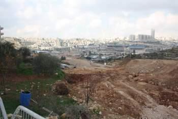
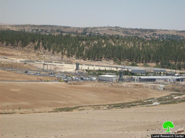
Israel takes over 234 Dunums of Lands of Beit Safafa and Sharafat to construct the Israeli bypass road No. 50
The Israeli 'Moriah Jerusalem Development Company' along with the Israeli Municipality of Jerusalem and...

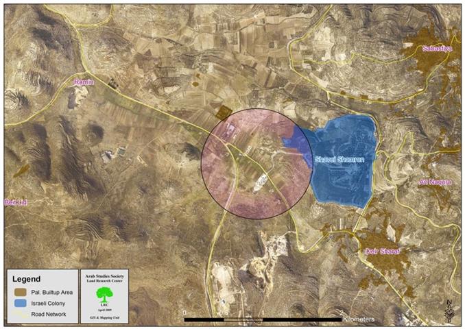
مجلس التنظيم الأعلى يقر مخطط تفصلي لتعديل طريق 57 المار بقرية رامين
الحدث: الاحتلال الإسرائيلي يقر مخطط لتعديل طريق رقم 57 المار في قرية رامين. تاريخ الحدث:...
Opening a colonial road in Al Khader
Violation: opening a 50 meters long, 4 meters wide colonial road connecting Hanania...
Opening a Colonial Road in Al Khader
Violation: opening a 50 meters long, 4 meters wide colonial road connecting Hanania and...
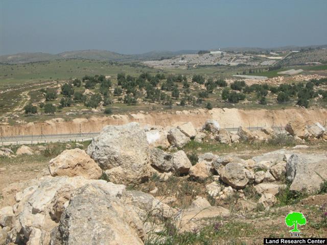
Opening a Road in Tqu’
Violation: opening a road in agricultural lands. Location: Roman and Fathura, 50 meters away from...
شق طريق في اراضي زراعية في قرية تقوع
الانتهاك : شق طريق في اراضي زراعية في تقوع. الموقع: منطقة رومان وفاثورة تبعد 50م...
مركز أبحاث الأراضي يرد على قانون إباحة شق الطرق للمستوطنين لحماية أراضي الدولة
مرة أخرى يثبت الاحتلال الإسرائيلي للأراضي الفلسطينية بأنه احتلال استيطاني تهجيري إحلالي ... لديه برنامج...
LRC Condemns a New Israeli Colonial Law…
Once again, the Israeli Occupation arrogantly reveals its true nature as a colonial entity which intends...

Connecting Colonies in Wadi Qana with a road Network
Violation: a road network to devour more Palestinian lands. Location: western Deir Istiya. Perpetrators: the West...
ربط المستوطنات الإسرائيلية في واد قانا بشبكة طرق واحدة – محافظة سلفيت
الانتهاك: ضياع المزيد من أراضي المزارعين لصالح شبكات طرق جديدة. موقع الانتهاك: منطقة الشعب غرب...

التهام المزيد من الأراضي الفلسطينية لشق طريق استيطاني جديد في قرية دير شرف
بالتزامن مع ما أشيع مؤخراً من قيام الاحتلال بإخلاء حاجز بيت ايبا ونصب بدل...
Israeli Occupation Devours More Land from Deir Sharaf to Establish a New Colonial Road
In synchronization with the removal of the Beit Iba checkpoint and replacing it with a new...
شق شارع استعماري لصالح مستعمرة شيلو
قام مجموعة من المستعمرين معززين بثلاث جرافات إسرائيلية صباح الرابع عشر من كانون ثاني 2009...

The Construction of A Colonial Road Benefiting Shilo Colonists in Qaruit Village
On the 14th of January, 2009 a group of colonists from the colony of Shilo used...
The Israeli Bypass Road System in the Occupied Palestinian Territory
The 'Israeli bypass road' term was first used directly after the Israeli occupation of the West...

شق طريق استعماري على حساب أراضي بلدة الظاهرية
شق طريق استعماري على حساب أراضي بلدة الظاهرية / محافظة الخليل: قامت جرافات الاحتلال...
The construction of a New Colonial Road South of the Town of Adh Dhahiriya
Israeli occupation forces bulldozed a new colonial road connecting between Wadi Al Khalil Crossing, located south...
شق شارع استعماري اسرائيلي بمحاذاة قرى غرب دورا يسبب تصدعات في مساكن قرية سكة
بدأت قوات الاحتلال الإسرائيلي العمل في شق الشارع الاستعماري في نهاية عام 2007، من...

The construction of a new Israeli Colonial road west of Dura frontline villages
Israeli occupation forces are currently constructing a colonial road west of the Front Line Villages in...
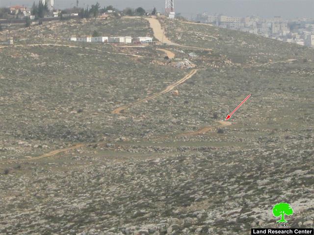
أعمال جارية لشق طريق استيطاني جديد لصالح مستوطنة ” حاجاي”
الموقع: واد المغير ' خلة القدس' – الريحية / محافظة الخليل تاريخ الاعتداء: 23/12/2007....

سلطات الاحتلال تشرع في استكمال مقطع من الطريق الرابط الذي يربط طريق 5 بمدخل مستعمرة ارائيل
شرعت سلطات الاحتلال مؤخرا تحديدا بعد انتهاء مؤتمر انابولس في شهر تشرين ثاني الماضي...
Israeli Occupation Authorities commence the construction of a new section of Bypass Road Number 5
In November 2007, the Israeli Occupation Authorities started razing lands in the villages of Marda and...
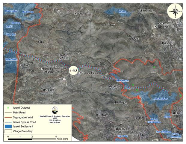
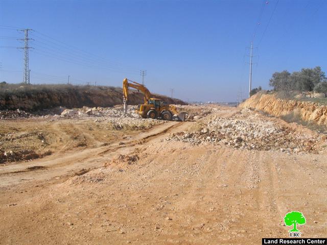
The Prohibition of Palestinian access on Israeli Bypass Road #443
''Everyone lawfully within the territory of a State shall, within that territory, have the right to...
LATEST NEWS

ملاخي هشالوم: أكثر من مجرد بؤرة استيطانية … مشروع تهويد وتوسّع اسرائيلي
........................................................

العدالة المؤجلة ورأي بلا تنفيذ: من قرار المحكمة إلى واقع الضم
........................................................

Striking Wave of Escalating Settler Attacks and Forced Displacement in the Palestinian Jordan Valley
........................................................

تصاعد اعتداءات المستوطنين وعمليات التهجير القسري في الأغوار الفلسطينية
........................................................
