• About The Project
  • Palestine in Century
  • Selected Maps
  • Glossary
  • About ARIJ
  • About LRC
  • By Year
    • Case Studies By Year
    • Daily Report By Year
Sunday, May 11, 2025
POICA
No Result
View All Result
  • Home
  • Settlements
    • New Israeli Settlements
    • Settlement Expansion
  • Israeli Violations
    • Agriculture
    • Confiscation
    • Demolition
    • Environment
    • Eviction of Palestinians
    • Settlers Attacks
  • Bypass Roads
  • Israeli Plans
  • Segregation
    • Checkpoints
    • Closure
    • Separation Plans
  • Military Orders
  • Reports
    • Daily Report
    • Monthly Report
    • Quarterly Report
No Result
View All Result
POICA
No Result
View All Result

Israeli settlers construct a new bypass road on lands of Kisan village

March 8, 2016
in Bypass Roads
Israeli settlers construct a new bypass road on lands of Kisan village


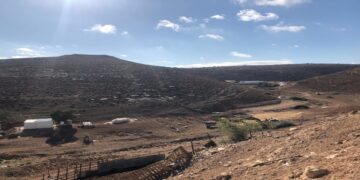
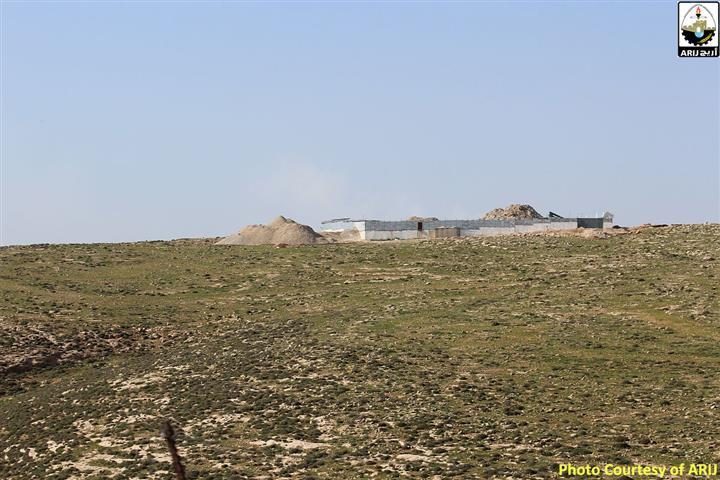
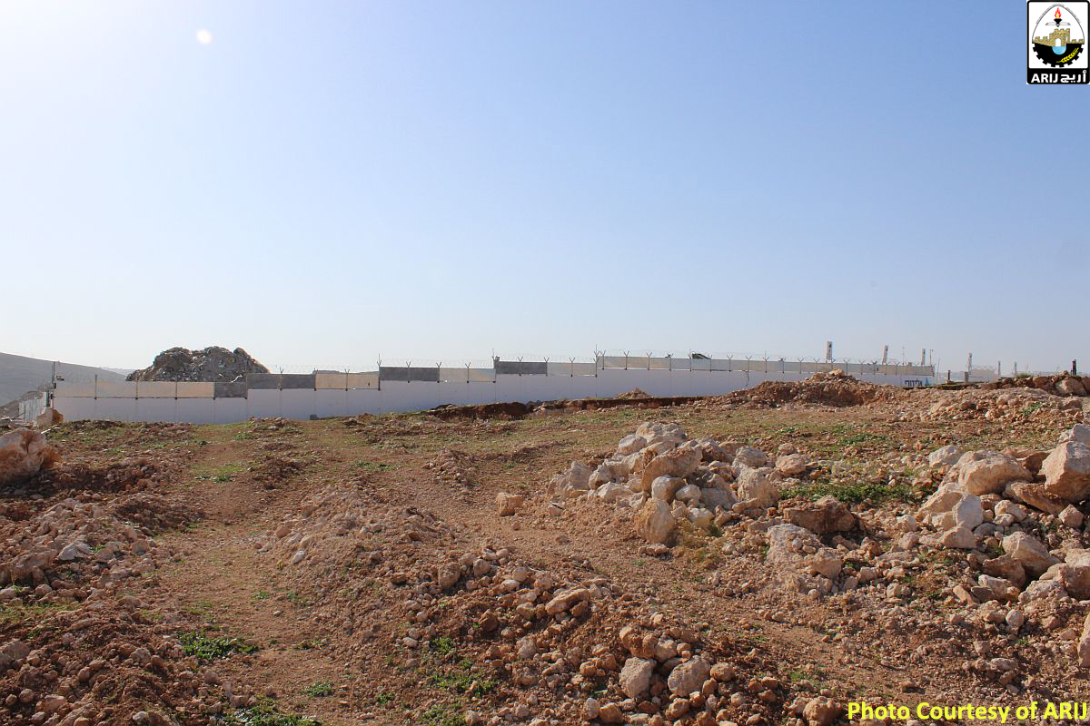
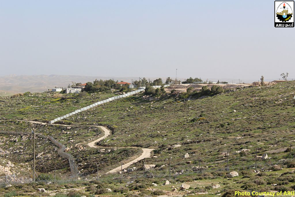
Israeli settlers, escorted by the Israeli occupation Army, constructed recently a 1.5 kilometers new bypass road on Palestinian land belonging to Kisan village, southeast of Bethlehem city. The road has been constructed for the use of a newly constructed outpost on a hill adjacent to Ibei Nhal outpost, to its south and aimed to facilitate the movement of Israeli settlers living in the newly constructed outpost. Once completed, settlers will be able to reach Kisan main road within 1 minute drive, whereas before they have to travel to Ibei Nahal outpost first and then to the main road, a matter of 5 minutes’ drive. One can see the road line clearly, dissecting the lands of Kisan villlage mountains. See Photos 1-4


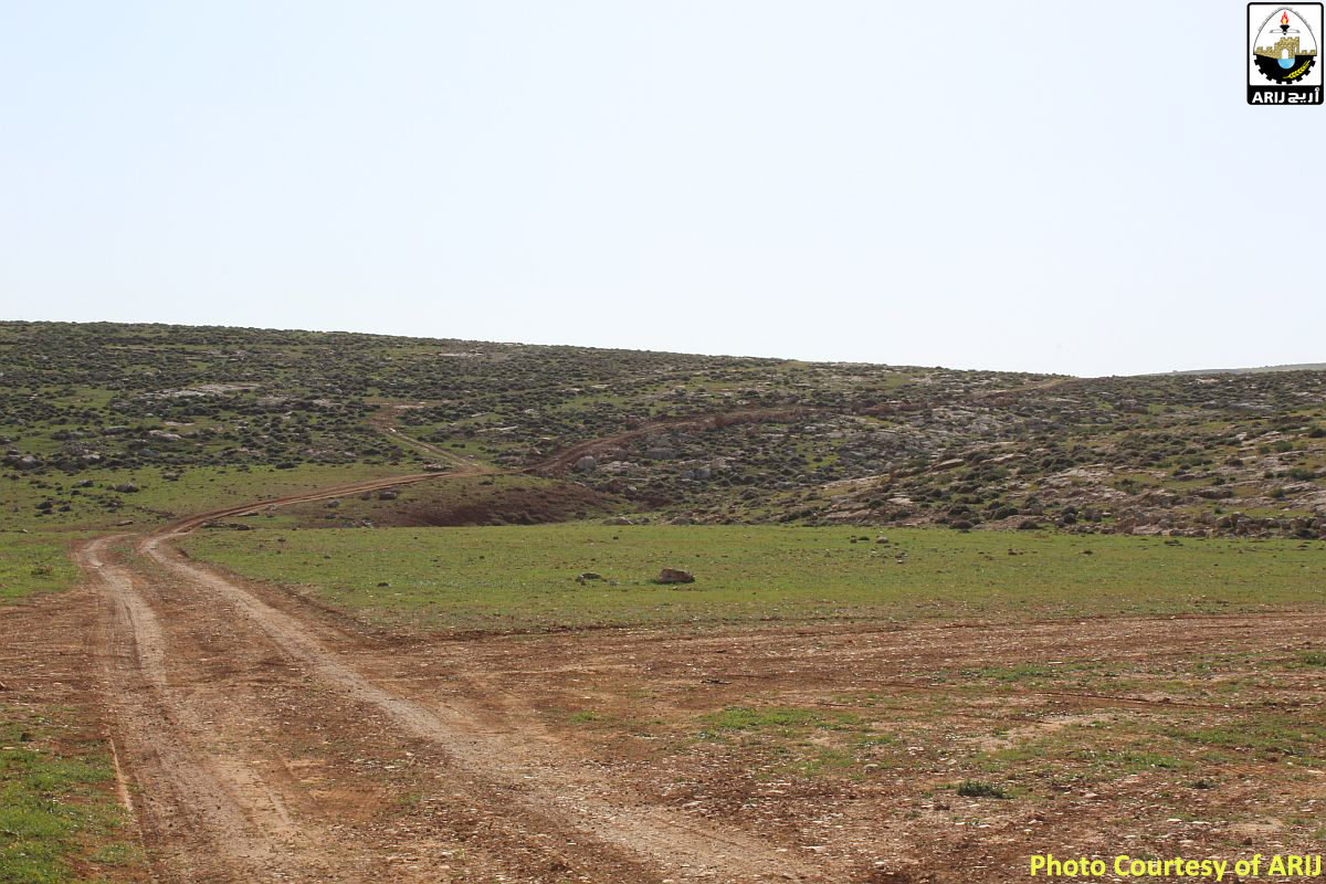
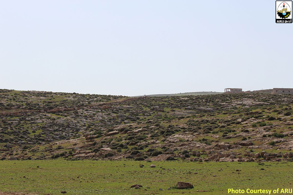
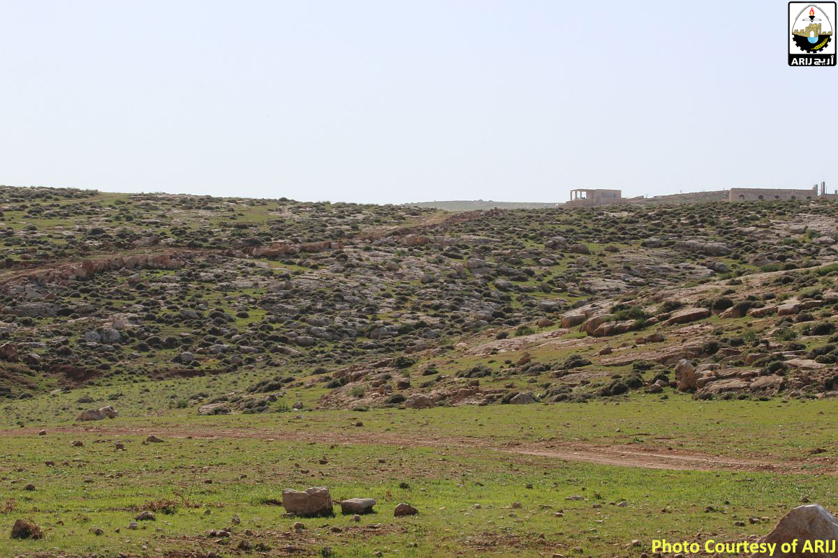
Photos 1-4: The newly constructed bypass road and settlement outpost

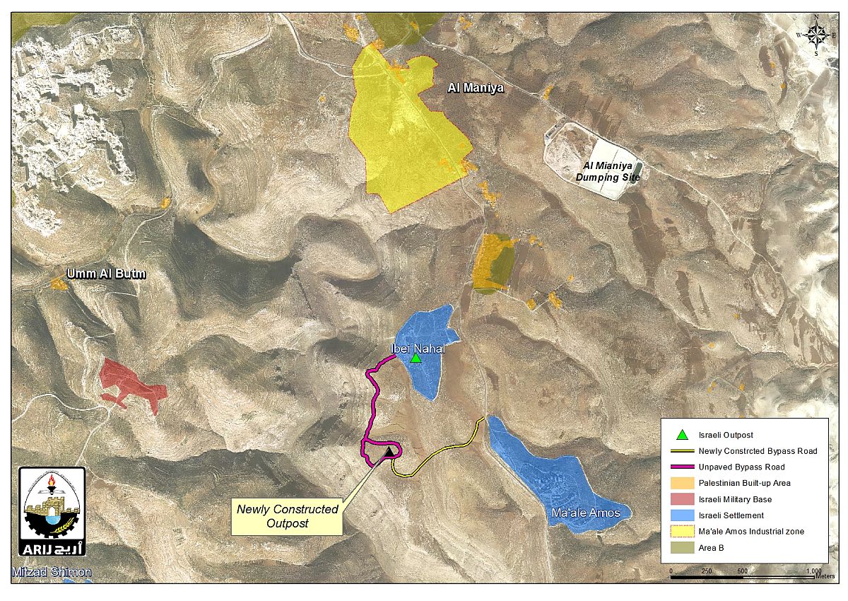
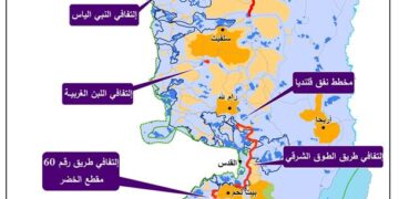
Map 1: The Israeli colonial activities taking place on lands of Kisan Village


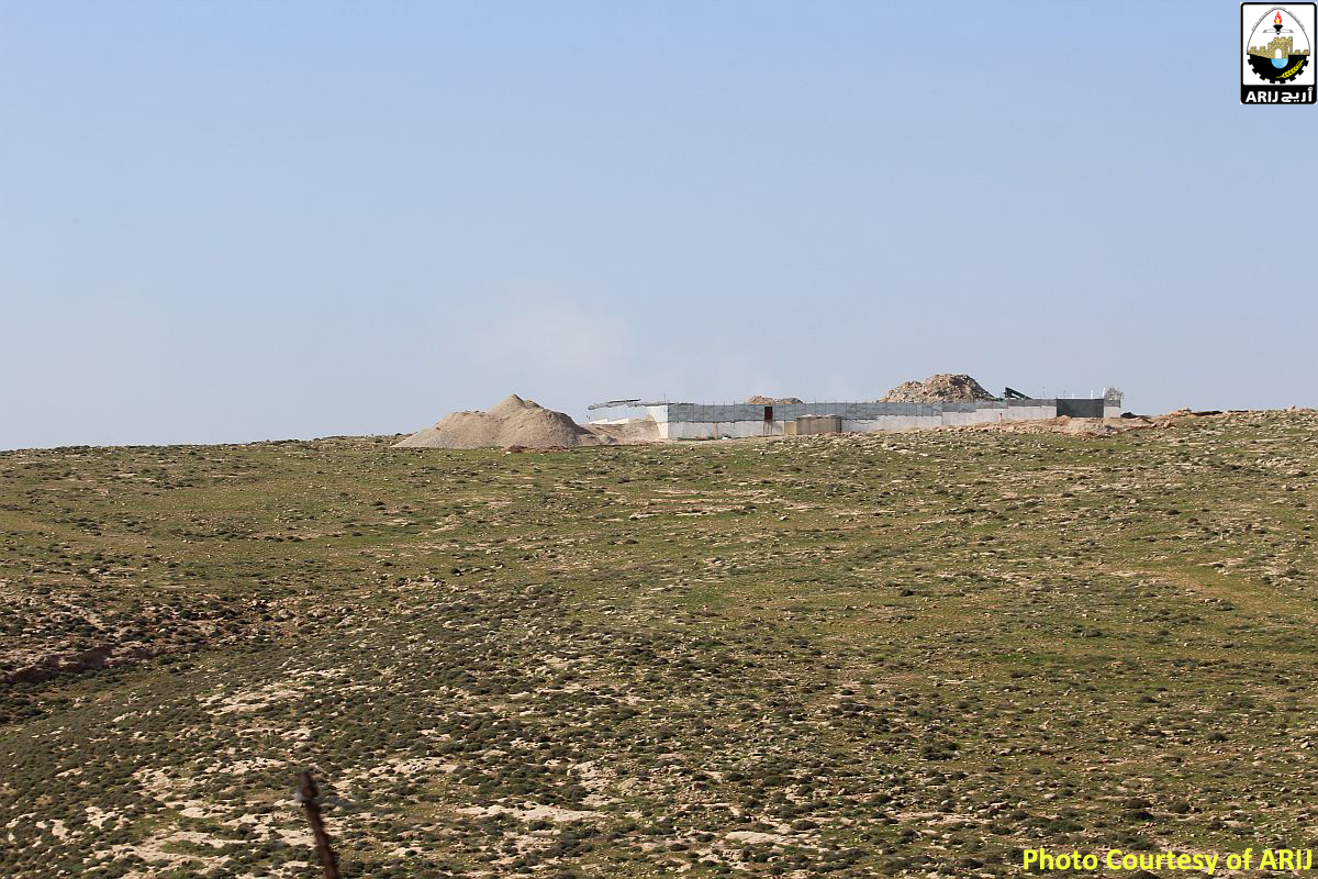
Head of Kisan Village Council, Mr. Hussein Ghazal, stated that settlers living in the new outpost started terrorizing residents of the village in order to prevent them from accessing the area. The lands surrounding the outpost are excellent for sheep grazing and agriculture; and villages for so long took their sheep to graze there; however, settlers living in the newly constructed outpost started their season of terrorizing Palestinians coming near to their location, by letting their dogs at residents to attack them. These attempts aim at cutting off villagers' means of livelihood in order to force them move out of the lands which are adjacent to the illegal Israeli outpost. This in turn has caused a state of fear and despair among villagers who feel that they are about to lose their lands due to the continuous settlers’ attacks. Note that in late 2014, settlers occupied the hill adjacent to Ibei Nahal outpost and started building in the area. Today, five structures can be seen in the site. 

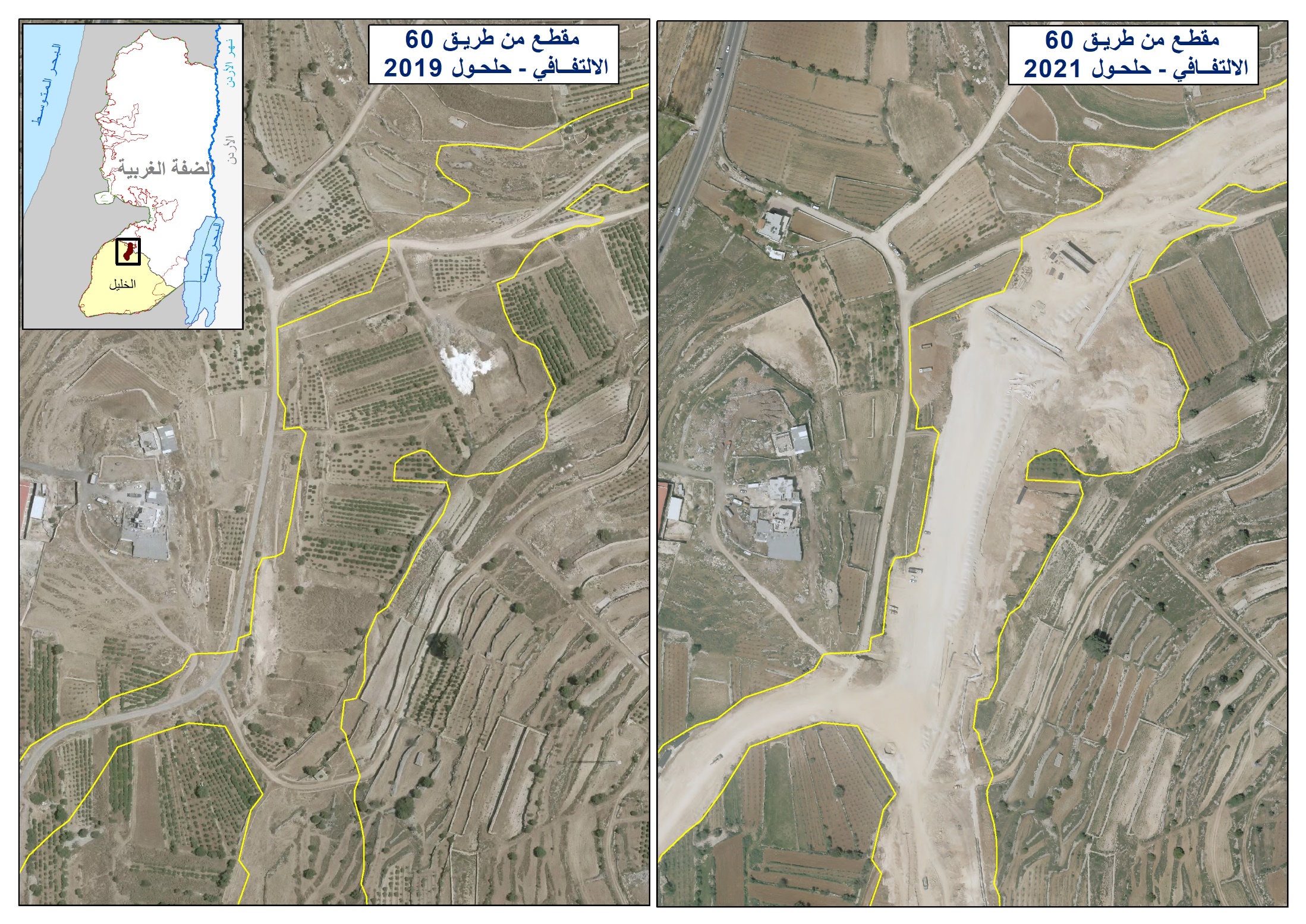
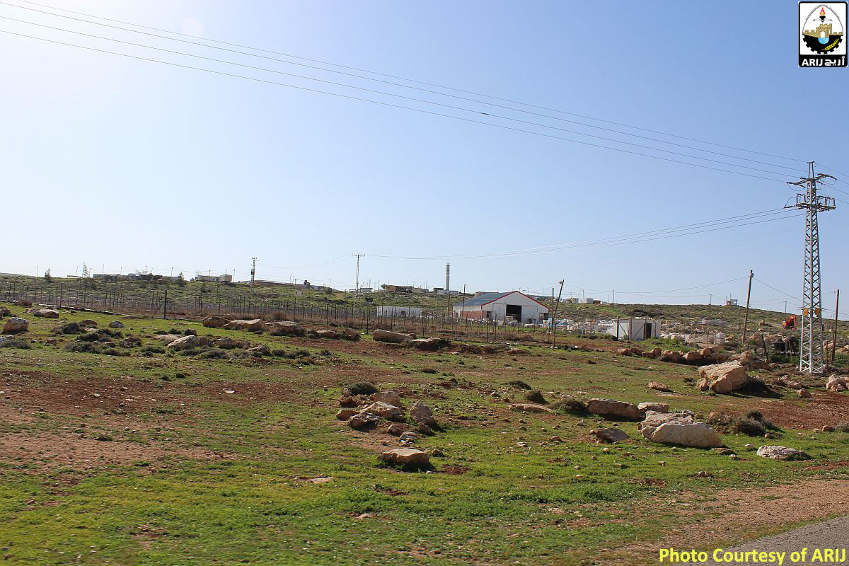
In the meantime, the Israeli machinery and bulldozers are working in the “Ma’ale Amos” industrial zone at the western entrance of Kisan village. Vast tract of Kisan village’s land has already been flattened for that purpose. See Photos 5-8


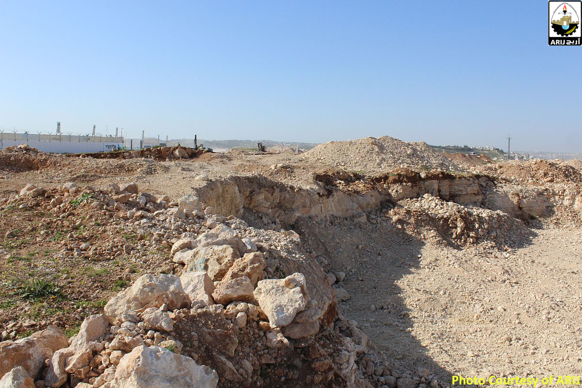
Photos 5-8: The construction of the Ma'ale Amos Industrial Zone is ongoing


Note that on the 8th of March 2015, the Israeli bulldozers escorted by the Israeli occupation Army stormed Kisan village southeast of Bethlehem city and started razing land in the area belonging to local residents from the village. Local residents were notified that time that their razed land and the area around (nearly 600 dunums of land) had been confiscated under the pretext of “State Land” in 2004. For more information, click here: Land Leveling in Kisan Village South of Bethlehem Governorate

Ma’ale Amos Industrial Zone on lands of Kisan Village – southeast of Bethlehem city

In August 1986, the so-called head of the Israeli Supreme Planning Council in the occupied Palestinian territory has approved plan No. 413/T which states the construction of an Industrial zone on lands of Kisan Village. According to the plan,  570 dunums were designated for the establishment of the industrial zone. Photo 1 is a copy of Ma’ale Amos Industrial Zone Plan 413/T:-

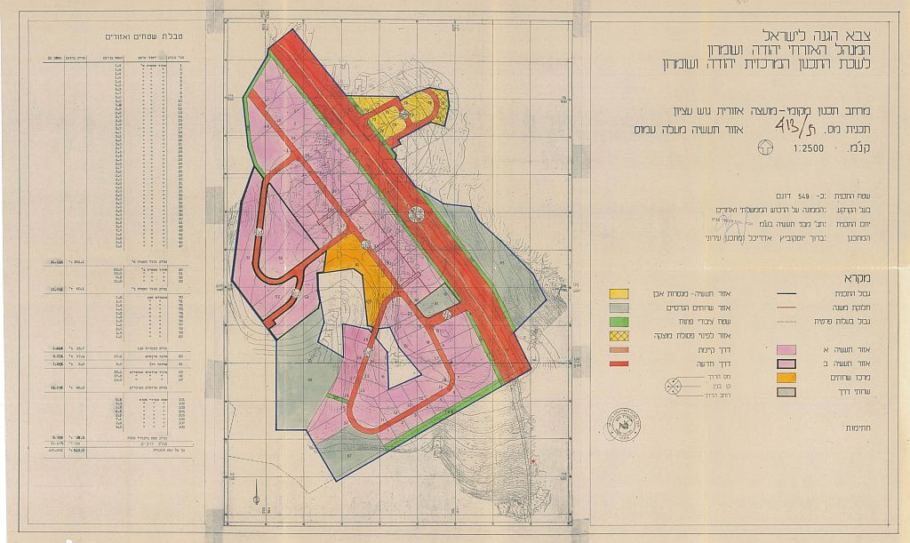
Photo 9: Israeli plan No. 413/T of Ma'ale Amos Industrial Zone


Israeli colonial expansion taking place at Ma’ale Amos settlement

ARIJ fieldworkers were able to observe the expansion taking place in Ma’ale Amos Settlement. Major settlement infrastructure has been built within the settlement preparing for new apartments to be added to the settlement.

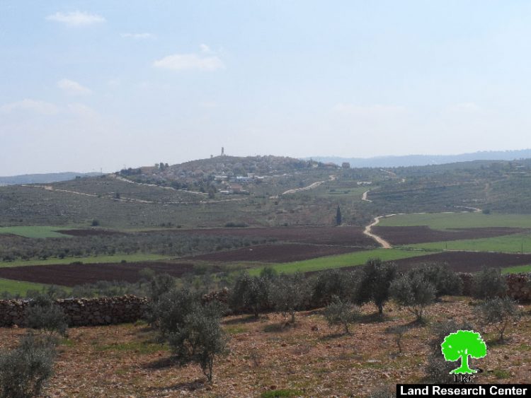
With regard to Ma’ale Amos settlement, an Israeli cabinet resolution number 1038 dated on the 24th of August 1980, and resolution Number 356, dated on the 18th of January 1981, the Israeli cabinet approved the establishment of the settlement of Ma’ale Amos along with two other settlements in the occupied Palestinian territory, on lands previously declared by the Israeli Occupation Army as “State Land”. The Israeli cabinet also assigned the World Zionist Organization (WZO‐SD) with the comprehensive responsibility for the establishment of the three settlements that time[1]. See Photos 10-11


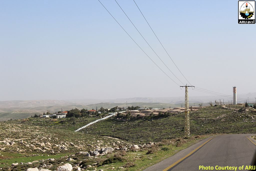
Photos 10-11: Expansion at Ma'ale Amos Settlement


The Ma’ale Amos settlement was established with regard to Plan No. 413/1 which stated the construction of 300 housing units. Today, Ma’ale Amos settlement occupies a total land area of 511 and is home to more than 350 Israeli settlers. Moreover, in the year 1999, an outpost to the northwest of Ma’ale Amos settlement was established on lands of Kisan Village under the name, Ibei Nahal. Today the outposts is home to 35 families and contains around 40 mobile homes in addition to other structures (recreation and services). Photos 12-13


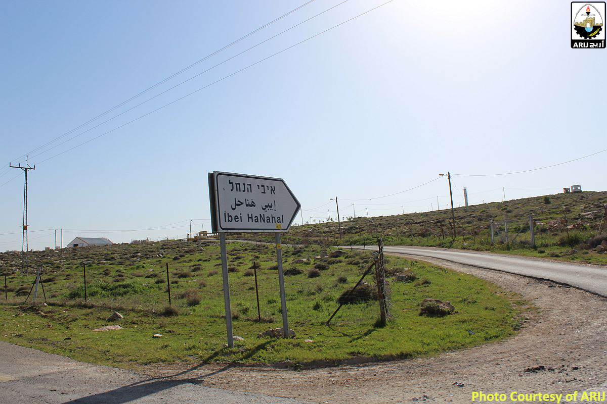
Photos 12-13: Ibei Nahal settlement oupost

To conclude

The never-ending expansionist plans taking place on lands of kisan village aim at reshaping the area for the favor of creating new facts on the ground. Israel plans to reintegrate the so-called “Gush Etzion East” settlement bloc–which includes the Illegal Israeli settlements of Nekodim, Tekoa', Kfar Eldad, and Ma'ale 'Amous along with a number of outposts in the area (around 35,000 dunums), with a combined population of more than 5000 Israeli settlers–with new lands allocated for expansionist purposes.


[1] Secret Israeli Database Reveals Full Extent of Illegal Settlement. read more:
http://www.haaretz.com/secret-israeli-database-reveals-full-extent-of-illegal-settlement-1.266936


Prepared by:
The Applied Research Institute – Jerusalem

Recommended For You

شق طريق استيطاني جديد يهدد سبل العيش في قرية بردلة

by arij
January 13, 2025
0
New Israeli Settlement Road Construction and Its Impact on the Village of Bardala in the Jordan Valley

المكان: تجمع بردلة- محافظة طوباس/الأغوار الزمان: سبتمبر 2024 الجهة المتضررة: أهالي قرية بردلة والقرى المجاورة الجهة المعتدية: ما تسمى بالإدارة المدنية الاسرائيلية الانتهاك: شق طريق استيطاني تفاصيل الانتهاك:...

Read moreDetails

New Israeli Settlement Road Construction and Its Impact on the Village of Bardala in the Jordan Valley

by arij
December 31, 2024
0
New Israeli Settlement Road Construction and Its Impact on the Village of Bardala in the Jordan Valley

  The construction of new settlement infrastructure in the occupied Palestinian territories has profound implications for local communities, threatening livelihoods, increasing isolation, and impairing socio-economic vulnerabilities. This case...

Read moreDetails

الطرق الالتفافية الاسرائيلية وأثرها على البيئة الفلسطينية

by arij
January 16, 2024
0
الطرق الالتفافية الاسرائيلية وأثرها على البيئة الفلسطينية

  الاعتداءات الإسرائيلية على الفلسطينيين لا تقتصر على التنكيل بالافراد، أو وضع القيود على الحركة والتنقل، أو استهداف المنازل والمنشات، أو مصادرة الأراضي، أو نهب الموارد والمصادر الطبيعية،...

Read moreDetails

Israeli Colonists Take Over an Agricultural Road in Ya’bad town / Jenin Governorate

by arij
January 12, 2022
0
Israeli Colonists Take Over an Agricultural Road in Ya’bad town / Jenin Governorate

  Violation: Taking over an agricultural road for the favor of colonization. Location: Ya’bad town / Jenin Governorate. Date: October 17th 2021. Perpetrators: Mevo Dotan Colony. Victims: Farmers...

Read moreDetails

New Colonial road to Be Opened on Sarta Village lands / Salfit Governorate

by arij
July 17, 2021
0
New Colonial road to Be Opened on Sarta Village lands / Salfit Governorate

  Violation: Opening a new Colonial Roads. Location: Sarta village/ Salfit Governorate. Date: June 1st 2021. Perpetrators: The Israeli Illegal Industrial Colony (Barkan). Victims: Farmers from the village....

Read moreDetails
Next Post
Israel to transform 2202.7 dunums from Salfit into “State Lands”

قرار بتحويل 2202.7 دونم من أراض جنوب نابلس الى أراضي دولة

LATEST NEWS

الأراضي الفلسطينية بين الذرائع الأمنية والأطماع الاستيطانية – “الأمن، الآثار، والطبيعة كحجج لاقتلاع الفلسطينيين من أراضيهم”

by arij
April 15, 2025
0

........................................................

الطرق الالتفافية الاسرائيلية وأثرها على البيئة الفلسطينية

انتهاك للطبيعة والهوية في الأراضي الفلسطينية المحتلة

by arij
March 17, 2025
0

........................................................

Israel Advances Settlement Plan on Ancient Olive Groves on lands of Beit Jala city, Violating International Law and depriving Palestinians their lands

إسرائيل تمضي قدمًا في مخطط استيطاني جديد على أراضي مدينة بيت جالا، في انتهاك للقانون الدولي وحرمان الفلسطينيين من أراضيهم

by arij
April 29, 2025
0

........................................................

Israel Advances Settlement Plan on Ancient Olive Groves on lands of Beit Jala city, Violating International Law and depriving Palestinians their lands

Israel Advances Settlement Plan on Ancient Olive Groves on lands of Beit Jala city, Violating International Law and depriving Palestinians their lands

by arij
April 29, 2025
0

........................................................

flag_yellow_lowEU-PfP-Logo

This website has been produced with the assistance of the European Union. The contents of this publication are the sole responsibility of ARIJ & LRC and can in no way be taken to reflect the views of the European Union.

© 2025 Copyright ARIJ . All Rights reserved. .

No Result
View All Result
  • Home
  • Settlements
    • New Israeli Settlements
    • Settlement Expansion
  • Israeli Violations
    • Agriculture
    • Confiscation
    • Demolition
    • Environment
    • Eviction of Palestinians
    • Settlers Attacks
  • Bypass Roads
  • Israeli Plans
  • Segregation
    • Checkpoints
    • Closure
    • Separation Plans
  • Military Orders
  • Reports
    • Daily Report
    • Monthly Report
    • Quarterly Report

© 2025 Copyright ARIJ . All Rights reserved. .