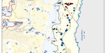
Wadi Fukin village, 4346 Dunums of land is one of the nine Palestinian villages located in the western part of Bethlehem Governorate. It lies 8 km away from Bethlehem center and approximately 16 km from East Jerusalem, and 0.5 km from the 1949 Armistice Line (the Green Line). The village houses a total population of 1,322 (PCBS 2012). Wadi Fukin village is one of the many Palestinian villages depopulated and destroyed during the 1948 war and was later rebuilt in the early 1970s when its original residents returned back to their lands to rebuilt their village.
Due to the semi mountainous lands, Wadi Fukin has rich agricultural lands, good grazing areas and open spaces to utilize, which reflect the good productivity of Grapes, fruits, Almond, and olive Oil.
The Israeli Colonial Activities in Wadi Fukin
Today, two illegal Israeli settlements: Hadar Betar to the east and Betar Illit to the southeast are neighboring the Palestinian village of Wadi Fukin. The two settlements were established on lands originally owned by Palestinians and continued to expand throughout the years on the expense of the village lands.
More than that the Israeli bypass road #375 encircled the northeastern parts of Wadi Fukin where this bypass road stretches from the northeast of Wadi Fukin, heads towards the northeast and north edges of Betar Ellit and Hadar Betar settlements to finally intersect with bypass road 60 (the main north-south artery of the West Bank).
The Segregation Wall at Wadi Fukin
According to the latest Segregation Wall updated map issued by the Israeli Ministry of Defense on April 30, 2007, the entire western rural villages of Bethlehem was isolated from Bethlehem governorate, Battir and Husan villages were set to be entrapped in one ghetto, Nahalin in another Ghetto, Al Jaba to be included within Hebron governorate, cutting it off from Bethlehem Governorate and as for Wadi Fukin, it was excluded separately in an enclave between the Israeli settlements and the 1949 Armistice Line (Green Line).
Giv’at Hadagan………a New Neighborhood in Efrat Settlement Southwest of Bethlehem Governorate
‘Efrat and Gush Etzion are an integral, elementary and evident part of Greater Jerusalem,” Netanyahu said. “They are the southern gates of Jerusalem and will always be part of the State of Israel. We are building Efrat and Gush Etzion with enthusiasm, faith and responsibility; thus we are also building education.”
Israeli Prime Minister Benyamin Netanyahu at first day of new school year- Aseh Hayil elementary school- Efrat Settlement – August 27, 2012.
And he was on his promise …………….. three weeks later and on September 24, 2012, the Israeli Army bulldozers started working on a site planned to be what called “Giv’at Hadagan” settlement neighborhood located north of the illegal settlement of Efrat (one of Gush Etzion settlement bloc) southwest of Bethlehem Governorate.
The story of “Giv’at Hadagan” neighborhood which is few hundred meters away from Al-Khader village town started in 1990s when the Israeli occupation authorities planned for a neighborhood of 500 homes in the site to settle dozens of settler’s families. On December 2011, the Israeli Ministry of Housing and Construction issued tenders for the construction of 40 housing units in Giv’at Hadagan instead of the 40 illegal caravans that was installed in the site in the year 2000, where as mentioned before the construction of the 40 housing units is a part of a larger plan to build more than 500 housing units n the new neighborhood which is awaiting of the approval of the Defense Minister before issuing tenders for marketing and construction. Map 4 & Photos:
Photos 1-4: the illegal Israeli caravans in Giv’at Hadagan settlement outpost
To Conclude
From 1967 and following the Israeli military occupation of the Palestinian lands, Israel is refusing to comply to the International law rules and conventions and to the United Nation Security Council Resolutions UNSCRs concerning the building and expanding the Illegal Israeli settlements, confiscating private lands, and demolition of Palestinian houses and properties, despite the fact that their existence are Illegal and constitute a grave breach of the International Law. Furthermore, Israel is deliberately expanding the settlements and their outposts and building a new of them in an attempt to impose facts on the ground to undermine the opportunity for a future Palestinian state based on two -state solution.
Under the International law rules and the signed agreements between the Palestinian and Israeli, Israel is prohibited from confiscating and looting the private Palestinian lands or taking any steps leading to change the status on the ground which might result to undermine any chance for a future “just and lasting” peace process.
The Fourth Geneva Convention of 1949, Article 49, states: ‘The occupying power shall not deport or transfer parts of its own population into the territories it occupies.’ Article 53 of the Convention also prohibits ‘any destruction by the Occupying Power of real or personal property belonging individually or collectively to private persons, or to the State, or to other public authorities, or to social or cooperative organizations, is prohibited, except where such destruction is rendered absolutely necessary by military operations.’
United Nations Security Council Resolution 452 (1979) which calls upon ‘the Government and people of Israel to cease, on an urgent basis, the establishment, construction and planning of settlements in the Arab territories occupied since 1967, including Jerusalem.’
United Nations Security Council Resolution 465 (1980) which ‘Determines that all measures taken by Israel to change the physical character, demographic composition, institutional structure of status of the Palestinian and other Arab territories occupied since 1967, including Jerusalem, or any part thereof, have no legal validity and that Israel’s policy and practices of setting parts of its population and new Immigrants in those territories constitute a flagrant violation of the fourth Geneva convention relative to the protection of civilian persons in time of war and also constitute a serious obstruction to achieving a comprehensive, just and lasting peace in the Middle East.’


