
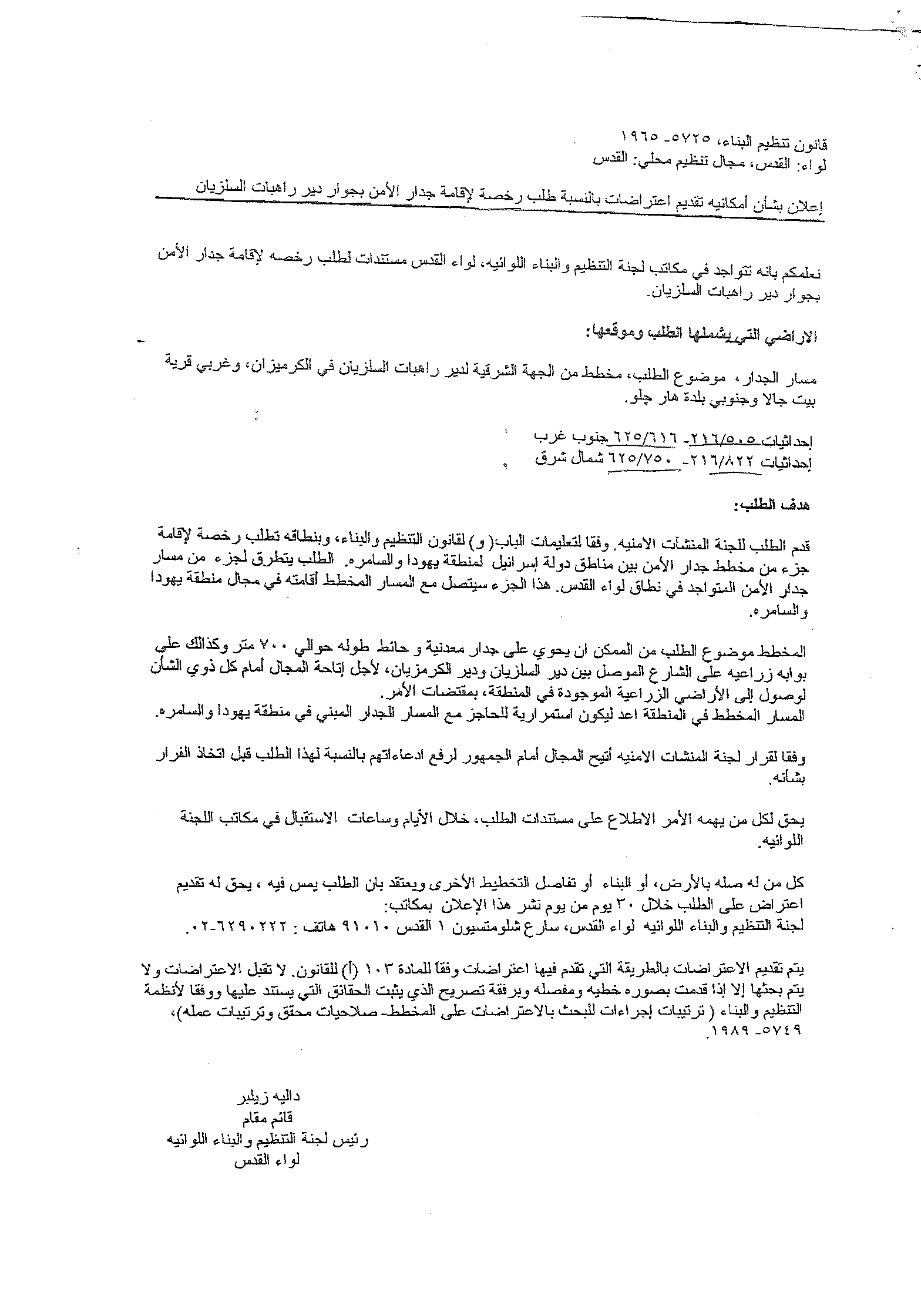
On October 13, 2011, the Municipality of Beit Jala city north of Bethlehem Governorate received two new military orders rerouting the Segregation Wall section which runs along the city’s northern lands. The two orders will come on 52.5 dunums of Beit Jala’s land.
The first Military Order holds number (11/08/T) was issued by the Israeli Ministry of Defense on September 22, 2011, and signed by Abi Mezrahi the chief commanding officer of the Israeli Occupation Army in the West Bank. According to the military order, the Army will seize some 37.3 dunums from Beit Jala city’s lands under the pretext – for military purposes use -, which is to build a part section of the Segregation Wall at that area. was issued by the Israeli Ministry of Defense on September 22, 2011, and signed by Abi Mezrahi the chief commanding officer of the Israeli Occupation Army in the West Bank. According to the military order, the Army will seize some 37.3 dunums from Beit Jala city’s lands under the pretext – for military purposes use -, which is to build a part section of the Segregation Wall at that area.
The second military order holds number (11/02/ST), was issued straight from the Israeli Ministry of Defense on September 22, 2011 and signed by the Director of the ministry since the targeted lands is located inside the unilaterally declared boundary of the Israeli municipality of Jerusalem; under which 15.2 dunums will be expropriated from Beit Jala’s lands for the construction of the Segregation Wall.According to the military orders, the owners of the targeted lands have 64 days period, starting from the date the orders were signed; to submit objections to the orders before they go into effect., was issued straight from the Israeli Ministry of Defense on September 22, 2011 and signed by the Director of the ministry since the targeted lands is located inside the unilaterally declared boundary of the Israeli municipality of Jerusalem; under which 15.2 dunums will be expropriated from Beit Jala’s lands for the construction of the Segregation Wall.According to the military orders, the owners of the targeted lands have 64 days period, starting from the date the orders were signed; to submit objections to the orders before they go into effect.
It is worth mentioning that on September 9, 2011, the Israeli Occupation Authorities handed over the nuns of Cremisan Monastery northwest of Beit Jala city in Bethlehem governorate a military order signed by the head of the Israeli Regional Planning and Construction Committee in the Israeli Ministry of Interior, Dalieh Zelbar, to acquaint them with what the order include about the targeted lands to complete the construction of the Segregation Wall at the northern section of Beit Jala city in Bethlehem Governorate. The new order (the order of September 2011) for the Wall at that area came to exclude the Cremisan Nuns Monastery, contrary to the original orders that included the Monastery within the segregated zone of the West Bank behind the Wall. The new order came in response to a previous objection submitted by the Nuns monastery against the original order that included the monastery within the segregation zone. However, the new order will restrict the Nuns access to the Monastery’s lands; meaning that they will not be able to employ any help to cultivate the land without prior arrangements and coordination; which usually requires more time than reasonable.
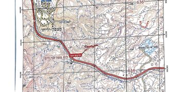
The new order (the order of September 2011) allows a period of 30 days to the owners of the targeted lands to submit their objections to the new proposed route of the Segregation Wall at the targeted area. The owners of the lands at the targeted area remain confused about the Israeli orders as it does not clearly show how the Segregation Wall is rerouted at the area but only distinguish the lands to be seized for military use; or whether their lands will be at the eastern or at the western side of the Wall. See the map below: allows a period of 30 days to the owners of the targeted lands to submit their objections to the new proposed route of the Segregation Wall at the targeted area. The owners of the lands at the targeted area remain confused about the Israeli orders as it does not clearly show how the Segregation Wall is rerouted at the area but only distinguish the lands to be seized for military use; or whether their lands will be at the eastern or at the western side of the Wall.

Map for the two military confiscation orders in Beit Jala
Glance about the Segregation Wall in Beit Jala
The town of Beit Jala is located to the west of Bethlehem city and to the southwest Jerusalem district borders. It has a population of 15,000 inhabitants the majority of whom are Palestinians Christian.
The Segregation Wall to run across the northern part of Beit Jala’s lands has a total length of 11.7 km, of which 2.7 km are constructed and 9 km still either in planning phase or under construction. The Wall extends from the northeastern part of Beit Jala and continues westward towards Gilo settlement, in parallel to the Israeli controlled bypass road 60 (the tunnel section). The Wall stands to isolate 6420 Dunums – some 48% of Beit Jala’s lands) behind the Segregation Wall, which will only be accessible to the landowner through valid Israeli issued permits.
Legal & International Status
The existence of the Israeli Apartheid Segregation Wall which stretches throughout the oPt, is Illegal where the Israeli Occupation State must dismantle it instead of seizing more Palestinian lands which constitutes a grave, flagrant and unjustified breach of the International law rules and conventions:
- The ICJ Advisory Opinion on the Legal Consequences of the Construction of a Wall in the Occupied Palestinian Territory in July 9, 2004. “The Court has reached the conclusion that the construction of the wall by Israel, the occupying power, in the Occupied Palestinian Territory including in and around East Jerusalem and its associated régime, is contrary to international law and has stated the legal consequences that are to be drawn from that illegality”. Also “Israel is under an obligation to make reparation for all damage caused by the construction of the wall in the Occupied Palestinian Territory, including in and around East Jerusalem.”
- Also Articles 53 &147 of the Fourth Geneva Convention indicated that: Extensive destruction and appropriation of property not justified by military necessity and carried out unlawfully and wantonly. is a grave breach of the Convention.
- Art. 23 of the Hague Convention of 1907 also provides: In addition to the prohibitions provided by special Conventions, it is especially forbidden to destroy or seize the enemy’s property, unless such destruction or seizure be imperatively demanded by the necessities of war.
- Under the Universal Declaration of Human Rights Adopted and proclaimed by General Assembly resolution 217 A (III) of, December 10, 1948, Article 17 reads: ‘No one shall be arbitrarily deprived of his property.’ Which means it bans Israel from destroying or confiscating the property of the Palestinians at any case.
- The Israeli Occupation practices in the occupied Palestinian territory and especially in the city of Jerusalem clearly violate the Palestinian human rights under international law and the fourth Geneva Convention of 1949 systematically, which constitute a crime of apartheid according to the International Convention on the Suppression and Punishment of the Crime of Apartheid (1973) which defines apartheid as: ‘the imposition of various legislative measures on different racial groups while injuring the rights of one. Moreover, the crime of Apartheid comprises a ‘crime against humanity’ and ‘a serious threat to international peace and security’.
Prepared by:


