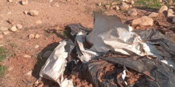
Violation: burning more than 400 tons of coal, and tons of wood.
Location: Barta’a ash Sharqiya – Jenin
Perpetrators: the Israeli Occupation Army.
Victims: 61 Palestinian families who benefit directly from the facilities.
Date: June 22, 2011.
Details:
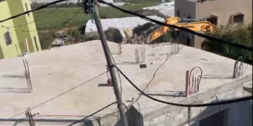
The Israelis are trying to hit the already crumbling Palestinian economy. On June 22, 2011, the Israeli Occupation Army started a large-scale demolition campaign against Palestinian coal production facilities in Barta’a. The Israeli justify such a campaign by claiming that the smoke produced by the facilities is disturbing the residents of near-by colonies despite the fact that the nearest colony, Mevo Dotan, is 10 km afar. The Israelis also claim that the facilities are located in areas classified ‘C’ according to Oslo Agreement and those were built without obtaining the needed permits.
Rising Flames ( 1-3)


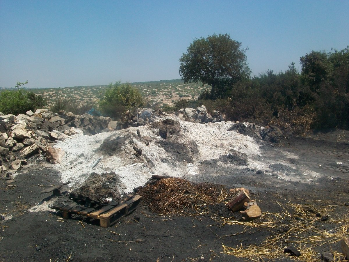
Table 1: owners and losses:
|
Victim
|
Facilities
|
Lost quantities – coal
|
Lost quantities – wood
|
Estimated losses (ILS)
|
Direct beneficiaries (families)
|
|
Husein Zayd
|
14
|
120
|
|
350,000
|
13
|
|
Farid Qabaha
|
8
|
45
|
48
|
250,000
|
8
|
|
Nour ‘Amarna
|
10
|
70
|
30
|
300,000
|
6
|
|
Zyad Zayd
Mohammad ‘Amarna
|
5
|
50
|
24
|
170,000
|
9
|
|
Khalid ‘Amarna
|
1
|
20
|
4
|
100,000
|
5
|
|
Yaser Qabaha
|
12
|
90
|
30
|
320,000
|
20
|
|
Total
|
50
|
395
|
136
|
1,490,000
|
61
|
In addition, the Israelis confiscated a dozer, a tractor, and demolished 12 water tanks and 4 shacks (60-80 m2 in area) that were used to store coal. Coal production is a basic source of income for the village. Coal production in Bart’a has been a craft passed through generations since the Ottoman regime.
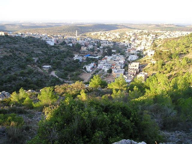
The Village of Barta’a:
The village of Barta’a Al Sharqiyya is located 30 kilometers west of the city of Jenin. The closest town to it is Ya’abad located 1 kilometers east of it. Three small khirbets surround the village including Khirbet Barta’a, Khirbet Abduallah Younis and Khirbet Al Mintar. The Israeli Racist Isolation Wall surrounds the villages from its eastern and southern directions leading to its separation from the West Bank. The area of its Master Plan is around 3,500 dunums while the total area of the village is 21,000 dunums. Its population (according to the village council) is 3900 most of them are from the Kabhha clan.
Israeli occupation forces started to establish the Racist Wall around the village in 2002, thus turning the lives of Palestinians into an unbearable hell with only one gate that came to be known as Al Reehan Checkpoint. The checkpoint is the only entry point into and out of the village. To make things worse, since May 16th, 2007, the administration of the checkpoint was handed over to a private security company and the checkpoint became as a “port” that required extensive search of each person entering or existing the village.
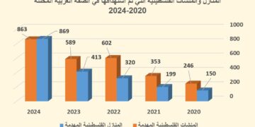
So far, more than 180 structures are under the Israeli demolition radar; 19 has already been demolished.
The Israelis claim that it is done on the pretext that the target structures are built in areas classified ‘C’; however, the true purpose is evicting the Palestinian residents to empty the lands.
Prepared by
The Land Research Center
LRC
The Land Research Center
LRC