As a part of the Israeli occupation authorities’ continuous attempts to vacate the land from its original Palestinian inhabitants for the benefit of the expansion of colonies and bypass roads, these authorities are planning to destroy the Palestinian community of Beit Skarya. The community is located of the main Hebron-Bethlehem Road and being sandwiched between a number of colonies in the Etzion area.
The history of this Palestinian community is rooted as far back as 400 years as a number of Palestinian families inhabited the region of Etzion. These families were distributed on 4 to 5 locations of which Beit Skarya is the largest. The lands of this region is still considered to be one of the most fertile in Bethlehem Governorate as it is famous for its grapes, apples, almonds and fig production.
Historical Background:
Since Zionists organizations began controlling Palestinian lands during the British Mandate era, the region of Etzion became early on a prime target for these organizations due to its fertility and strategic location on the way between Hebron and Jerusalem. As such, the colony of Kfar Etzion was established in 1943 followed by the colony of Masho’at Ishaq in 1945 while the colony of Rush Etzurim was established in 1946 and the colony of Ra’eilim in 1947. The colonies became known as Gush Etzion (i.e. the Etzion compound).
During the 1948 Al Nakba War, the Haghana and Shtern Zionists gangs controlled the Gush Etzion area and was successful in separating Jerusalem and Hebron. However, the Jordanian Army managed to liberate the Etzion area after a tough battle in which hundreds were killed and hundreds others were injured. The strategic location was restored to Jordan’s control which allowed the Palestinians to go back to their villages in the area.


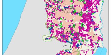
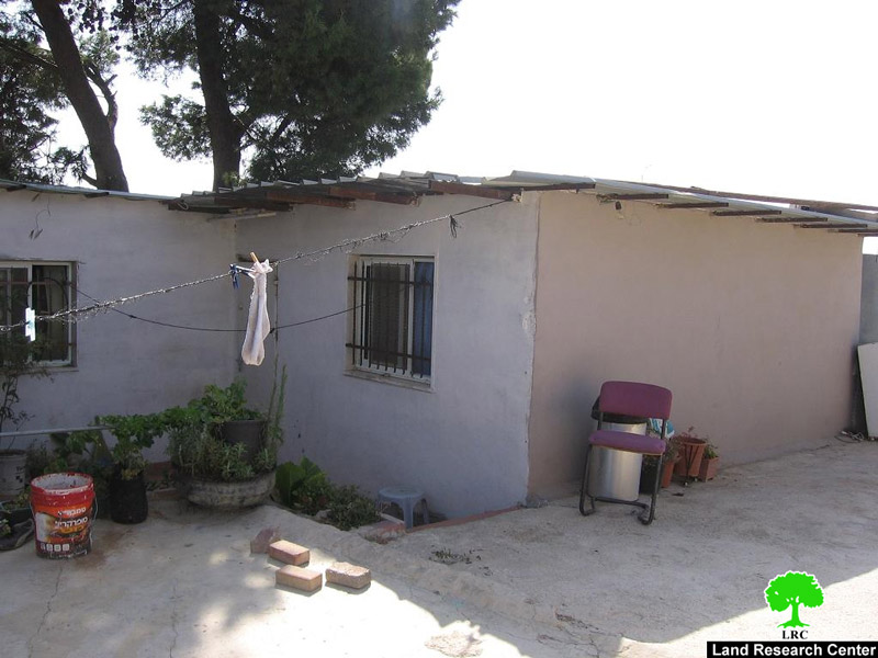
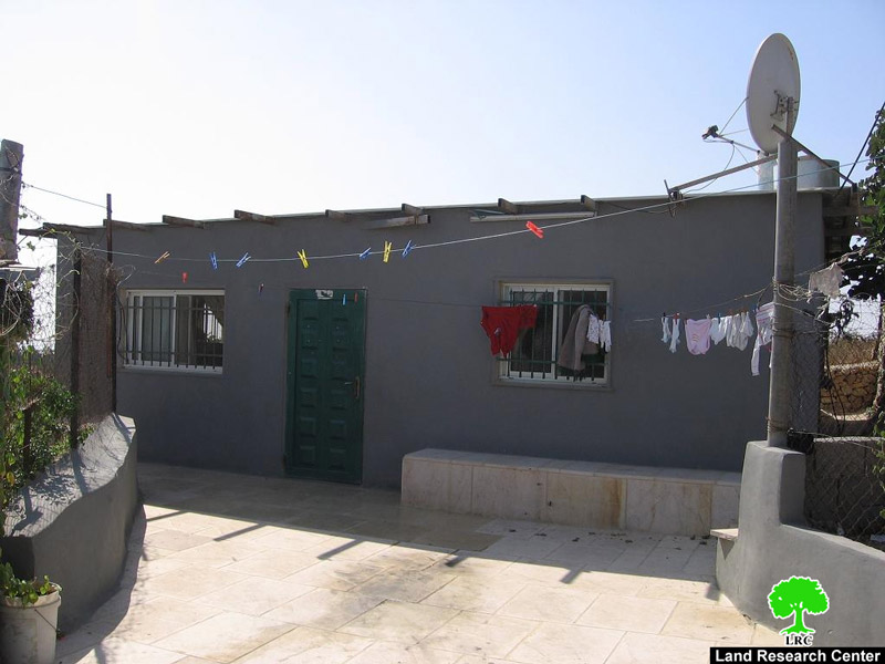
Photos 1+2: Israeli colonies surround Beit Skarya
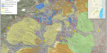
Yet, in the aftermath of the Israeli occupation of the West Bank in 1967, occupation forces re-established the colonies in Etzion as currently there are 16 colonies in the said region. In the same token, the only Palestinian community that still exists in the area is Beit Skarya with no ability to expand or to grow. The so-called Israeli “Civil” administration issued a map in 2009 in which the area of Gush Etzion appeared to be 7 times the original 1948 colony of Kfar Etzion. In other words, the current area of Gush Etzion is about 70,000 dunums while in pre-1948 the area was only 10,000 dunums. Moreover, the map showed that most of the lands that will be used for further colonial expansion are concentrated in the western section of the Gush and specifically between the colonies of Allon Shevut and Rush Tsurim (where Beit Skarya is located).
Due to the steadfastness of the community of Beit Skarya in the midst of this large number of colonies, it’s been targeted by occupation authorities in order to displace its Palestinian inhabitants and use its lands for further colonial expansion. The location of the community between the colonies of Rush Tsurim and Allon Shevut makes it a prime target for intense Israeli pressure. In this context, Israeli occupation authorities have issued in the year 2005 demolition orders against 29 houses and structures in the khirbet. These orders were issued against all structures in the khirbet except for those built before the occupation of 1967. In the year 2008, occupation forces demolished 6 houses and structures in the khirbet despite the fact that the owners of the structures own land deeds and titles. Moreover, a lawyer has been hired by the local community to follow up of the demolition orders. Yet, Israeli occupation authorities came to community on the 15th of July, 2010 to deliver an additional 4 demolition orders against the following houses:
|
No.
|
Name
|
No. Family Members
|
No. of Children
|
Type of Structures
|
Nature of Use
|
Area in m2
|
Picture
|
|
1
|
Mohammad Ibrahim Jadallah
|
6
|
4
|
A house and a shop
|
Used
|
100
|
 |
|
2
|
Mohammad Ahmad Sa’ad
|
4
|
2
|
House
|
Inhabited
|
100
|
 |
|
3
|
Ayman Khalil Mahmoud Sa’ad
|
9
|
7
|
House
|
Inhabited
|
120
|
 |
|
4
|
Tayseer Mohammad Oudeh
|
6
|
4
|
House
|
Inhabited
|
80
|
 |
It has to be emphasized that it is the second time that these structures receive demolition orders. All of these structures are made of cement blocks with zinc roofs. Only 5 houses in the community are made of proper blocks and cement roofs as they were built before the year 1967.


Photos 7 + 8: The debris of houses demolished in 2008
Beit Skarya in Brief:
The khirbet is located south west of the city of Bethlehem in the midst of a sea of the colonies of Gush Etzion. The number of its houses and structures is 35 in which two clans are living; Sa’ad and Oudeh. There is a mosque in the khirbet located near the school in which 50 students receive their education until the 7th grade.

Photos 9 + 10: Maqam Al Nabi Zakariya
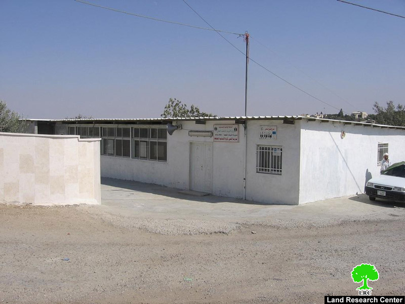
Photo 11: The school of the khirbet
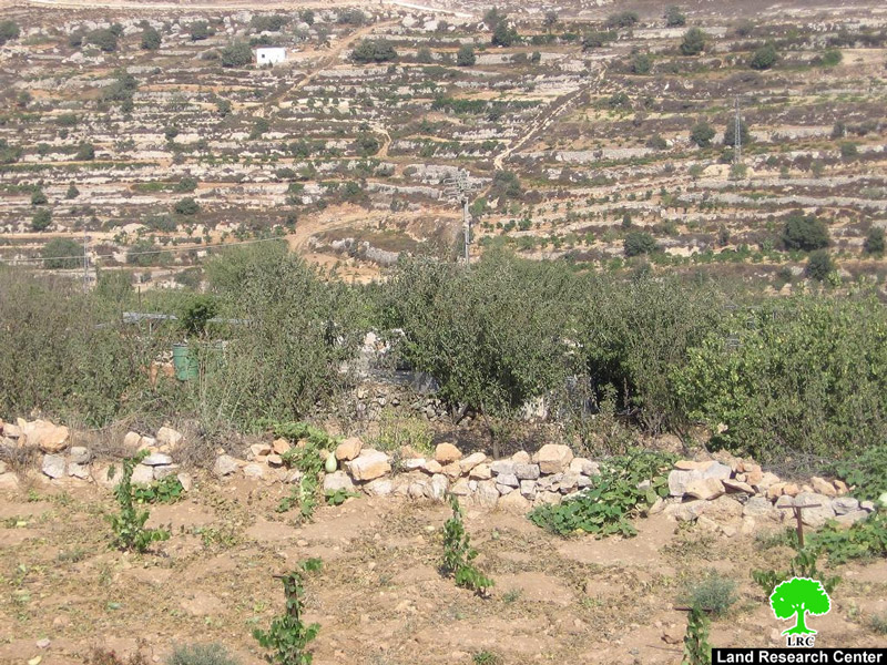
The population of the khirbet depends mainly on farming whatever is left of their lands with barely and almonds as well as on herding. The community faces a problem of youth migration due to Israeli restrictions on building.
Similarly to other Palestinian communities surrounded by Israeli colonies, the residents of the khirbet face harassment from the colonists. In this case, the colonists have insisted to prevent the call for prayers from the khirbet’s mosque using the pretext that it is a cause for “disturbance.” The following picture is a copy of a complaint submitted by the colonists to the Israeli “civil” administration in which they claim that the call for prayers is a nuisance for them. In turn, the “civil” administration provided the head of Beit Skarya’s village a copy of the complaint and demanded that the speakers won’t be used during the calls for prayers as “not to bother” the colonists.
Prepared by
The Land Research Center
LRC
The Land Research Center
LRC