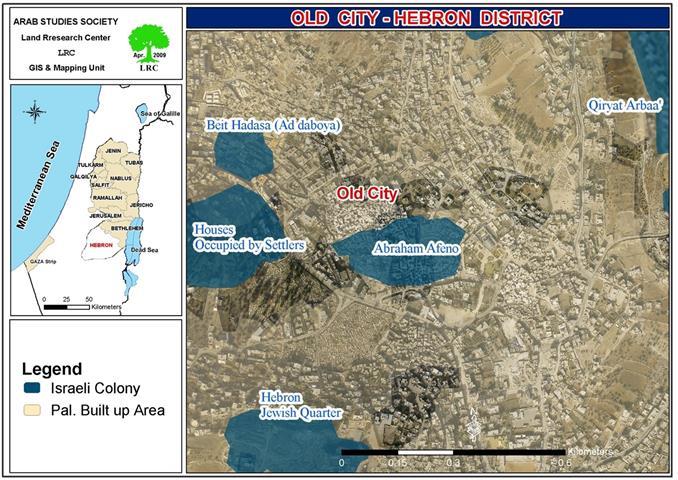
Location: Wadi al Hsein – Hebron city.

Violators: Avi Mezrahi Aloof, high commander of the Israeli forces in the West Bank.
Victims: Palestinians from Abu S’efan, Da’na, and Jabir families.
Details:
The Israeli Occupation Army announced the confiscation of land for the purposes of milling a colonial road that connects Kiryat Arba colony with the Ibrahimi Mosque in Hebron city.
The Israeli Occupation Authorities handed the order to the landlords; theorder was signed by Avi Mezrahi Aloof, high commander of the Israeli forces in the West Bank. The order was entitled ‘laying hand military order number 10/17/T’ and ordered the confiscation of 750 m2 for ‘security reasons’.

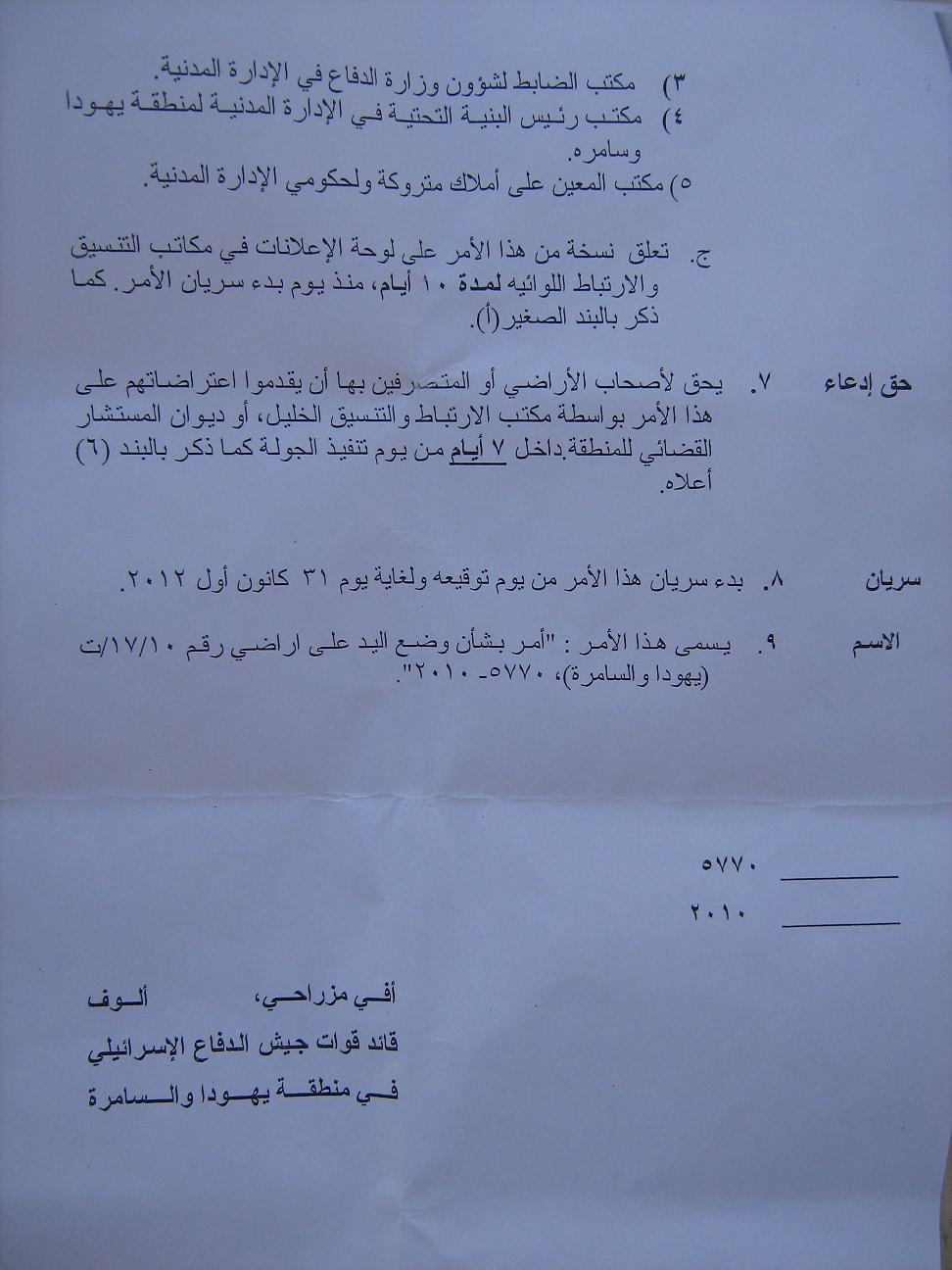
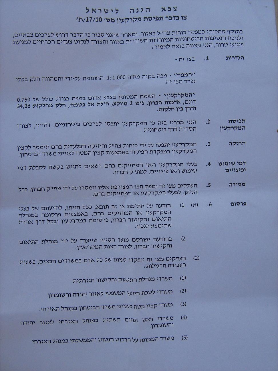

A photocopy of the order in Arabic and Hebrew
It must be noted that the order specified 750 m2, which is the area needed for the road itself. However, the order did not accurately specified areas needed for amendments such as pavements. Such military orders are never specific which most probably makes the threatened area much larger than the aforementioned.
Through previous experiences, it is believed that the threatened area is to be around 24 dunums (1 dunum = 1000 m2), it is believed that the Occupation Authorities will probably prevent farmers from exploiting their lands using the same lame excuse of ‘security reasons’. The order provided the victims with a week time to file objections.
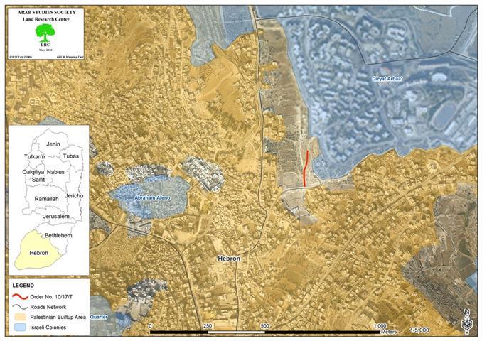
The order was issued as a result of the Israeli Occupation Minister of Transportation decision who announced on April 22, 2010 a plan for milling a colonial road that connects a branch of by-pass road ’60’ with Kiryat Arba colony and with the Ibrahimi Mosque in Hebron Old City. The minister stated that a 10 million $ budget has been allocated for this purpose.

Picture 1: sector of by-pass road ’60’
This indicates that the process will begin soon, work will start near Kiryat Arba and continuous in other areas, devouring tens of dunums of Palestinian farms.
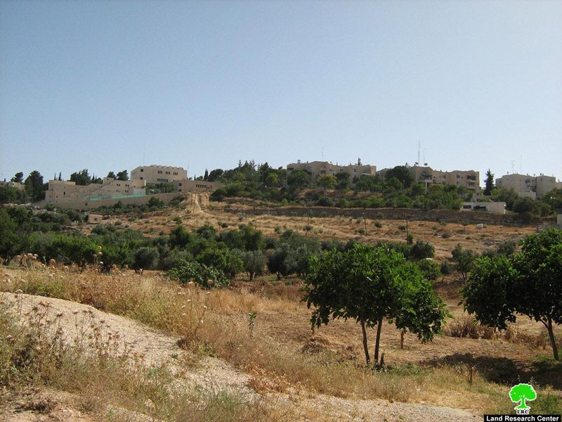
Picture 2: lands to be consumed by the Israeli plans
It must be noted that colonists living in Kiryat Arba use an unpaved road to reach the Ibrahimi Mosque. The road passes through Palestinian farms which were seized by the colonists in 2002. The new road is to replace the current one.

Picture 3: the unpaved road
According to eyewitnesses in Wadi al Hsein, surveyors and engineers were scanning the area and put marks indicating the path of the road. The second phase of this project, if achieved, will lead to the demolition of tens of houses in the Old City. Landlords of the threatened lands (phase one only):
|
No.
|
Landlord
|
Area (dunum)
|
description
|
|
1
|
Jamil abu S’efan
|
7
|
Planted with olives and prunus
|
|
2
|
Kayid Da’na
|
11
|
Planted with olives and prunus
|
|
3
|
Munthir Jabir
|
5
|
Planted with olives and prunus
|
|
4
|
Abdul Men’em Jabir
|
1
|
Planted with olives and prunus
|
|
Total
|
24
|
|
|
Residents of Wadi al Hsein which are already suffering from the extreme measures of the Israeli Army and the colonists will be deprived from the right to use and exploit their lands which exceeds 24 dunums in area.
Prepared by
The Land Research Center
LRC
The Land Research Center
LRC