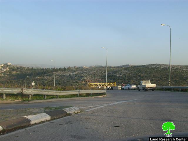
Violation: the closure of Kafr ad Dik village western entrance.
Date: January 24, 2010.
Violators: the Israeli Occupation Army.
Victims: Kafr ad Dik and its surrounding villages’ residents.
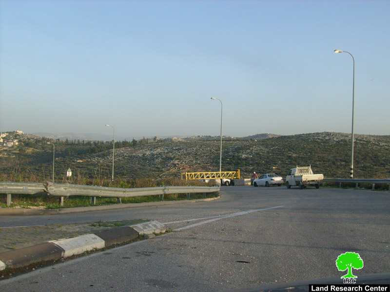
Photo 1: Kafr Addik’s entrance closed with an iron gate
Kafr ADDik suffers from the closure:
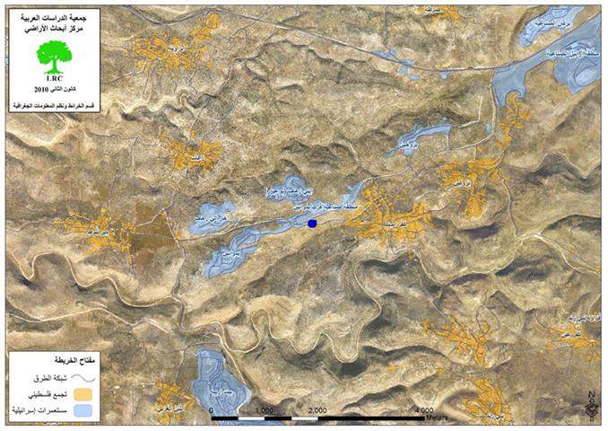
Kafr ad Dik is located to the west of Salfit City in the Occupied Palestinian Territories. More than 5000 people reside in the village.
Many of the Israeli Occupation Government and Army officials expressed the intention if facilitating movement in the West Bank by removing some of the blockades and barriers placed during the second Intifada. Nevertheless, these false intentions led to the re-closure of the main entrance of Kafr ad Dik which connected the village to the by-pass road number 443 which is the only connection between the Palestinian villages of Kafr ad Dik and Burqin and their Palestinian surroundings.
Kafr ad Dik western entrance was closed by the Israelis in 2000 which negatively affected the economical, social, and educational situation of the locals. 10 years of suffering passed before the Israeli Occupation Army decided to lift the siege on the village on January 9, 2010. The residents of the village never trusted the Israelis and they were sure that this won’t last. Nonetheless, 15 days of deceit passed before the Israeli Occupation army decided to close the entrance again.
It must be pointed that the Israelis are trying to win the support of the US and the EU countries using these deceits as cover for their crimes against humanity. One of the locals stated:’ we were pleased to know that the siege was lifted. However, the Israeli Occupation Army did it in an attempt to show the worlds that they are (the Israelis) are facilitating our lives. I wonder how??!!! Every day there are closures and colonists – protected by the Israeli Occupation Army- aggressions.
Consequences of the closure imposed on the village:
-
Movement restriction affects students, teachers, medical staff etc. traveling between the village and its surroundings. Traveling became not only difficult but also costly. Previously, it took 5 minutes to go from Kafr ad Dik to Deir Ballut. However, the distance was tripled besides the need to use side roads that are rough and unpaved.
-
The economical effects of the closure include the restrictions imposed on goods as well as people.
Kafr ad Dik, an Overview:
-
Location: Kafr ad Dik is located 11km to the west of Nablus City and North West of Ramallah City. It is under the jurisdiction of Salfit Governorate.
-
Population: around 5000 people.
-
Total area: 17807.5 dunums (one dunum = 1000 m2)
-
Built-up area: 791 dunum.
Colonies: Kafr ad Dik is surrounded by four Israeli Colonies:
-
Peduel Colony: established in 1984, its built-up area is around 151 dunum. Its total area is around 595 from which 418 dunums were confiscated from Kafr ad Dik lands. It is populated by 1088.
-
The Industrial area, Peduel: it was established in 1991. The total industrial area which is totally built on Kafr ad Dik lands is about 264 dunums.
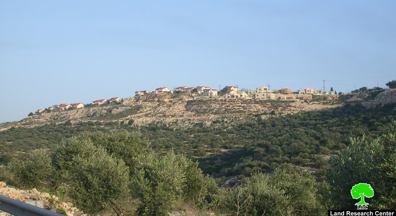
Photo 2: Pidu’el colony occupying the Palestinian land of kafr Addik
-
Har Alei Zahav Colony: it was established in 1982. The total residential area of the colony is 290 dunums; all are expropriated from Kafr ad Dik. 424 settlers live there.
-
Brukhin Colony: the colony was established in 1999. The residential area of the colony is 265.5 dunums of which 20 are expropriated from Kafr ad Dik lands.
There exist two natural wells in the village, ‘Ein al Fawarra and ‘Ein Sreida. The locals used to depend on those wells for their drinking water. However, since August 2009, a new water network has been operated in the area.
Prepared by
The Land Research Center
LRC
The Land Research Center
LRC