Violation: Preventing villagers from reaching their lands.
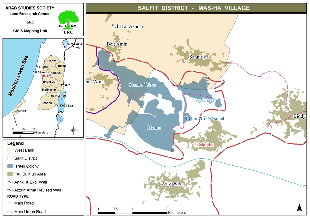
Location: Mas-ha village.
Date: The beginning of 2010 and on.
Violators: The Israeli Occupation Armed Forces.
Victims: Mas-ha villagers.
Introduction:
every New Year's eve, people renew their wishes of a life full of prosperity and peace. Mas-ha villagers had another idea since they have received the New Year with the resumption of their misery which began with the construction of the Racist Segregation Wall back in 2003. The Wall isolated and destroyed more than 5500 acres (95% of the total area of the village). The village was turned into an isolated and besieged camp after it lost most of its area and its connection with its Palestinian surrounding.
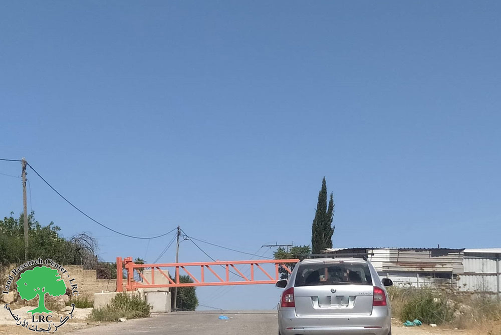
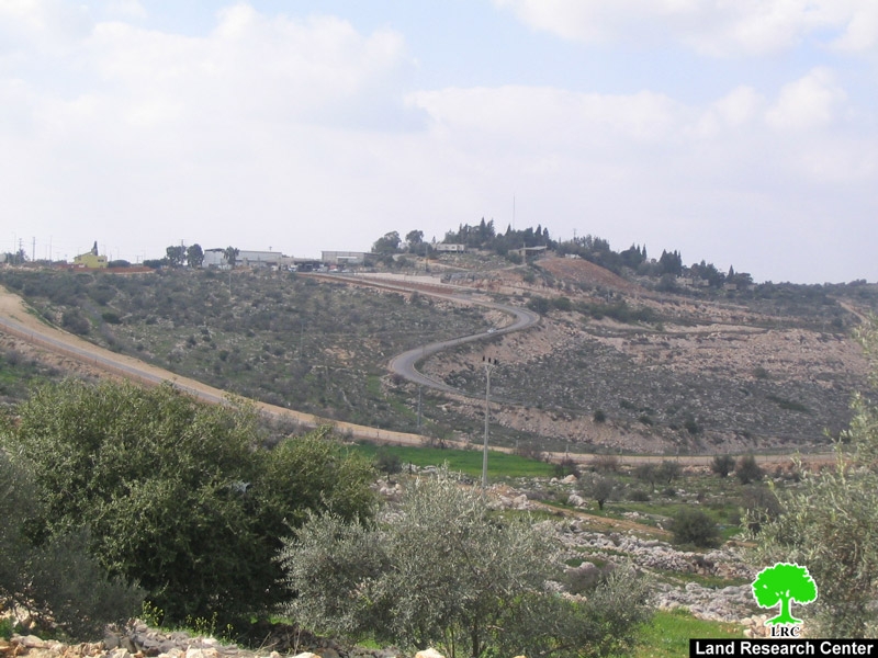
In 2010, the Israeli Occupation Army decided to permanently seal gate number 1543 located to the north west of the village. The decision rendered the lands of 2200 farmers unreachable. It must be noted that since its establishment in 2003, Gate 1543 were opened 3 times a day, but this has changed in August 2008; until the olive picking season last the year, the gate was opened only in special occasions (such as olive picking season, pruning season, etc). In the beginning of 2010, the Gate was permanently closed without justifying the decision.
Picture 1: the Iron Gate (1534) which left the village isolated
Noah Amer (34), a farmer from the village said: 'since the construction of the Wall around the village, we have been suffering from a real catastrophe; we cannot get to our lands unless we receive permits from the Israeli Occupation. The conditions required for acquiring a permit are difficult to meet and usually they are given to certain group of people.”
In the past, we were allowed through the Gate 3 times a day. In August 2008, the Occupation Army decided to close the date except for the olive picking season. In 2009 olive picking season, only 15% of the village population received the permits required to pass through the gate.
Moreover, during the previous olive picking season, Israeli Occupation authorities specified a certain number of days when the villagers were allowed to use the gate, 20 days they said. However, and as they usually do, Israeli forces did not keep their promise as they have opened the gate for only ten days. This policy has led to a disastrous olive picking season since most of the villagers were not able to reach their trees and the few who could were not able to complete their mission because of the limited time period.
Mr. Noah continued by saying that 'I believe that I suffered more than the others. When I went to check on my lands, I was surprised to find that 100 olive trees were burnt or uprooted by the hands of Etz Efrayim colonists. I have informed the legal authorities, the ICRC, but my efforts were futile.It is obvious that the action was based on plan. The colonists want to take advantage of the unprotected lands and do as much damage to Palestinians as they can'. He sorely added.
'The Israeli Occupation Army kept on sealing the Gate even after the end of the olive picking season. Many appeals were made through International and Humanitarian Organizations in an attempt to protect our lands that are threatened to be used for the accelerating expansions of the nearby Israeli colonies including Etz Efrayim and Elkana. There is no doubt that the Israeli Occupation Army refuses to issue of any permits to keep us away from our lands and give the colonists the 'right' to do whatever they wish in it.' He explained. It must be pointed that the Israeli Authorities built two iron gates within the wall that surrounds the village.

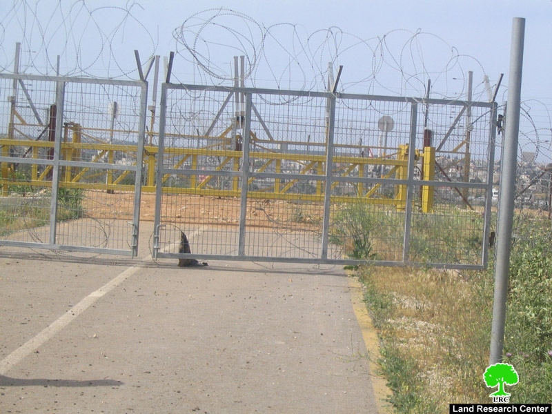
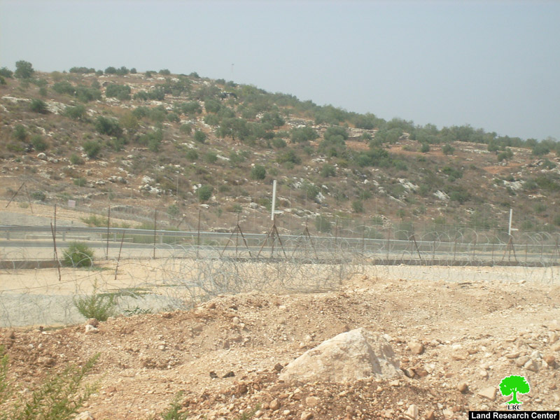
Picture 2+3: part of the Segregation Wall surrounding Mes-ha
The Segregation Wall around Mes-ha:
1. The part of the Wall surrounding the village is 3 km long. It is combined of 8 meters high cement wall, barbered wires, electronic fences, and trenches. The total width of the wall is 40~50 meters.
2. The Wall that surrounds the village has isolated 95% of the village lands turning it into a small crowded ghetto. It also rendered the villagers who largely depended on farming for living into unemployed. Moreover, it hugely limited the ability of urban expansion as the needed space for the natural growth has become too narrow.
3. As a result of the construction of the Wall, wide areas, planted with citrus, olives, and vegetables, were confiscated for the Wall's sake. Also, the only well in the village was taken. In addition, more than 1000 olive trees were uprooted while 7 barnyards were destroyed.
4. The construction of the Racist Wall resulted in the destruction of the commercial market in Mes-h. More than 17000 families used to benefit from that market. 75% of the village population is currently unemployed.
5. The Wall left the village with only one exit through Biddya village.
6. One house was completely isolated from its surrounding. As such, residents cannot move freely and when they do, it is usually done under strict surveillance. The landlord is not allowed to do any renovations or expansions within his property.
7. The Wall prevented people living in Kafr Qasim village, located inside 'Israel', from visiting their relatives and friends in Mes-ha.
8. The Israeli Colonization Council took advantage from the situation and started establishing new residential units on Palestinians lands. They also made a new road network that connects the colonies in the area (Elkana A, Elkana B, and Etz Efrayim)
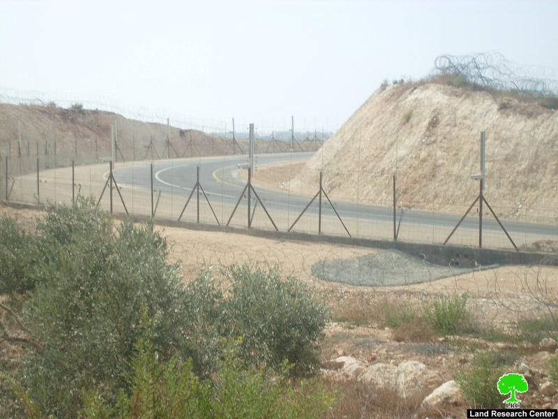
Picture4+5: fence built to protect a colonial road that is built on Mes-ha lands
Mes-ha Village – General Information:
Mes-ha was separated into two villages in 1948 as the Israelis occupied 70% of the total area of the village, the part called Kafr Qasim. In 1956 the Zionists gangs made a terrible massacre in Kafr Qasim which caused the departure of most of its residents.
Mes-ha is 6 km away from the 'Green Line' and is 35 km away from Nablus city and 20 km away from Salfit city. It is located within Salfit Governorate jurisdiction. According to the Palestinian Central Bureau of Statistics, the total population of the village in 2007 was 2003 people.
The total area of the village is 7870 dunums divided into 598.6 dunums of residential area, 6272 dunums are used for farming while 1000 dunums are used for grazing and unexploited areas.
Prepared by
The Land Research Center
LRC