Location: The location of Shi’eb Abu Yousef in the town of Halhul.
Type of Violation: Plowing of 4 dunums for the benefit of the colony of Karmi Tzur.
Date of Violation: 1/8/2009.
Violator: Colonists from the colony of Karmi Tzur.
Affected: Mr. Sa’eed Madia and his brothers and others from the town of Halhul in addition to Mr. Mahmoud Abdel Rahman Sabarneh from the town of Beit Ummar.
The Violation:
Israeli occupation authorities and colonists plowed Palestinian lands located near the colony of Karmi Tzur built atop lands from the towns of Beit Ummar and Halhul.
Mr. Sa’eed Madia expressed the following to the Land Research Center (LRC)’s field researcher: ' On the morning of the 1st of August, 2009, I found out that part of my 2-dunum piece of land (which is located in Shi’eb Al Hajj, Parcel 9 near the colony of Karmi Tzue) was plowed by tractors. Moreover, the grape grove was removed while my neighbor’s land was also plowed.
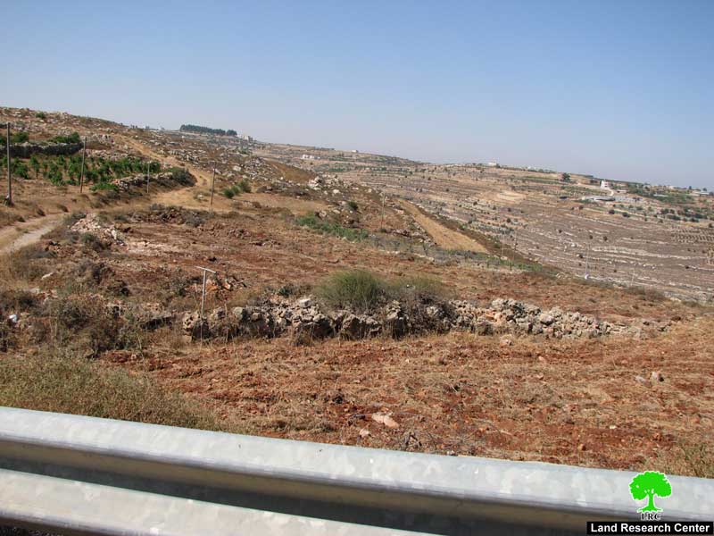
Photos 1+2: The land of Mr. Sa’eed Madia plowed by Karmi Tzur colonists.
Madia continued …'My land is the main entrance to agricultural lands belonging to 26 farmers from Halhul. All of them are prevented from accessing their land by the colonists. '
The land of Mr. Madia is located south of a piece of land that has the flag of Israel raised atop it. From the north, another piece of land belonging to his relatives is present at a distance of 200 meters away from the colony. Surveillance cameras are scattered throughout the lands as they are considered to be part of the fence surrounding the colony. The presence of such cameras provided a motive for the Israeli High Court to issue its decision to allow the Palestinian farmers to gain access to their lands. Yet, it’s been documented on a number of occasions that Israeli colonists from Karmi Tzur prevent the Palestinian farmers from doing just that.
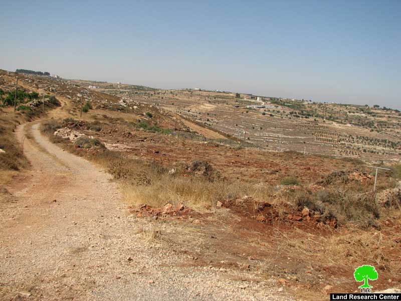
Moreover, Israeli bulldozers plowed another piece of land owned by Mr. Mahmoud Abdel Rahman Sabarneh and located inside the colony of Karmi Tzur. The plowing transformed it to a 50-meter road connecting it to the fence surrounding the colony. According to the Palestine Solidarity Project, Israeli occupation forces are planning to establish an observation tower to be used in “defending the colony.”
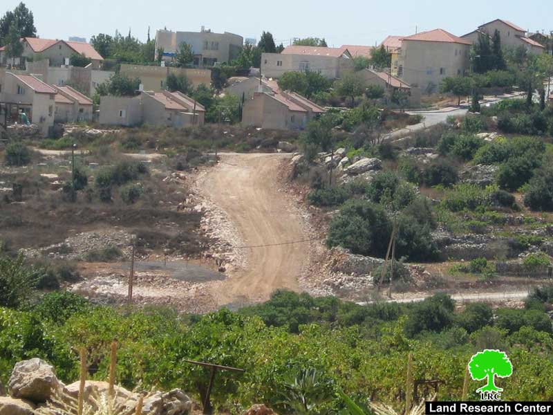
Photo 3: The plowing of the land of Mr. Sabarneh
Previous Violations:
Since the creation of the colony of Karmi Tzur in 1984, colonists’ attacks and harassment never ceased to take place. Some of the main violations include the following:
- In 2001 Israeli colonist established an outpost associated with the colony on its southwestern side. Despite the illegal status of the outpost, a road was established connecting it with the mother colony with the approval of the so-called Israeli “Civil Administration” at the expense of Shi’eb Al Hajj. The land of Mr. Madia is located between the road and the outpost.
- In 2002 Israeli colonists prevented Palestinian farmers from entering their lands located in the vicinity of the colony during the olive harvest season. The colonists kept presence at the hills surrounding the colony which prohibited the Palestinians from reaching their lands.
- In the years 2006 and 2007 Israeli occupation forces placed a fence of barbwires at a distance of 20 dunums away from the old fence under the pretext of creating a buffer zone surrounding the colony for “security” purposes. The lands located in the buffer zone belong to Abdullah Abu Dayya, Mahmoud Mustafa Aby Dayya , Khalil Mohammad Abde rabbo Aby Dayya, the heirs of Hajj Hijazi Madia, Mohammad Abdel Aziz Madia, Ya’aqoub Saber Al Barbarawi, Bader Issa Abu Yousef, Hamdi Abu Yousef in addition to Abdullah Aqel and his brothers.
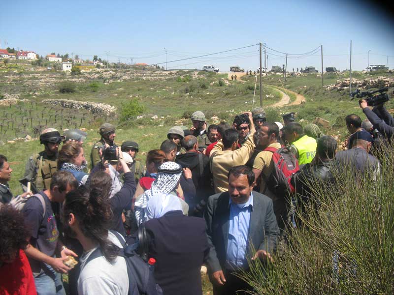
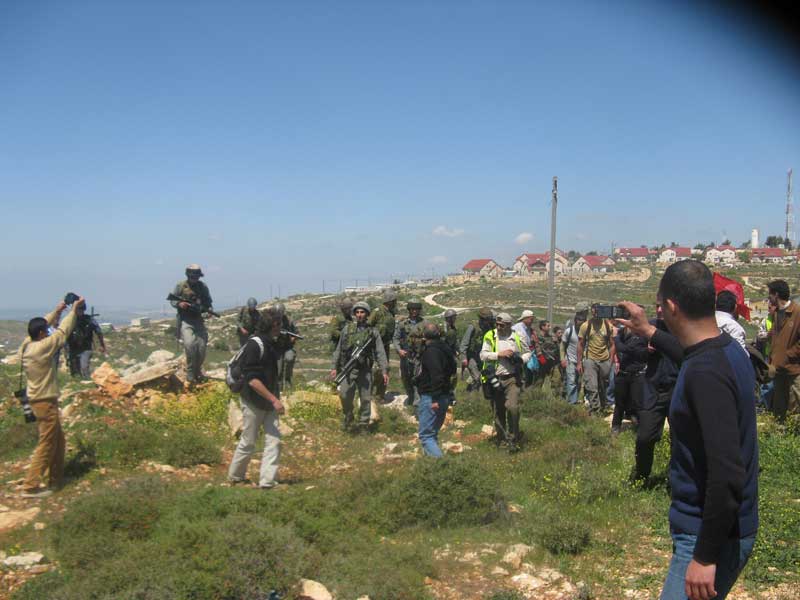
Photos 4+5: Large Israeli forces preventing Palestinian farmers,
along with their international supporters, from reaching their lands.
Karmi Tzur:
The colony of Karmi Tzur as established in 1984 atop lands from the towns of Halhul (Shi’eb Al Hajj, Wadi Al Amir, Shi’eb Mu’eisar, and Shi’eb Abu Yousef) and Beit Ummar (Thaher Jalis Hill). It is located 9 kilometers north of the city of Hebron. Its build-up area is estimated to be 160 dunums in which 713 colonists live. It is worth noting that, according to the Oslo II Agreement signed in Cairo in 1997, the colony was slated for eviction. Yet, Israeli occupation authorities reneged on its promise to do that.
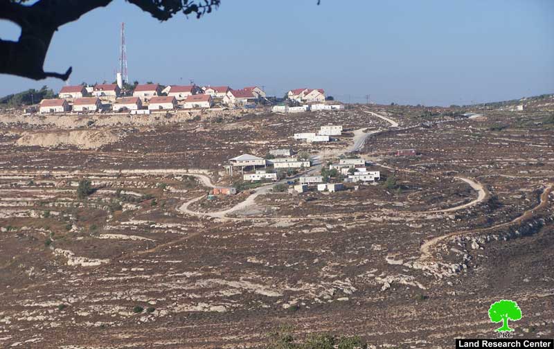
Photo 6: A general view of the colony of Karmi Tzur
The Town of Halhul:
The town of Halhul is located 7 kilometers north of the city of Hebron. Its total area approaches 39,000 dunums of which 9,000 dunums are its built-up area while the remaining area is planted with grapes, almonds and peaches. It is considered the highest point in the West Bank as it stands at 1050 meters above sea level. According to the Palestinian Bureau of Statistics, there are around 22,413 Palestinians living in the town.
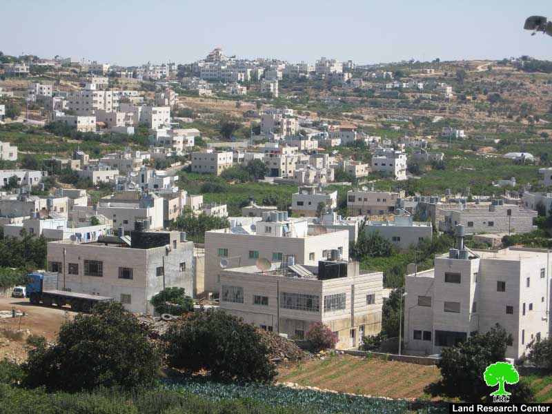
Photo 7: General view of the town of Halhul.
:::::::
[1] LRC’s GIS Unit.
Prepared by:
The Land Research Center
LRC