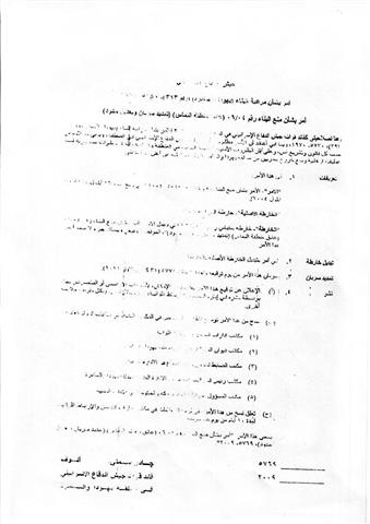
Photo 1: Target the Land
Violation: Israeli occupation forces issued a military order calling upon land owners to vacate and remove all agricultural structures on 380 rehabilitated dunums. Please follow the link to view the Order.
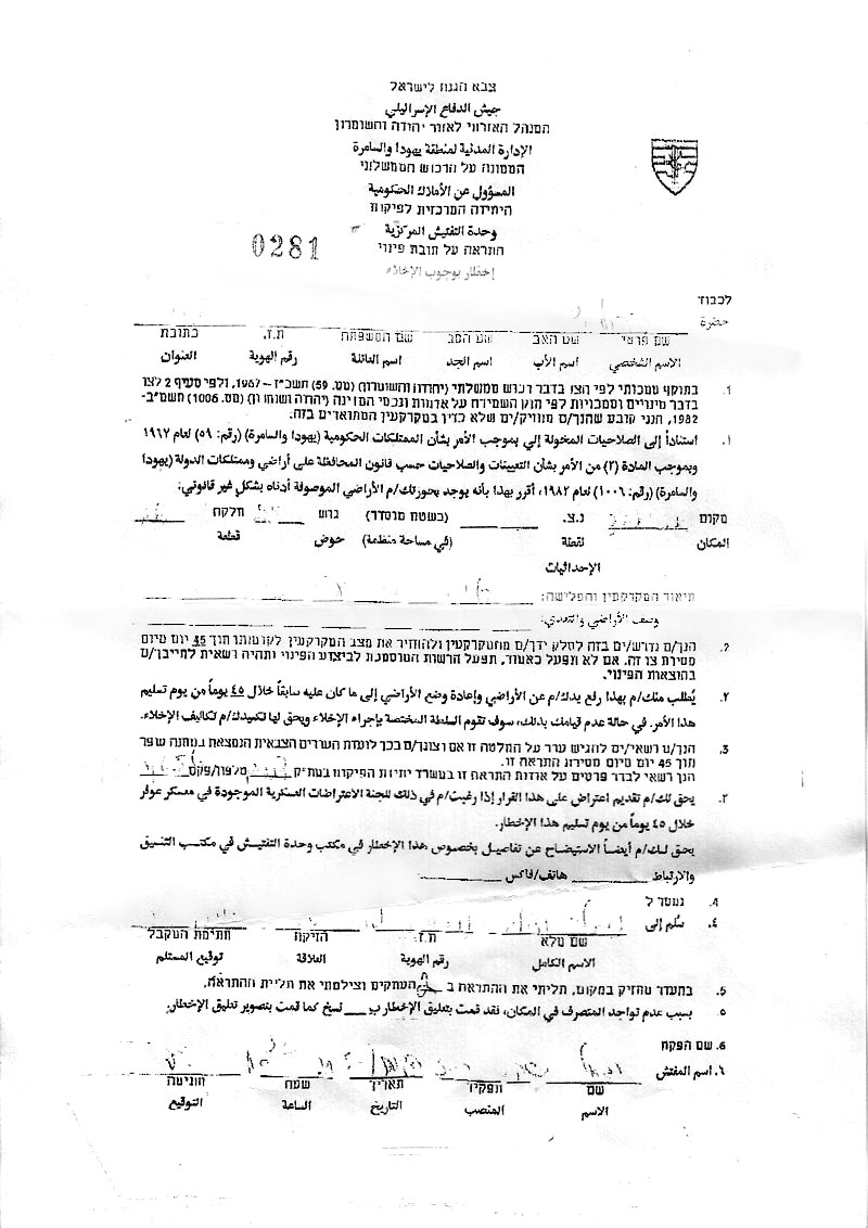
Date: May 22nd, 2009.
Location: The lands are located in the village of Ya’abad in the Governorate of Jenin. They are located 1.5 kilometers west of the village in an area known as Al Qatayen. The targeted lands are also located 2 kilometers east of the colony of Shakeid.
Land Description: The lands are planted with olive trees for the past 6 years. They were rehabilitated in cooperation between land owners and the Palestinian Ministry of Agriculture.
Violation Pretext: Israeli forces declared the lands as “State Lands.”
Land Owners: the owners of the targeted lands are all from Ya’abad and they include the following:
|
Name of Owner
|
Area of the Land
|
Parcel No.
|
|
Mohammad Abed Anees Qabha
|
48
|
9, 26,25
|
|
Mohammad Shareef Zaid
|
45
|
25, 16, 24
|
|
Anees Hasan Qabha
|
45
|
25, 16, 24
|
|
Adnan Ismaeil Zaid
|
25
|
25, 16, 24
|
|
Adnan Jaber Hamarsha
|
35
|
9, 15, 16
|
|
Husni Abed Zaid
|
40
|
9, 15, 16
|
|
Yousef Zaid
|
40
|
9, 15, 16
|
|
Mohammad Ismaeil Qabha
|
40
|
9, 15, 16
|
|
Tayseer Zaid
|
50
|
25و 15, 30
|
|
TOTAL
|
368
|
|
The Details:
On the 22nd of May, 2009, the so-called Israeli “Civil Administration” issued a military order declaring its intention to confiscate 380 dunums of Ya’abad’s agricultural lands. The targeted lands are considered “State Lands” since the Jordanian era (i.e. before the inception of the Israeli occupation). It was a common practice that the Jordanian government would rent out the lands to a number of farmers in return for a specific fee. Around 9 families have rented out the targeted lands from the Jordanian government since 1964 as work on these lands have become the main source of income for them.

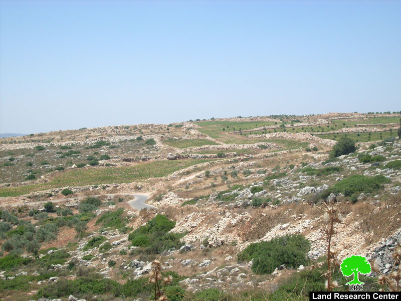
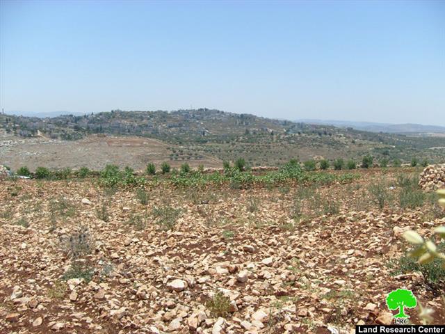
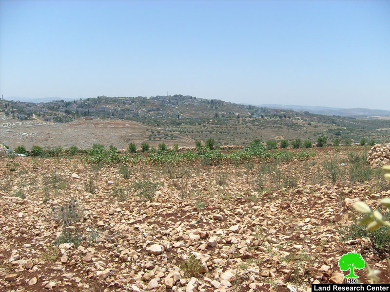
Photo 2 & Photo 3: A general overview of the targeted lands
It is worth pointing out that three months ago a humanitarian organization has funded a land rehabilitation project targeting the threatened lands. In addition to terracing and land reclamation, trees, bushes and seedlings were planted in the land making its productivity even higher.
Mr. Mohammad Shareef Zaid, one of the affected farmers, has indicated the following to Land Research Center’s field researcher: ‘ I own 45 dunums of fertile agricultural lands in the area of Al Qatayen. I totally depend on them in securing the basic needs of my 7-member family especially after I have lost my work inside the Green Line due to the construction of the Racist Wall. I remember working in the land even before the Israeli occupation in 1967. Occupation authorities have tried a number of times to overtake the land as, for example, they suggested once the land owners would rent the land out from the occupation government. Land owners refused to do so as it would give legitimacy to the Occupation Power. Now, they are trying to take away our lands after they have deprived us from income generated through employment inside the Green Line. This fact threatens our presence in the area as denial of access to our land is the final blow to our existence in the area.’
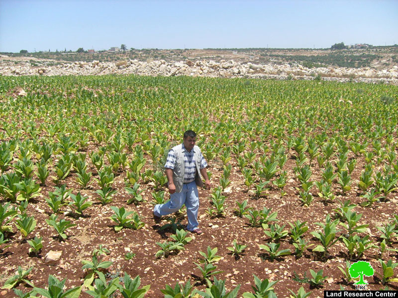
Photo 4: Mr. Mohammad Al Shareef in his threatened lands.
Occupation forces gave land owners a 45-day period to remove all the trees and remove the terracing and the agricultural produce. Otherwise, occupation forces would do that themselves at the expense of the farmers. The occupation forces claim that the agreement signed between the farmers and the Jordanian government is not valid and, as such, the targeted lands are considered to be “State Lands” belonging to the State of Israel.

Photo 5: The Racist Barrier separating Ya’abad lands from its owners.
Ya’abad: General Information
-
The town is located 17 kilometers southwest of the City of Jenin.
-
Its population is around 15,000 Palestinians.
-
The surface area of the town is around 15 km2.
-
The area of the lands associated with the town is around 37,000 dunums.
-
Around 7,000 dunums have become isolated behind the Racist Separation Wall.
-
19% of the population of the town are registered refugees.
-
A number of clans live in the town including the clans of Abu Baker, Attatra, Zaid, Amarneh, Qabha, Badarneh, Harz Allah, Abu Shamleh and Abbadi.
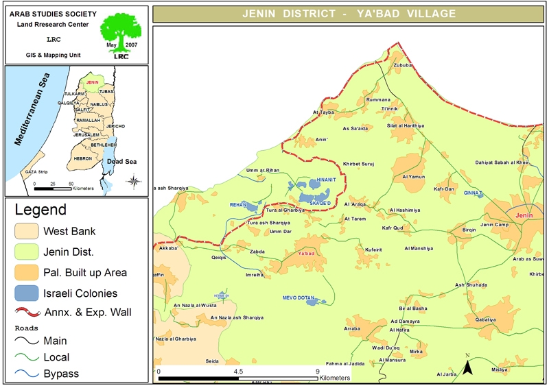
Map 1: Location of Ya’abad Village
Prepared by:
The Land Research Center
LRC
The Land Research Center
LRC