Farmers in Faqqu'a Village, Jenin district are still suffering from the Israeli measures preventing them from tending their remaining agricultural lands located in the eastern side of the Wall path inside the territories of the West Bank under the pretext of safeguarding the Israeli security. The inaccessible land include Hajeej ash Sharqi, Al-Muraba'h, Khalit Al-Kibara, Al-Manayes, Al-Balad, Marj Younes and Teen Nasser to the north east of the Village.
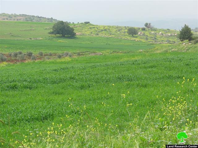
(Photo 1: some of the agricultural land inaccessible to Palestinian farmers
inside the West Bank side of the Wall )
The target agricultural land is considered the most fertile lands in Faqqu'a village. It used to be cultivated with vegetables and crops periodically. Also, it is considered the main source of income to the people in the village who lost their work inside the green line after the establishment of the Segregation wall in 2002 which converted the life of the people into an unbearable situation.
According to the existing Israeli policy all farmers are not allowed to enter or tend their land located at the depth of 500 meters from the path of the Wall. To enforce this policy Israeli soldiers chase and dismiss farmers out of the area in addition to destroying crops either by cutting them or spraying them with chemical substances.
Most recent, the occupation authorities adapted a new way to prevent the people to use their lands. They chase shepherds and prevent them from using the grazing lands to the north and east of the village under the pretext that these lands are located in the vicinity of the wall. These lands are considered the only lands accessible for shepherds after the establishment of the wall. Due to the deprivation of many people from their income, poverty and unemployment increased within the village community.
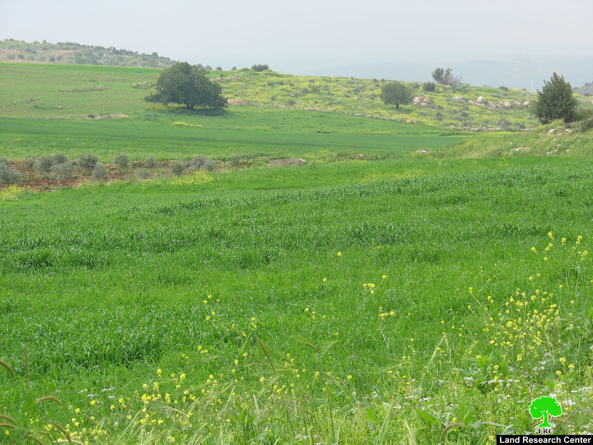
(Photo 2: the Wall path and some of the Faqqu'a land that was separated behind it)
A glimpse on Faqqu'a village:
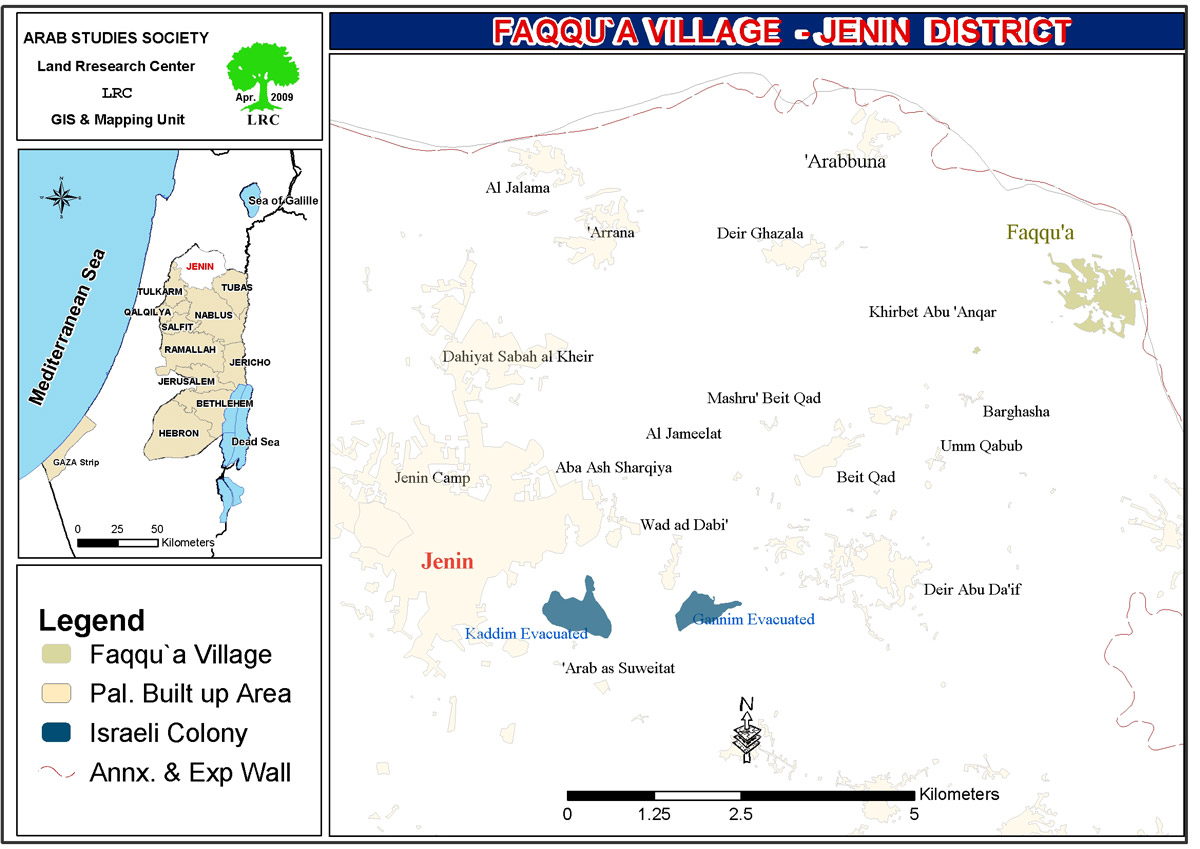
The village is located near the green line at the distance of 11km to the north east of Jenin city. Its population is 4250 and its total land area is 36000 Dunum. About 24000 Dunums were confiscated during the war of 1948, 8000 Ddunums are registered as state land and about 4000 dunums are completely under the occupation's control. The Israeli occupation authorities, also, confiscated and isolated 450 dunum behind the Wall. The village built up is 200 Dunums ( Source: Faqqu'a village's local council ). See Map 1
Faqqu'a and the wall:
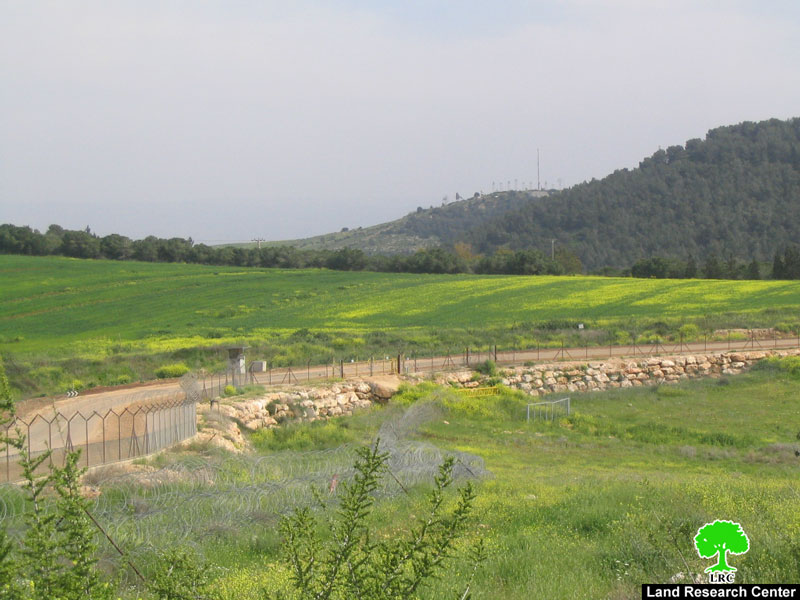
The village is surrounded with the Wall from three sides: east, west and north. The only access left is from south. This wall extends to 6 km inside the village lands from the three sides. The lands that were separated behind the Wall t are characterized as: 35% planted with fruitful trees, 35% are suitable for ground crops , 10% forests and 20% are pastures and state land. The Israeli occupation built two agricultural gates in the Wall for the use of farmers. However, they are closed through out the year except at the time of olive picking and for limited hours only: from 8 to 9 AM , and from 4 to 5 PM.
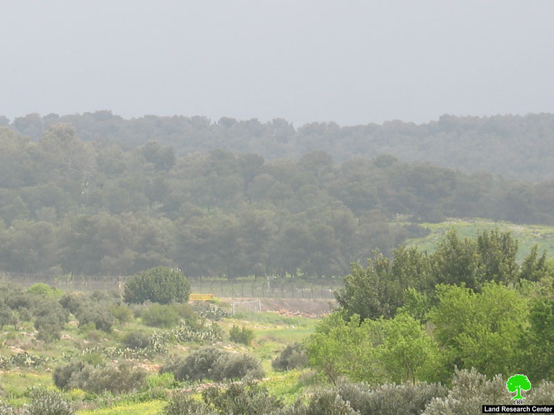
(Photo 3: One of the two yellow agricultural Wall gates that remains close most of the time)
According to the information given by the Village Council only 22 people out of hundreds were given passing permits to enter into their land inside the Wall. Israeli measures for permission application are very complicated and time consuming. Also there are some houses located about 30m from the Wall path whose owners are anxious and afraid from the daily Israeli practices.
Related case studies:
1. Jalbun and Faqqu'a land taken for the Wall Jenin Governorate, June, 2007;
2. Faqqu'a Village is loosing more of its land for the construction of a new road, April, 2007.
3. Olive picking season has become a nightmare for Faqqu'a citizens Jenin governorate, October, 2004.
Prepared by:
The Land Research Center
LRC


