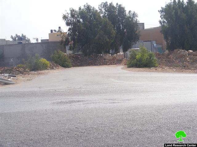
On the 23rd of October, 2008 Israeli occupation forces closed down the main entrance to the town of Azzoun Al Shamaliya located north of it. The forces placed earthmounds all along the entrance of the town which is considered its main artery as it connects the town with Road 55. This is the third time that the entrance was closed in 2008.
On the next day a big Israeli force carried out an incursion into the town and imposed a strict curfew on its residents. Sound bombs were used during the incursion with the explicit reason of instilling fear in the hearts of the Palestinian residents of the town. The time during which the curfew was imposed was the busiest time in the town as farmers were heading back to it after collecting their olives from the nearby fields.
During the early pre-dawn hours of Saturday October 25th an extensive search-and-arrest campaign was conducted by the occupation forces in the nearby town of Azzun Al Atma. Around 18 Palestinians were arrested and maltreated. Israeli occupation soldiers informed the Palestinian villagers that the curfew will be imposed on Azzun Al Shamaliya between 4:00 PM on Saturday and 9:00 AM on Sunday. Also, access to the nearby village of Izbat Al Tabib was denied as occupation forces kept an armed patrol at its entrance.

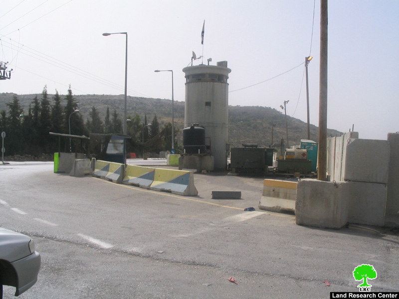
Photo 1 & Photo 2: An Israeli Army Petrol blocking the access to Izbat Tabib village.
General Information about Azzun:
Location: The village of Azzun is located on Road 55 which connects between the cities of Nablus and Qalqilia. It is also located 23 kilometers west of the city of Nablus and around 9 kilometers east of the city of Qalqilia. It is connected to the governorate of Ramallah through a paved road which links it to the villages of Kufr Thuluth, Masha, Dier Ballout and Beir Zeit. As such, the village of Azzun has a central location as it is surrounded by a number of villages including:
-
From the north: Seir, Jayyous, Kufr Jamal, Kufr Ayyoush, Kufr Zeibad and Kufr Sur.
-
From the south: Kufr Thuluth, Sinirya, Masha, Bidya and Al Zawiya
-
From the west: Al Nabi Ilyas and Asala
-
From the east: Kufr Laqif, Jinsafuit, Hijja, Baqat Al Hatab, Ammatien, Far’ata, Jeit, Kufr Qaddoum and Sirra.
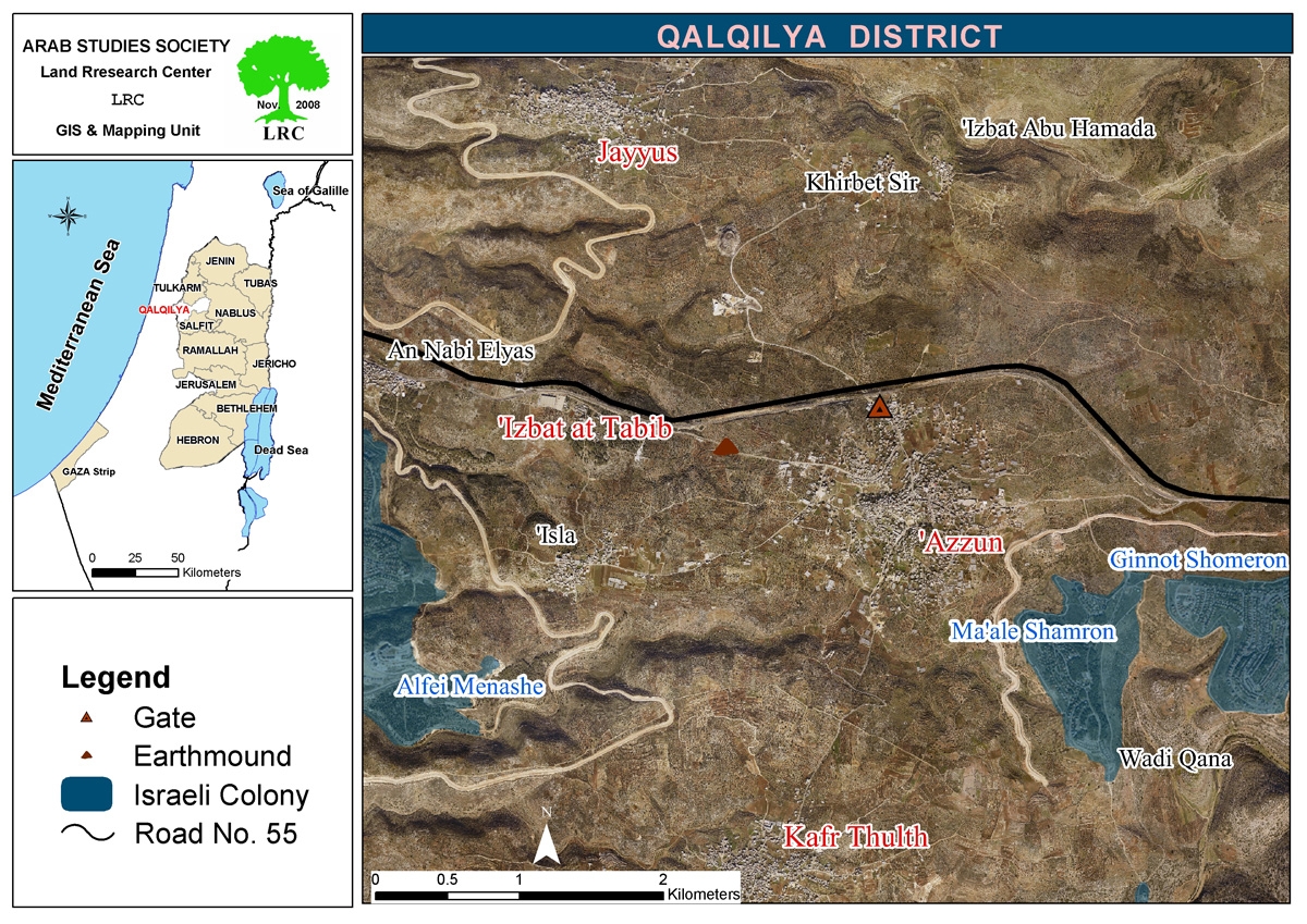
Area and Population: The original total area of the town of Azzun Al Shamiliya was about 24,000 dunums. Its boundaries lie near the lands of Qalqilia and Habla in the north, Kufr Laqif and Dier Istya in the east and the Azzun forest (inside the Green Line) in the west. After the 1948 War, only 9,139 dunums (of which 1,209 dunums are its built-up area nowadays) was left of the village. Its current population is about 7985. It is worth noting that Azzun is the mother village for a number of smaller villages including Asala, Al Nabi Ilyas, Izbat Al Tabib and Khirbet Barthouta.
Colonial Activity: There are three colonies surrounding the village:
1. The colony of Ma’ale Shomron: established in 1980. Its total area is 1903 dunums of which 216 dunums are its build-up area. The number of its colonists was 549 in 2004.
2. The colony of Ghanat Shomron: established in 1985. Its current build-up area is 484 dunums.
3. The colony of Karni Shomron: established in 1978. Its total area is 7339 dunums of which 1351 dunums are its build-up area. The number of its colonists was 6,270 in 2005.
Prepared by:
The Land Research Center
LRC