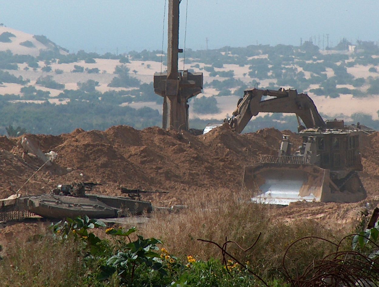
On September 13, 2008, the Israeli Army raided the village of Ni’lin West of Ramallah governorate in the middle of the night to arrest Palestinian minors. The raid was carried out by more than 100 Israeli soldiers who entered the village after midnight and surrounded several Palestinian houses before the break the doors and enter the houses terrorizing all those living there. The Israeli raid resulted in the arrest of the following:
-
Mohammad Khawaja (11 years old)
-
Abed Rahman Khawaja (13 years old)
-
Al’a Adien Khawaja (18 years old)
-
Sufian Khawaja (19 years old)
The detainees were transported to a holding facility under the control of the Israeli Army and only one of them; Mohammad Khawaja (11 years old) was granted bail for USD $900 pending he shows to trial, which is, supposes to take place today September 16, 2008.
The charges presented to them were that they participated in the demonstration and protests against the Israeli Army working to confiscate and isolate their land behind the Segregation Wall. The arrested youth including the minors were severally beaten and humiliated during the time of their arrest.
It should be mentioned here that Israel have no restriction to force collective punishment or arrest minors and violate the international law. Currently there are more than 300 Palestinian minors in Israeli prisons
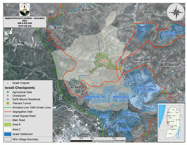
Ni’lin village: Location & Population
Ni'lin is a Palestinian village located about 18 kilometers to the west of Ramallah city. The village boundary spreads on 14794 dunums of lands and is the home to 4751 inhabitants (Palestinian Central Bureau of Statistics, 2007) most of whom work in agriculture after loosing their jobs inside Israel following the eruption of the second Intifada in September 2000.
The village is surrounded by the Palestinian villages of Deir Qiddes and Kharbatha Bani Harith from the east, Al Midya and the Armistice line (Green Line from the West, Qibya and Budrus from the north) from the south side of the village Modi’n Illit settlements’ bloc. According to Oslo II Interim Agreement signed between the Israeli Government and the Palestinian National Authority in 1995, Ni’lin village was classified into the following jurisdictions as in table 1.
|
Table1. land classification in Ni’lin |
||
|
Area |
Area in Dunums |
% |
|
Area A |
0 |
0 |
|
Area B |
988 |
6.7 |
|
Area C |
13806 |
93.3 |
|
Total |
14794 |
100 |
Source: Geo-Informatics Department Database – ARIJ 2008
Ni’lin village following the 1967 Israeli Occupation
Following the 1967 Israeli Occupation of the West Bank and the Gaza Strip, the Israeli Government successively confiscated vast areas of lands to construct settlements, construct bypass roads and build military bases. Ni’lin village was one of many Palestinian villages in the West Bank that witnessed the Israeli violations, hence, Modi'in 'Illit settlements bloc exist today.
On March 7, 2008, the Israeli minister of defense, Ehud Barak, issued an order to turn Modi'in 'Illit settlements bloc to a municipality. Modi'in 'Illit was established in 1991, 8 kilometers to the northwest of Jerusalem city. It is now known as Modi'in 'Illit settlement bloc containing five settlements with more than 40,000 Israeli settlers, which makes it one of the largest of settlements bloc in the occupied Palestinian Territory. Table 2 shows the Israeli settlements surrounding Ni’lin village.
|
Table 2: Modi'in 'Illit settlements bloc surrounding Ni’lin village |
||||
|
Settlement Name |
Date of Establishment |
Population 2006 |
Area/ Dunum |
Area of settlements inside Village Boundary/ Dunum |
|
Hashmona'im |
1985 |
2400 |
1050 |
934 |
|
Mattityahu |
1980 |
1400 |
683 |
661 |
|
Menora |
1998 |
1804 |
759 |
20 |
|
Shilat |
1977 |
376 |
978 |
74 |
|
Modi'in Illit (Qiryat Sefer) |
1991 |
34500 |
3973 |
274 |
|
Total |
|
40480 |
7443 |
1963 |
Source: Geo-Informatics Department Database – ARIJ 2008
The Israeli Segregation Plan in Ni'lin Village
According to the Israeli Segregation Wall route in the vicinity area running 8.7 kilometers near Ni’lin village, some 5883 Dunums (40% of Ni’lin’s lands) will be lost behind the Segregation Wall. Table 3 shows the status of the Segregation Wall in Ni’lin area and table 4 shows the land Use/Land Cover (LULC) of the area isolated. See Table 3
|
Table 3: Status of the Segregation Wall running on Ni’lin land |
|
|
2.7 Km |
Existing Sections |
|
2.9 Km |
Planned Sections |
|
3.1 Km |
Under Construction |
|
8.7 Km |
Total Length |
Source: Geo-Informatics Department Database – ARIJ 2008
Table4
|
Land classification Land Use/ Land Cover |
LULC of Ni’lin village boundary |
LULC of area isolated by the Wall &% |
|
Agricultural lands |
5487 |
1059 (19%) |
|
Forests and non- Vegetation areas |
1898 |
1838 (97%) |
|
Forests & Open spaces |
4774 |
1009 (21%) |
|
Artificial landscape |
12 |
0 |
|
Palestinian Built-up area |
660 |
14 (2%) |
|
Israeli settlement |
1963 |
1963 (100%) |
|
Total |
14794 |
5883 |
Source: Geo-Informatics Department Database – ARIJ 2008
::::::::::::::
Areas Definition in Oslo II Interim Agreement of September 1995
-
Area A: The Israeli army has pulled out fully and Palestinians hold all responsibilities for internal security and Public order.
-
Area B: The Palestinians have responsibility for civil life such as economics, health, and education; while, Israel retains full control over security and administration related to the territory.
-
Area C: Palestinians have full control over the civil administration and Israel continues to have overriding responsibility for security.
Prepared by
The Applied Research Institute – Jerusalem