On February 23, 2008, the Israeli Army handed out residents of Ad Dhahryieh and Dura towns located at the southern part of Hebron Governorate an amendment-addition to a previously issued military order number (05/183/T), which states the confiscation of 766 dunums of lands from the two communities. The confiscation order also came on some lands from Bir Al Sabba inside the 1949 Armistice Line (Green Line). The military order was issued under the claim of military uses to construct a security fence (part of the Segregation Wall) around Eshkolot settlement located in the southwestern part of Hebron Governorate. See Annex 1 for translation of Military Order
According to the analysis conducted by the Applied Research Institute – GIS Department, the Israeli confiscation order issued for the construction of the so-called security fence is actually 861 dunums, which contradicts what came in the military order (766 Dunums) See Table 1 for more details.
|
Table 1: Area Confiscated for the construction of the Israeli Segregation Wall according to Military Order Number (05/183/T) |
|
|
Palestinian Community |
Area in Dunum |
|
Bir Al Sabba area |
585 |
|
Dura |
108 |
|
Ed Dhahiriya |
168 |
|
Total |
861 |
|
|
|
|
Total Wall length as described in Military Order Number (05/183/T) |
|
|
Palestinian Community |
Wall Length (km) |
|
Bir Al Sabba area |
11 |
|
Dura |
13.4 |
|
Ed Dhahiriya |
9.6 |
|
Total |
34 |
Source: ARIJ GIS Database – 2008
Military Order (05/183/T) …
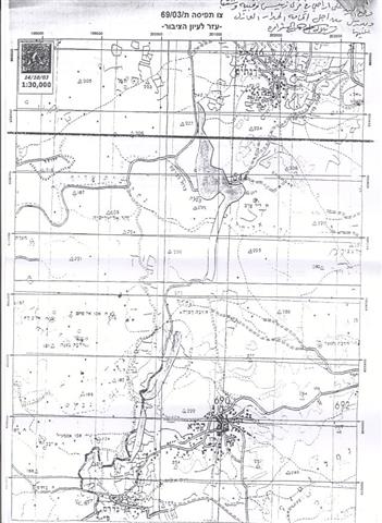
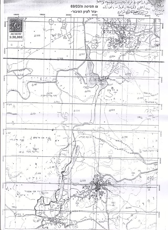
On October 31, 2005, the Israeli Army handed out residents of the aforementioned villages a military order number (05/183/T) to confiscate 292 dunums of lands to construct part-section of the Segregation Wall in the vicinity of Eshkolot settlement at the southern tip of the west Bank. The order at that time, stated that the construction is for two Wall sections, the first to the northwest of Eshkolot settlement, parallel to the 1949 Armistice Line (Green Line) while the second was to surround Eshkolot settlement from its eastern part (stretching from north – south to southwest). See Map 1
The new amendment-addition to military order number (05/183/T) increases the area targeted for confiscation from Ad Dhahriyeh and Dura communities than what was stated in the original order; in fact, the order comes to complete the annexation of Eshkolot settlement beyond the Wall as dozens of other Israeli settlements enclosed by the Israeli Segregation Wall further north of the West Bank.
Why is it a land grab?
The numbers speak on their own, while Israel claim that the so-called security fence is intended to protect the illegal settlements and to prevent infiltration to Israel, they are confiscating more, much more of the Palestinian land to realize that questionable purpose. The Israeli settlement Eshkolot has a built-up area of 157 Dunums, however, the Israeli Army routed the Israeli Segregation Wall around it to confiscate – annex – 2434 Dunums that is 15 times more than the area of the Israeli settlement.
Something to look ahead for in the near future
Along the same route of the Segregation Wall of the Israeli settlement Eshkolot lies another Israeli settlement called Sinsaneh built on 234 Dunums of confiscated Palestinian land, and likewise the Israeli Army intend to include it within the Segregation Wall, and thus an anticipated Israeli military order to issue for this purpose where it will confiscate – annex – 829 Dunums (3 time more than the area of the Israeli settlement) of Palestinian land to realize their plan.
Eshkolot settlement
The Israeli Eshkolot settlement was established in 1982 southwest of Hebron governorate and colonized by more than 225 Jewish settlers. The settlement's built-up area comprises an area of 157 dunums of lands originally owned by Palestinian villagers of Ad Dhahryieh. This settlement has neither strategic nor economic importance whatsoever. For almost one and a half year, this Wall section was left un-constructed to the west of the settlement at a length of 4.1 km in anticipation of an Israeli decision to dismantle this settlement and construct the Wall on the 1949 Armistice Line (Green Line).
To conclude:-
The Israeli Government and through the construction of the Segregation Wall, seeks to annex the largest number of Israeli settlements where the majority of Israeli settlers' population lives. The latest version of the Israeli Segregation Wall map indicate that upon the completion of the Wall, a total of 107 Israeli settlements with more than 80% of the total Israeli settlers population will be annexed to Israel's proper. This clearly contradicts Israel's claim that the construction of their so-called security fence is intended for security purposes. Moreover, upon completion, the Segregation Wall will consequentially annex and in this manner confiscation approximately 13% (713 km square) of the West Bank Area (5661 km square), which will include the area of Israeli settlements, outposts, military bases, Palestinian agricultural areas and open space, but worse than that it will deal the Palestinian economy and agriculture sector a mortal blow keeping it incapacitated and dependent.
Annex 1:-
|
Israel Defense Forces Order to Seize lands # (05/183/T)
According to my authorities as a Military Chief Commander in the Region of Judea and Samaria, and as I believe that it is imperative for military reasons due to the special security situation in the region, I order the following:
1- In This Order:
The 'Map' – signed in scale 1: 15.000 and attached to the order is an essential part of this order.
The 'Lands' – An area of 766 dunums of land marked in red in the map and is located in lands of: Ad Dhahriyeh: (parcel 5: Wadi Fatem and 'Enab Al Kabera Hamlet) Dura: (parcel 52 : Al Sabti) Bir Al Sabba : (No Information)
2- I announce by that the above mentioned lands are seized for imperative military purposes, to construct a security wall in Eshkolot Settlement Area in lands of Ad Dhahriyeh, Dura and Bir As Sabe'.
3- The IDF seize the lands and an absolute control of the land is given to the Military Chief Commander of the Central Region through the Ministry of Defense Chief Officer in the Civil Administration Office.
4- Land Owners or those or those who act on behalf of them have the right to go to the District Coordination Office (DCO) in Hebron to get usage expenses and compensation.
5- Copies of this military order and the attached map are handed out to Land owners or to the District Co-ordination Office in Hebron.
6A-1: This military order is to be notified to Land Owners or those who act on behalf of them by posting it at the District Coordination Office in Bethlehem and dispersing it on the lands by any possible mean.
6A-2: Land Owners shall be notified by the date of the field visit that will be conducted by the District Coordination Office in Hebron to present the lands in the Order.
6B- Copies of the military order and the attached map are available for interested parties at the following places:
6C- Copy of the military order and the attached map is set at Hebron District Coordination Office Board for 10 days from the issuance date of the military order, as mentioned in Part (A).
7- Land owners or those who act on behalf of ownership have the right to object the military order in 7 days from the date of the field visit as mentioned in Part (5A) above through the District Coordination Office in Bethlehem or at the Office of the juridical advisor in the region.
8- This order is valid from the date it was signed and until 31/06/2008.
10- This order is called: 'Order to seize lands n0 (05/183/T) (Amendment No. 3), (Judea & Samaria) 5766-2005. Gadi Shemni |
Prepared by
The Applied Reserach Institute – Jerusalem


