( Photo 1: olive trees that were cut down near the Wall path for security pretexts)
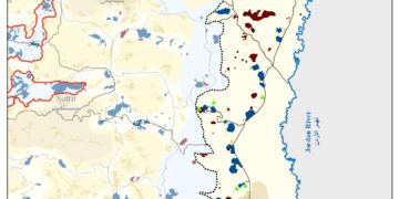
Location, population and area
Tura Al Gharbiya village is located 18 km to the south west of Jenin city. Its total land area is 2000 dunums, of which 204 dunums are built up area, while its total population is 1300. Currently, about 82% of the population depend on agriculture and animal husbandry as main income after losing their jobs inside Israel following the erection of the Segregation Wall. Before this, 92% of population were dependent on work inside Israel as main income and on agriculture as supplementary income.
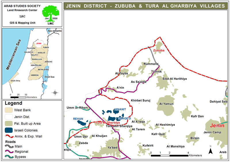
( Map 1: location of Tura Al Gharbiya and Zabuba)
Land confiscation and access prevention
Once the Wall construction was completed in the year 2003 almost half of the village's total surface land area has been separated behind its path. The 1000 dunums that were separated are considered the most fertile part of Tura Al Gharbiya's land as it is located in the plain of the village. Ever since, the occupation authorities have limited the access of owners and farmers into this area for security pretexts forcing every individual farmer to apply for passing permits from the Israeli military before he/she gets into his/her land. Such permits are difficult to obtain because farmers are asked to bring with them land registration documents, security clearance etc… Therefore, only a very limited number of farmers are able to get such permits at the proper time when it is needed.
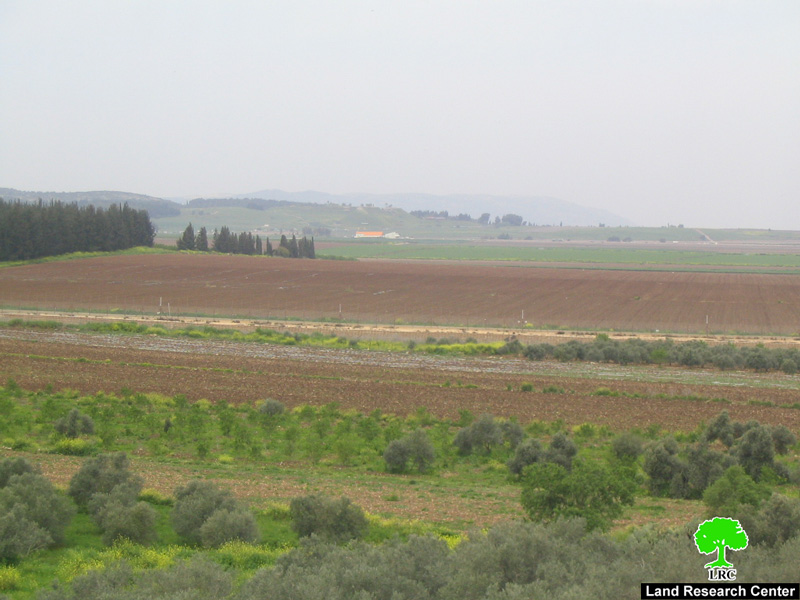
( Photo 2: Tura Al Gharbiya- Jenin: Fertile land separated behind the Wall path)
Even, if farmers get passing permits it doesn’t mean they can easily and freely enter in to their land as the Israeli army controls all the so –called Wall agricultural gates which are opened for short periods in the morning and evening or remain closed all the time when their is any security alert from the Israeli point of view. Also, to reach these gates farmers have to use alternative roads which are longer, more difficult and more costly after closing all the usual roads at the hands of the Israeli occupation. This policy which is applied all over the West Bank is a source of continuous suffering and worry for farmers and land owners and it dose seriously affects the possibility of land accessibility in the area.
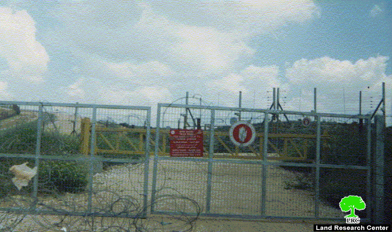
( Photo 3: Tura Al Gharbiya- Jenin: a closed Wall gate)
Official terrorism
Speaking about the eastern bank of the Wall path from the village side it faces almost the same bad fate as its owners are unable to tend it because of the ongoing Israeli ban on this land. Even shepherds are not allowed to enter the area, for example, the Israeli army opened fire last October for no particular reason at shepherd Fathi Misleh Qabaha whilst grazing his cattle and dismissed him out of the area. This incident has caused a lot of tension amongst farmers and shepherds who became reluctant to approach that area.
Following the erection of the Wall in the village unemployment and poverty levels have increased to unprecedented levels, especially, after separating the most fertile portions of land behind its path and limitating accessibility into the area.
No Palestinian construction near the Wall
In related development, the Israeli occupation authorities started a campaign of banning any Palestinian construction in the vicinity of the Wall path. While these authorities refuse to give construction permissions for Palestinians as the area is classifies as zone C according to Oslo agreement it began to distribute notifications to halt construction in the already started house and agricultural projects the latest of which was the house of Mr. Naji Taher Qabaha from Tura Al Gharbiya which was built 15 years ago.
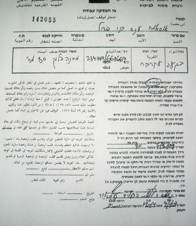
( Photo 4: Tura Al Gharbiya- Jenin: A copy of one of the halt construction notifications)
In an interview with LRC field worker Mr. Fayez Khalil Masu'od from Tura Al Gharbiya said that after he had lost his job in Israel because of the Wall and closure he built a barrack for poultry rearing in his land, but later he received a demolition order for this barrack under the pretext of being close to the Wall path.
Land devastation continued in Zabuba village
The village of Zabuba is located to the west of Jenin city and has the total population of 2393. Its land area is 2431 dunum of which 243 dunums are built up zone.
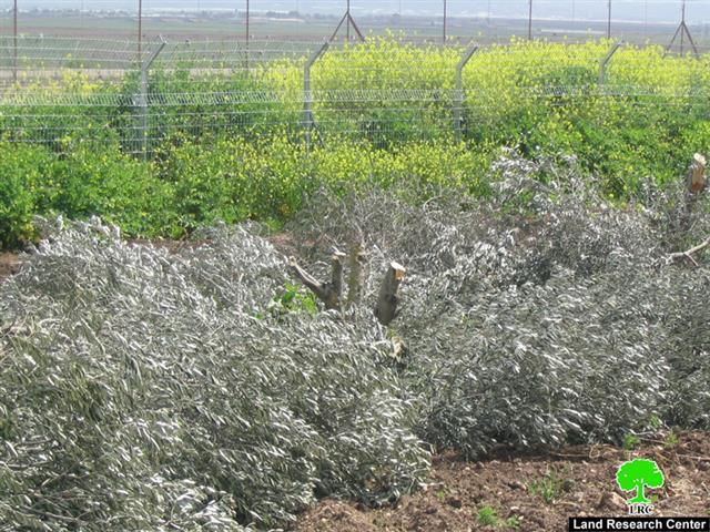
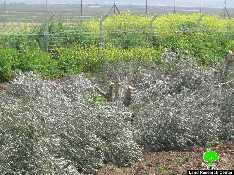
Similar to Tura Al Gharbiya, the Israeli occupation authorities continue to prohibit farmers and shepherds from approaching their land in the eastern side of the Wall path. In this regard, the occupation authorities systematically cut down fruitful olive trees and devastated agricultural fields situated in the vicinity of the Wall. These acts of formal sabotage took place three times during the course of the last year as followed:
1. At the beginning of March, 2008, more than 61 olive trees were cut down and 40 dunums cultivated with cereals were devastated. This land is owned by Mr. Mohammed Saleh Jaradat and Mr. Sabri Farid Abu Baker.
2. During September, 2008, an additional 74 olive trees were cut down.
3. In mid December, 2008, another 50 olive trees were, also, cut down. This brings to 185 the total number of olive trees that was cut down in Zabuba village alone during the course of the last year.
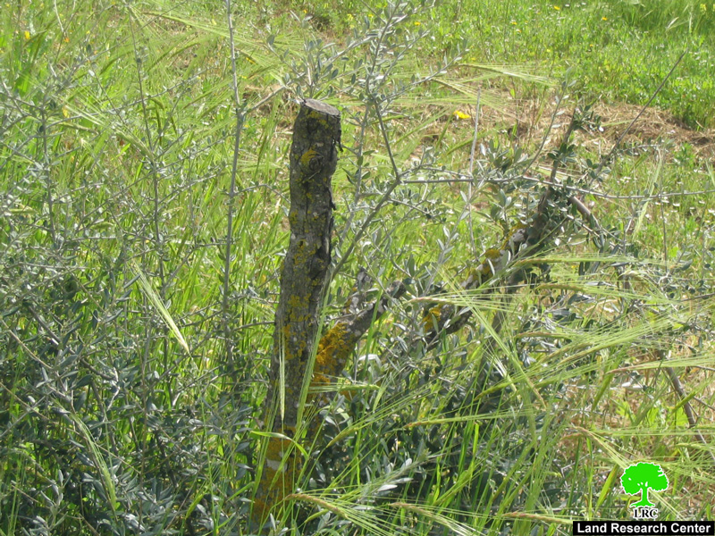
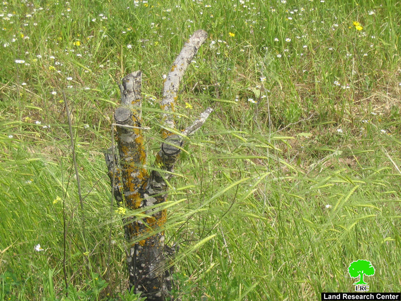
( Photo 5&6: Zabuba- Jenin: olive trees cut down last March near the Wall path)
Goal justifies means
The occupation authorities claim that the aforementioned number of trees was cut down due to security reasons, that is, the obstruction of the work of surveillance cameras fixed to the Wall path and to the military checkpoint at the western entrance to the nearby Salim village. These authorities say that the targeted trees are long enough to block the vision of the cameras, although these 'long' trees had been in place years before even the idea of the Wall construction was a reality.

( Photo 7: Zabuba- Jenin: a section of the Wall path that was built at the expense of the village land )
Prepared by
The Land Research Center
LRC