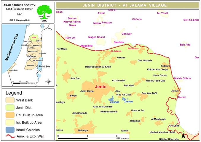
Location, Population and area
Al Jalama is a border village located eight kilometers to the north of the city of Jenin on the main Jenin – Nazareth road. It has the total land area of 3121 dunums of which 536 dunums are built up area. There are 350 dunums of the village land which are covered with agricultural green houses and 1000 dunums cultivated with ground seasonal crops such as wheat and barley, 500 dunums planted with vegetables and the remaining areas are olive groves (Source: Field work and GIS unit at LRC).
Currently, the population of Al Jalama mounts to 2595 inhabitants (source: PCBS). Before the construction of the Segregation Wall in 2003, the majority of the population were dependent on either labor market in Israeli or on agriculture as main income. However, after the Wall construction and the loss of land, around 60% of them became jobless and dependent on foreign aid. 2% of the population are Christians from the family of As Samori.

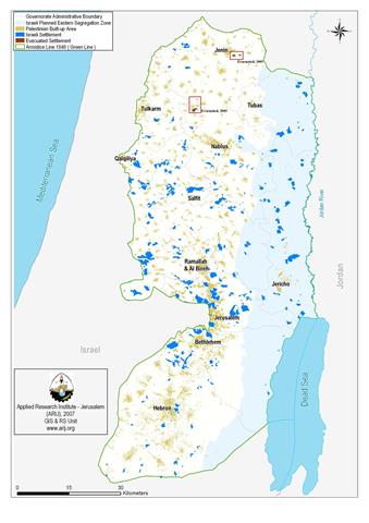
(Map 1: location of Al Jalama village)
Before the war of 1948 the three neighboring villages of Al Jalama, Sandala and Al Muqeibla were forming one geographic and demographic unity as their citizens derive from the same extended families of Farha, Sha'ban, Abu Isa, Ash Sha'ir and Sbeihat. They used to enjoy joint services such as schools, clinics, etc…After the war, two of the villages – Sandala and Al Muqeibla – were cut out by the green line and became part of Israel. In addition, a number of people from the families of Al Jaramna, Lawhna and Jalaiqa took refuge to Al Jalama village and became registered refugees by UNRWA.
Al Jalama and the Wall
The Wall was built at the length of 4 km over the land of Al Jalama destroying under its path around 400 dunums and separating behind about 24 dunums. Another 40 dunums of the village's land were, also, seized for the construction of the This brings to 464 the number of dunums that were destroyed, confiscated or separated as a result of the Wall construction in Al Jalama. This figure represents 14.8% of the total land area of the village.
The construction of the Segregation wall in the year 2003 resulted in the closure of the whole area in the face of Palestinians wanting to enter Israel for work or trade and the insertion of Al Jalama crossing terminal which mainly serves as an outlet for the merchandise of Israeli products in Jenin district. This step has caused far reaching economic, social and psychological impacts on the local communities in the three border villages as followed:
Economic impacts
-
The village of Al Jalama was considered to be agriculturally advanced due to its proximity to the Green Line as plastic houses and irrigated vegetations spread throughout its relatively small basin. It is very well known for the quality of its produce which was easily marketed to Palestinians of 1948 through the village’s main market before the construction of the Wall and the removal of the market which was, also, utilized in marketing vegetables and livestock coming from West Bank farming communities, especially those of Tubas and Jenin. Nowadays, the village is suffering due to the prevention of its inhabitants from exporting their produce into Israel and abroad and as a result of other violations committed by Israeli occupation forces.
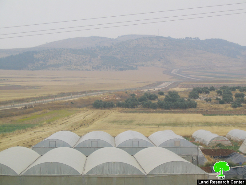
(Photo 1: Al Jalama-Jenin: some of the green houses passed by the Wall path on the left hand side)
-
The village used to be the main gate into and out of the Green Line as commercial goods used to enter Jenin through Al Jalama checkpoint before the construction of the Wall. No Arab Israelis or foreigners are allowed to go to Jenin district through Al Jalama terminal which only worsens matters to local residents and add to their economic hardships.
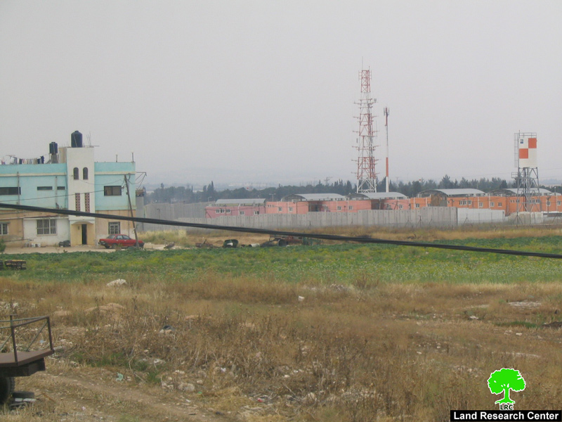
(Photo 2: To the right is the path of the Wall and the Al Jalama terminal;
to the left is a Palestinian house inside Al Jalama village)
Social impacts
-
Marital and other social relationships strongly exist between the Palestinians of Al Jalama and their counterparts in Muqaibleh and Sandala as the distance between them ranges between 300 to 1000 meters only. When work on the Wall began, tens of families whose heads were married to women from Muqaibleh and Sandala ended up having to move into the Green Line causing their separation from their original families in Al Jalama. In many other cases, marriages ended up in divorce due to the impossibility of maintaining constant relationship. Such examples include:
1. The case of Mr. Sa'id As Sahori, 32 years old, from Al Jalama village, who was forced to divorce his wife who lives with his her two daughters in the nearby, although, inaccessible village of Muqaibleh after the Israeli authorities had denied him of family reunification, or even passing permit;
2. The case of Mr. Mohanad Hasan Sha'ban, 29 years old, from Al Jalama, who got to divorce his wife from the village of Daboriya at the foot of Mount Tabor near Nazareth because he was denied family reunification by the Israeli occupation authorities.

(Photo 3: the village of Sandala is seen on the other side of the Wall opposite Al Jalama )
-
The prevention of casual family visits between the families of Al Jalama and the above-mentioned two villages.
-
The increase of social and psychological pressures due to the siege of Al Jalama.
Psychological impacts
-
The lives of the residents of the village are usually threatened when they try to access their farms as most of it, along with their houses, are located close to the Wall. Such a fact causes the farmers to feel insecure while at work on their lands due to the increased and noticeable presence of Israeli patrols.
On the other hand, the Israeli army often break into houses in the village under security pretexts destroying furniture and properties and manning house roofs. An example of this is the house of Mr. Mohammed Sa'id Sha'ban, 24 years old, whose house is only 30 meters from the Wall path which has been stormed and vandalized on several occasions by the occupation army.
Prepared by
The Land Research Center
LRC