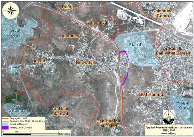
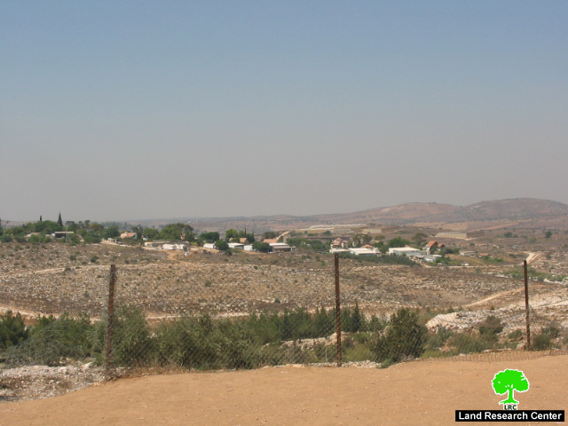
'Road barrier' is the latest Israeli tool for land confiscation in the West Bank. According to the Israeli army's published series of Wall maps and revised Wall maps, all the roads that are used by the Israeli settlers or army in the West Bank are marked with yellow color indicated to in the legendaries as 'road protection'. To put this in action, the Israeli army completed the erection a road barrier on road number 317 in the southern part of Hebron governorate. This road barrier whose total length is 13 km runs from the settlements of Karmel to that of Tene in south Hebron at the length of 13 km. It was provided to secure the movement of Jewish settlers driving along the bypass road by restricting Palestinian vehicular access onto them. It involved the construction of a continuous barrier of concrete running along the northern side of the bypass road. Built within three to four meters of the edge of the road, the barrier is 80cm to 1m high to prevent vehicles from crossing onto the main road (see case study ' road barrier replaces older Wall' , February, 2006'
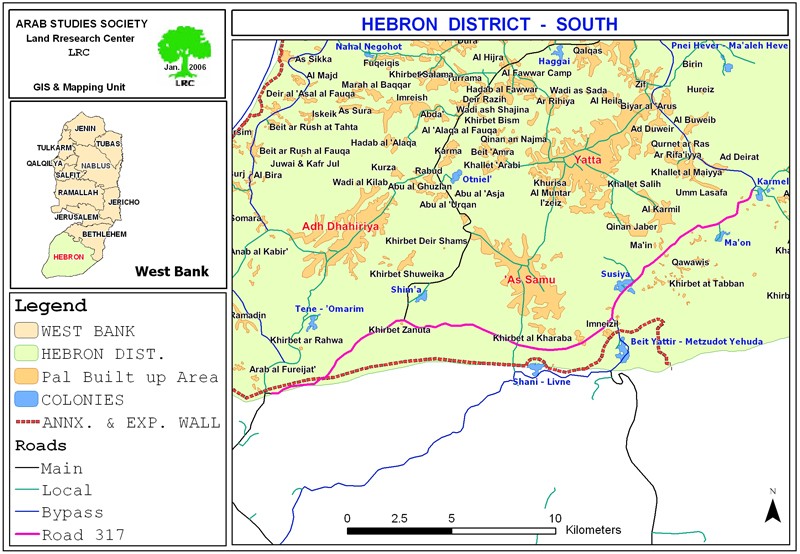

(Photo 1: road barrier on road number 317 south of Hebron)
Two more road barriers
As a continuation of this expansionist policy being carried out under security claims, the Israeli Army issued two new military orders for the construction of two road barriers: the first, on road number 60 in Wadi Hebron connecting Tene settlement with Bir Shiva' and confiscating 138 dunums for this purpose (see case study 'security barrier confiscates and separates more of Palestinian land around Tene settlement, July, 2006' ; the second, on bypass road number 3265 that connects the Negohot settlement with Kibutz Sheqiv inside Israel.to the west of Beit Awwa town.
This latest military order which carries the number of 98/06/T was issued on July 24th, 2006. It involves the construction of a continuous concrete barrier along the northern and southern sides of the bypass at the length of 2250 meters and width of 42 meters.
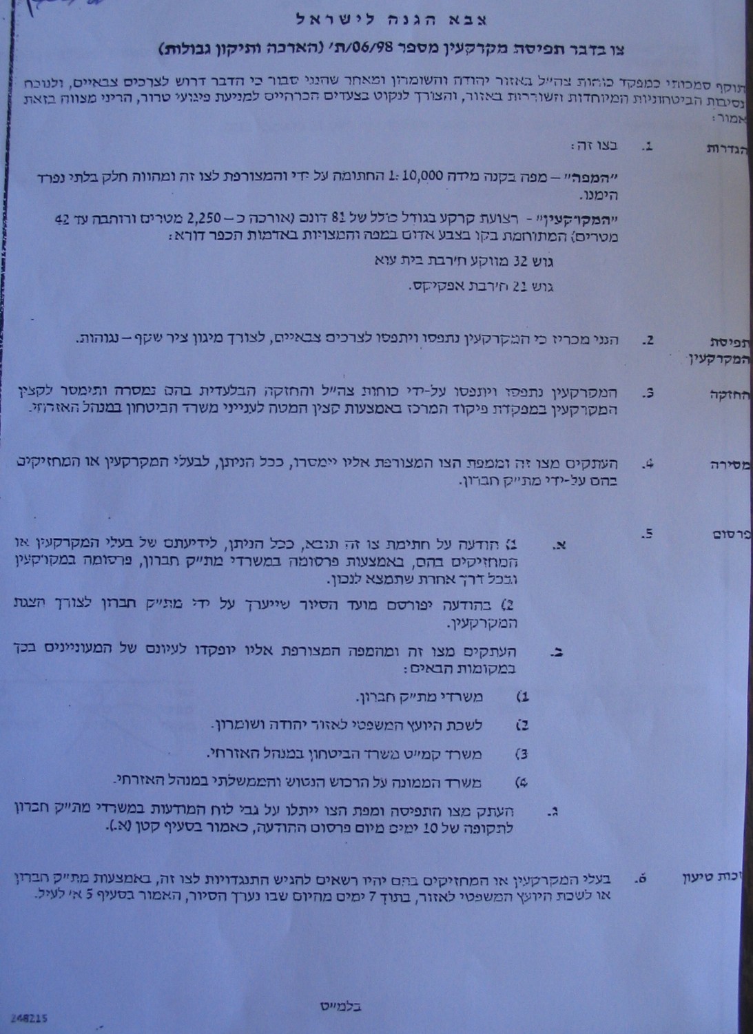

(Photos 2 & 3: a copy of the military order and its attached map)
The total of at least 94.5 dunums of land will be confiscated for this purpose. It is worth mentioning that this road was built two years ago over 150 dunums of Palestinian owned land belonging to the villages of Beit Awwa and As Sikka. It passes between the two villages; therefore, it constitutes a barrier not a link as Palestinians are not allowed to use it or cross onto it. With the inception of the proposed road barrier, it will, even, become impossible to cross from one side to the other.
Local Palestinian sources warned that in case the latest military decree was implemented it would complicate access to hundreds of dunums of olive and almond trees and damage more than 300 additional dunums in the vicinity of the target road. It will, also, stop the crossing of people and goods from one village to another.

(Map 2: The green colored section 2 of bypass road number 3265 that
will be provided with the above mentioned road barrier)
The settlement of Negohot
Established in the year 1982 over lands confiscated from the villages of Beit Awwa and Ifqeiqis. Its population toll went down to 135 in the year 2004, compared to 400 before the out break of the Intifada in the year 2000 (Source- Foundation for Middle East Peace- Washington). The settlement has the total built municipal and built up area of 90 dunums (Source- Foundation for Middle East Peace- Washington).
Beit Awwa
Beit Awwa is located on the green line about 22 km to the south west of Hebron city. Its lands extend as far as the green line. It has the population of about 10000 inhabitants. Its remaining total surface land area is 7148 dunums, including 1505 dunums as built up area.
During the War of 1948, Beit Awwa lost almost half of its land to Israel. The village became under heavy artillery bombardment on the part of the Israeli army during the war of 1967 inflicting heavy damage and making hundreds of people homeless or refugees. Nevertheless, the village remerged and became one of the largest villages in the area.
Concerning the Annexation and Expansion Wall, the total of about 600 dunums was seized or separated for the purpose of Wall construction cultivated with almost 3000 olive and almond trees.
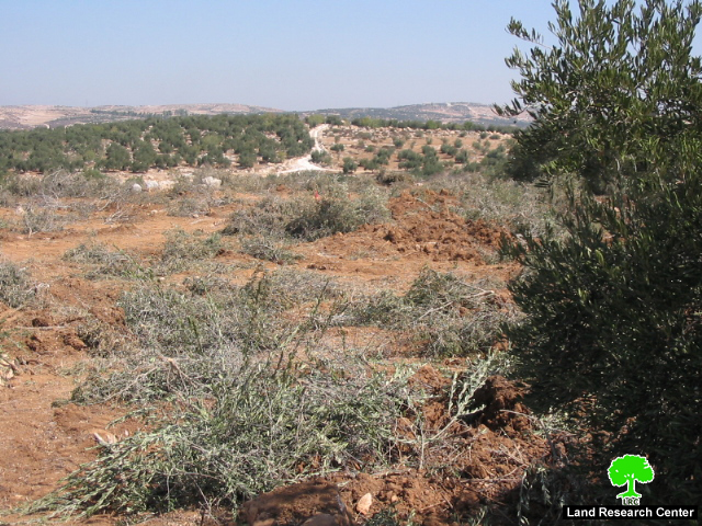
Photo 4: The Wall path targeted olive orchards in Beit Awwa
Part of the Wall was built with cement at the western edge of the town to separate it from Kibutz Sheqiv inside the green line.
(Photo 5: Kibutz Sheqiv to the west of Beit Awwa)
As Sikka
The village of As Sikka is located about 20 km to the south west of Hebron city on the green line. Its land total surface area is 3137 dunums of which 300 dunums are built up area. As Sikka has the population of 1000 people, mostly working in agriculture.
In an interview with LRC filed worker, the head of As Sikka village council, Mr. Majid Hashish, said the Israeli bulldozers destroyed dozens of dunums of agricultural land during the construction of the Wall in the year 2004, mostly planted with olive trees in Wadi Kharash north of the village. He confirmed that the targeted lands are considered the main source of living for Palestinian families, especially at the time of military closure and restriction of movement. Not less than 2000 olive trees have been uprooted from As Sikka lands to make room for the construction of the Wall. At the western edges of the village.
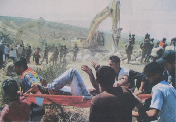
(Photo 7: Some of the Anti Wall confrontations broke out between Palestinian
protesters and Israeli forces in Wadi Kharash during 2004)
Photo courtesy of Al Quds Newspaper
Mr. Hashish went on the say that in 1948, about 80% of the village lands were confiscated by Israel. From the remaining area, the total of 80 dunums have been confiscated or separated for the construction of the Wall. Now, the village is strangled by Israeli settlements from the west and east, as well as from the bypass road from the north.
Prepared by
The Land Research Center
LRC