The Israeli occupation forces (IOF) distributed dozens of written notices stipulating the uprooting of hundreds of olive and almond trees in the eastern bank of the Segregation Wall path in Jenin district under security pretexts. The notices were stuck at the tree trunks planted at the depth of 100 meters from the Wall path and belonging to farmers from Zabuba village. The notices state, in Arabic language, that 'it is temporarily forbidden to enter the land until the process of tree uprooting has been completed'.
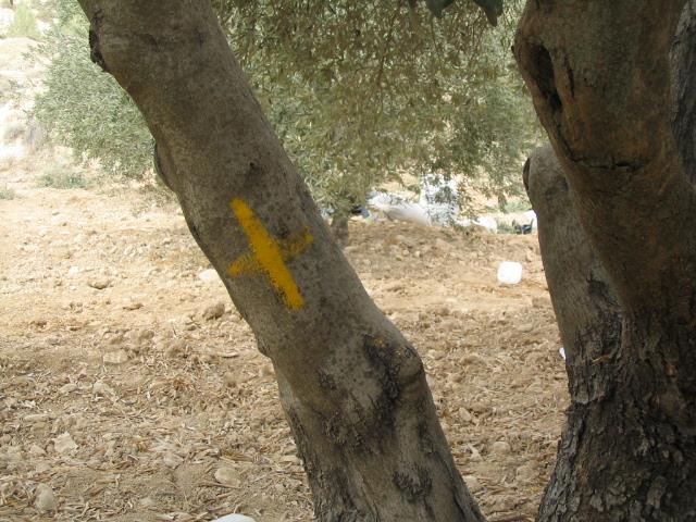
To put this in action, Israeli soldiers marked the trunks of these target trees with yellow paint, maintained intensified presence in the target lands and blocked the entry of farmers into their lands which has been planted with these trees many years ago.
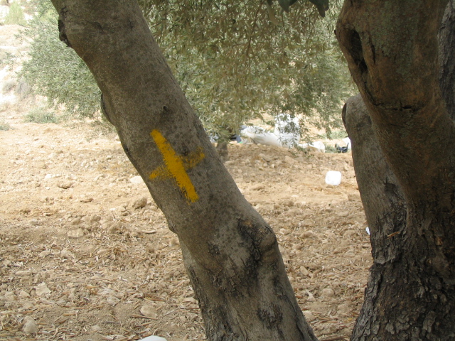
Photo 1: Zabuba – Jenin: an olive tree being marked for uprooting
Affected Palestinian farmers confirmed to LRC field worker that the Arm'y security claim is just a trick aimed at misleading the public opinion and concealing the real intention behind this arbitrary action which comes as part of the ongoing policy of dispossession, deprivation and economic punishment.
Location, population and area
The village of Zabuba is located 12 km to the north west of Jenin. It borders the green line and is located in the most north western corner of the West Bank. On the main Jenin- Haifa road at the southern edge of Zabuba is located the border crossing point of Salim.
Zabuba's current population toll is 2400, mainly formed of three families: Jaradat, Maqalda and Amarneh. Its remaining total land area is 2431 dunums, of which 685 dunums are built up area. During the War of 1948, Zabuba had lost about 18000 dunums of land. Another 2000 dunums of fertile were lost as part of Rhodes border modification agreement of 1958 bringing to 20000 the number of dunums took out from the village. All the Zabuba taken over land is considered one of the most fertile plain land in the whole of the West Bank, as it is part of Marj Ibn Amer plain (plain of Esdraelon).
Zabuba and the Wall
Because of its strategic geographical location in the junction point connecting between the Galilee region in the north and Jerusalem in the south, Jordan valley in the east and the Mediterranean in the west the village of Zabuba has been going under continuous Israeli violations ever since the establishment of the state of Israel.
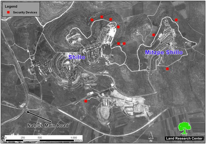
The inception of the Segregation Wall on its land was the most recent episode in the series of non- stop violations. In fact, the first stage of the Wall construction started here in Zabuba at the length of 6 km destroying about 500 dunums under its path and separating more than 1000 others behind. Wall works were completed in this section during the first half of 2004. See Map 1
The IOF have been refusing to allow Palestinian access to the separated land as no Wall gates has been fixed in the 6 km long Wall section in Zabuba. The aforementioned Salim border crossing is the only possibility in this matter; however, it is mainly used for military purposes and very often closed in the face of Palestinian farmers willing to reach their separated land. This situation has lately encouraged the Israeli kibbutzes in the area to use these lands as grazing zones for their cow herds, in addition to releasing flocks of wild pigs in these lands for the purpose of destroying what has remained of ground crops and other plantations.
The construction of the Segregation Wall has, also, separated the village from its sisterly villages and towns in the other side of the green line, hence, creating more difficulties for social communication and interaction, especially amongst families of the same origin and lineages. For example, there are strong social and traditional relationships between the citizens of Zabuba and their counterparts and relatives in Um Al Fahim town (only 7 km to the west of Zabuba) and Salim village (only 3 km to the west of Zabuba). Nowadays, the journey from Zabuba to Um Al Fahim takes almost two days instead of only 15 minutes as one has to sneak to Jerusalem and from there proceed to Um Al Fahim in an adventurous and more costly journey. Mohammed Jaber Ali Maqalda, for instance, has two daughters married in Um Al Fahim and he has been unable to see them for the past 6 months because of the existence of the Wall.
On the other side, the Wall has blocked the urban expansion of the village towards north and north west as the village's land is either confiscated or separated behind the Wall. In addition, the Israeli occupation authorities have restricted construction at the depth of 150 meters from the eastern side of the Wall path. Moreover, the Haifa- Jenin main road which is located at the southern borders of the village is another barrier preventing any expansion in the village's built up area towards south.
Prepared by
The Land Research Center
LRC