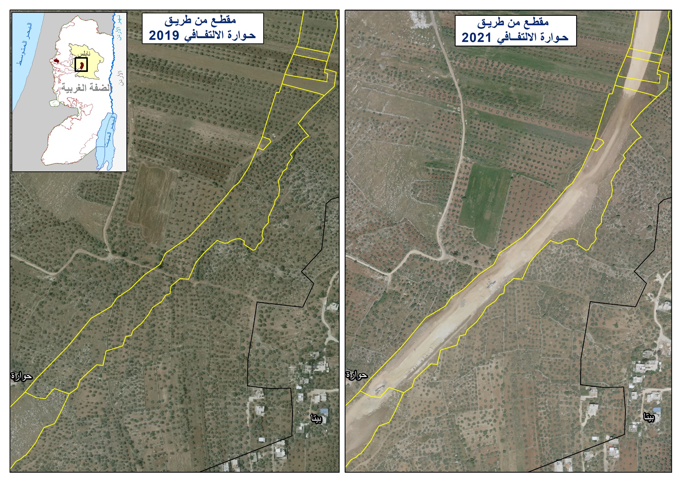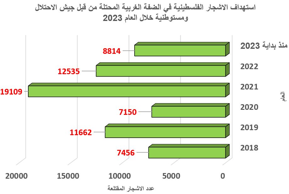
Starting from April, 2006, the Israeli occupation forces began to tighten measures on farmers and citizens of the village of Habla, Qalqiliya, by terrorizing and preventing them from approaching their agricultural fields, especially those located near the eastern sections of the Annexation and Expansion Wall.
Location, population and area
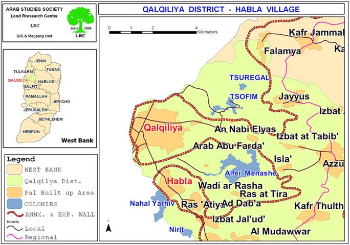
The border village of Habla is located at the southern edge of Qalqiliya city. It has the total population of 5000 people. It's built up area is 863 dunums out of a total surface area of 4717. See Map 1
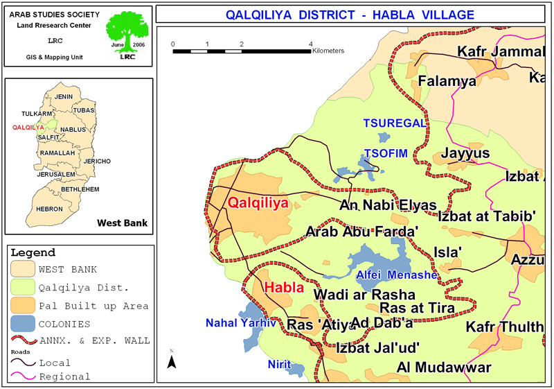
Map 1: location of Habla village
Continuous terror campaign
The Israeli army's measures against farmers and villagers encompass firing shoots in the air between now and then, producing noisy and scary sounds from military watch towers, and preventing them from approaching their cultivated lands. Thorough examination and checking of all agricultural material, including insecticides, manure and fertilizers are, also, being carried out by the Israeli army under the pretext of safeguarding the Israeli security. See Photo 1
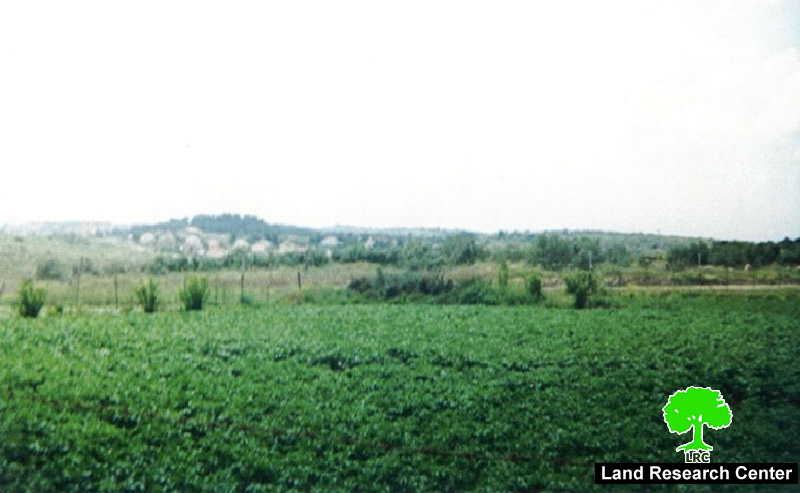
(Photo 1: in the background is the settlement of Alfei Menashe:
in the foreground is an agricultural field whose owners are constantly terrorized
by the army because of its proximity to Wall )
The village and Wall
The village of Habla has lost large parts of its fertile land to the Israeli occupation in 1948 and became part of current Israel. The two settlements of Nahal Yarhiv and Nirit in the western side of the green line were partially built on the confiscated Habla's land which is considered one of the most productive lands because of its fertility and availability of underground water. Hence, it has been a target of the Israeli military occupation after the War of 1967. As a result of the Wall plan which was initiated in the year 2002,more than 49% of the remaining Habla's land has been destroyed under the path of the Wall or separated behind it. This, in effect, has raised the level of unemployment in the village to 70% as most of families depend on agriculture for their daily livelihood. The Wall travels about 4 km around the village from three sides: north, west and south. See Photo 2
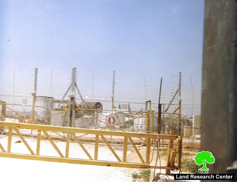
(Photo 2: a Wall gate very often closed by the army to prevent Palestinian
farmers from tending their crops in the other side of the Wall)
Before the Wall was established Habla served as a border trade center between Israel and the West Bank as thousands of shoppers would come from the other side of the green line to purchase goods from Habla market. But now, with the inception of the Wall, hundreds of Palestinian families have lost their only source of income.
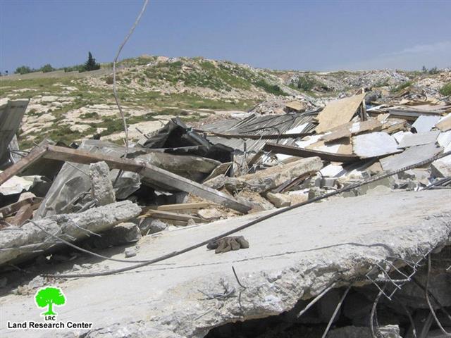
The Wall has, also, caused the destruction of nearly 100 dunums of agricultural plastic houses, the uprooting of more than 300 olive and citrus trees and the stealing of 7 underground wells for the benefit of Alfei Menashe settlement which is situated only one km to the east of the village ( established in 1983 over 150 dunums of Habla land and in 2004 it had the population of 5433 settler). Moreover, two underground wells were destroye3d under the path of the Wall. See Map 3
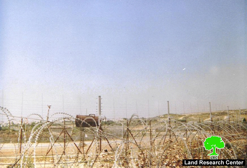
(Photo 3: a section of the barbed wire Wall path around the village of Habla )
On the other hand, and at the beginning of 2005, the Israeli army dug a tunnel to connect the city of Qalqiliya with its southern and eastern villages over 50 dunums of lands confiscated f45rom Habla village.
Most seriously, the villages of Habla, together with its neighboring khirbets of Ras Atiya and Izbat Jal'ud are located inside a closed canton created by the Wall since 2003 (see the attached map).
Prepared by
The Land Research Center
LRC