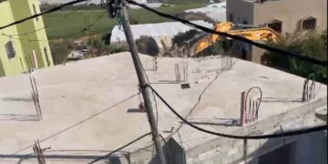
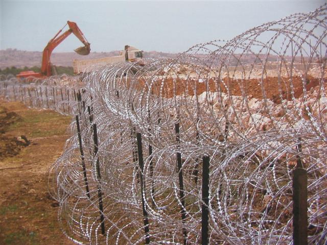
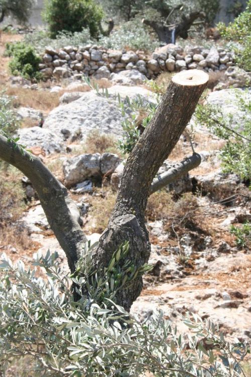
Early on June 27, 2006, the Israeli Army unleashed its anti-nature force of destruction on Beit Jala's land; northwest to pave the way for the Israeli Segregation Wall set to close off the town's northern and northwestern lands from its owners. Already at the their first day to destroy the cultivated lands of Beit Jala, the Israeli Army members send offs destroyed more than 100 fruitful olive trees located along the designated route set for the Segregation Wall. See Photo 1 & Photo 2
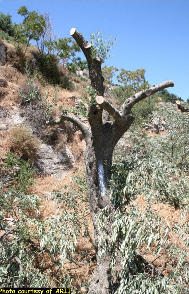
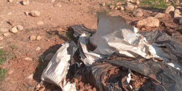
The trees will be uprooted later on just as soon as the Israeli Army complete marking of all trees planted where the route of the Segregation Wall will go. The marking placed by the Israeli Army on the trees set for uprooting is spray paint on trees' trunks and red ribbons tied on trees' branches. See Photo 3, Photo 4 & Photo 5

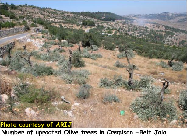
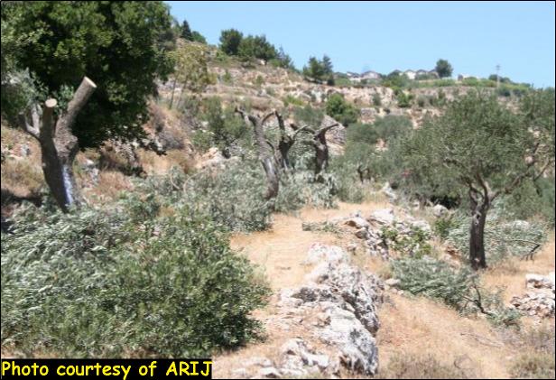
According to the route of the Segregation Wall, thousands of fruitful olive trees face the threat of destruction and uprooting if the Israelis proceed with their plans to put up the Segregation Wall on Beit Jala's north and northwestern lands.
Upon first estimate; tens of Beit Jala's families who owned the lands for generations are affected by the Israeli Army malicious acts as they stand to lose a regular and hefty part of their annual income coming from their olive harvest.
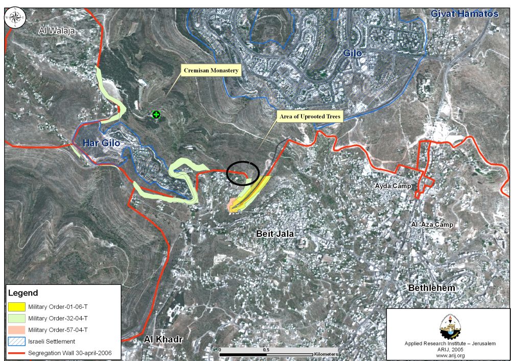
The Israeli Segregation Wall is set to run across 11.7 Km of Beit Jala's lands; already 2.7 Km completed and the remaining 9 are under construction or planning. The Wall extends from the northeastern part of Beit Jala, runs along the northern part of Ayda refugee camp, cuts through Beit Jala’s northern lands, stretches west towards Gilo settlement, continues until it reached bypass road 60 (the tunnel section) and then runs along road 60. The Wall stands to isolate behind it some 6420 Dunums (approximately 45% of Beit Jala's lands), which will effectively become out of their owners hands and beyond their reach unless they (the owners) are in possession of a valid permits issued from the Israeli civil administration. See Map of the Affected Area
The following (Table 1) shows the amount and classification of Palestinian lands belong to Beit Jala's residents isolated by the Israeli Segregation Wall upon its completion.
|
Amount and classification of lands isolated by the Israeli Segregation Wall in Beit Jala |
|
|
Land Classification |
Area in Dunums |
|
Agricultural Lands |
2808 |
|
Open Space |
1216 |
|
Forests |
1003 |
|
Total |
5027 |
According to Beit Jala's municipality, the population stands at 3628 person/Km² as of 2005 and with 1216 Dunums (71%) of the open space set for future development of the town's build up area by the Segregation Zones; the population density is projected to increase to nearly 4196 persons/ Km² within the coming five years. The agricultural sector of the Beit Jala is also looking to suffer enormously by the Segregation Wall as landowners of Beit Jala will lose 2808 Dunums (62%) of their agricultural lands behind the Segregation Wall.
Related Case Studies
Prepared by
The Applied Research Institute – Jerusalem
ARIJ