Wall re-routing: a new tool for the destruction and confiscation of more Palestinian land
An additional 894.500 dunums (eight hundred ninety four dunums and five hundred square meters) of fertile ...
Read moreAn additional 894.500 dunums (eight hundred ninety four dunums and five hundred square meters) of fertile ...
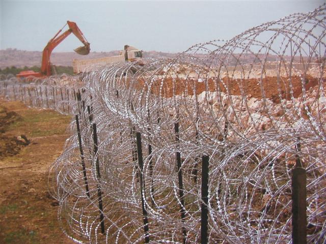
Read more(Photo 1: Wall works in the western parts of Hebron governorate) The Governorate of Hebron ...
Read moreEarly on June 27, 2006, the Israeli Army unleashed its anti-nature force of destruction on Beit ...
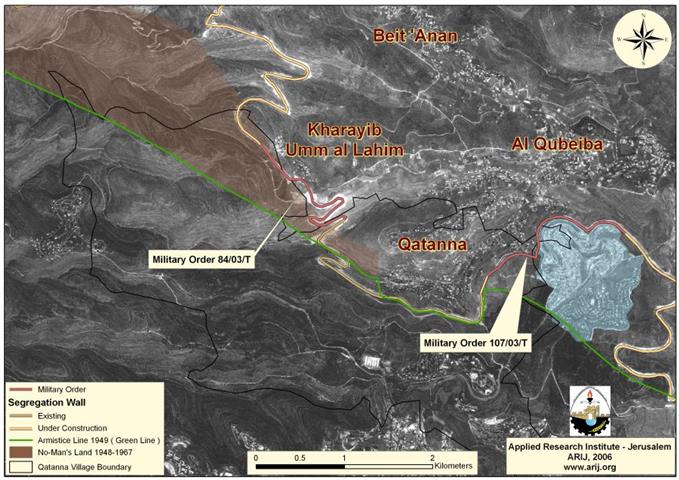
Read moreQatanna village: Location and Population Qatanna, a Palestinian village located 12 Kilometers to the northwest of ...
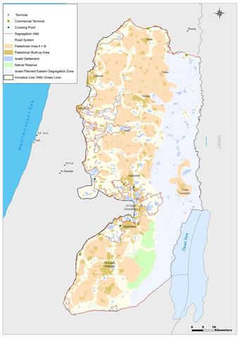
Read moreFollowing the occupation of the West Bank, including East Jerusalem, and the Gaza Strip in 1967, ...
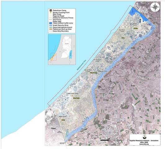
Read moreBackground Geographically, Gaza Strip forms the westernmost portion of the Palestinian territories, having land borders with ...
Read moreThe Israeli occupation authority, as part of its segregation Wall plan for the northwestern Bethlehem area, ...
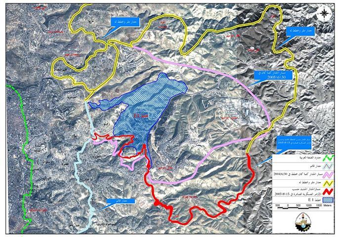
Read moreThe Israeli Government endorsed on April 30, 2006, an updated Wall plan which included changes in ...
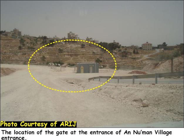
Read moreوضعت محكمة العدل العليا الإسرائيلية نهاية لأحلام سكان قرية العيزرية في القدس الشرقية ...
Read moreصورة رقم 1: مسكن المواطن زيد زيدان جابر في موقع طريق ضرغام في قرية ...
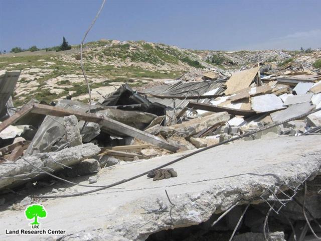
Read morePhoto 1: the house of Mr. Zeid Zeidan Jaber in Al Zayyem after demolition The ...
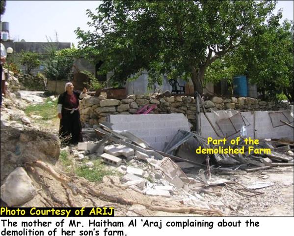
Read moreStarting from April, 2006, the Israeli occupation forces began to tighten measures on farmers and citizens ...
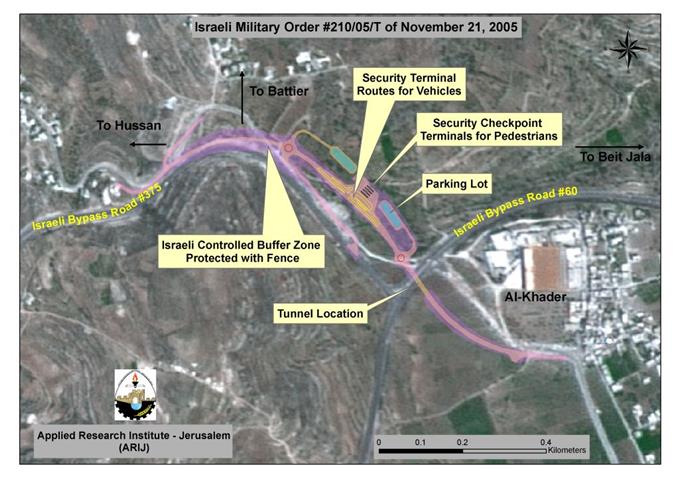
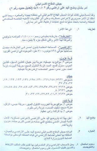
Read moreAfter issuing the military order (# 210/05/T) in 21, November 2005, which states the confiscation of ...
Read more