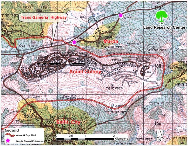
The Israeli occupation forces set up two iron gates at the western and eastern entrances to Marda village, Salfit governorate during last February turning the whole village into a big prison. See Map 1
(Map 1: The western and eastern entrances to Marda
village closed by iron gates and earth mounds)
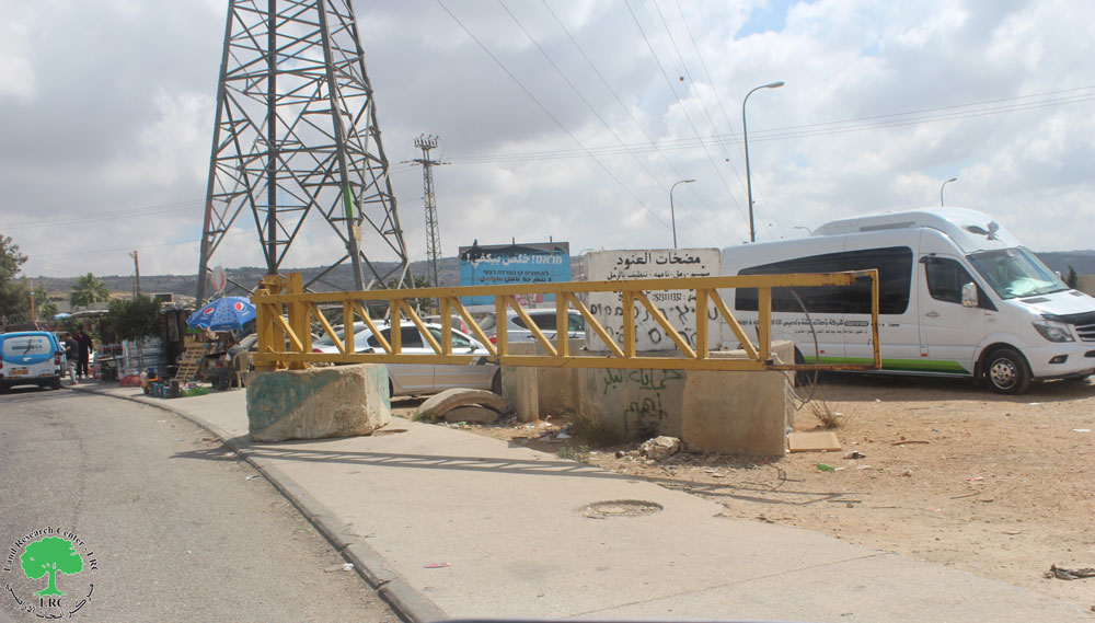
Although the western entrance has been closed with earth mounds since the outbreak of the Intifada in the year 2000 it was provided with a new iron gate. The eastern gate has been the only passage way for the residents of the village but only after passing through regular checking at the hands of the Israeli soldiers stationed there.
Location, population and area
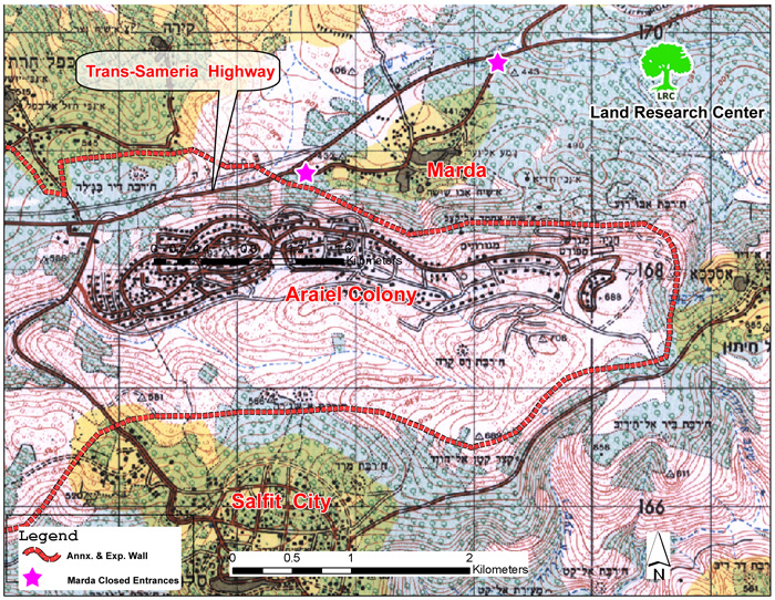
The village of Marda is located 9 km to the north west of Salfit city. It is besieged between Ariel settlement in the south and Trans Samaria highway in the north. It has the total population of 2400. Its total surface area before 1978 was 9326 dunums of which 499 are built up area. See Map 2
(Map 2: Location of Marda between the settlement
of Ariel and Trans Samaria hog way)
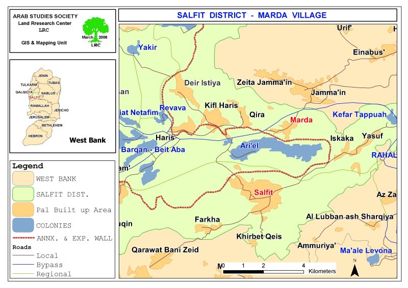
The construction of Ariel settlement started in 1978 over lands confiscated from Marda village and from the villages of Haris, Kifl Haris, Qira, Jamma'in, Iskaka and Yasuf in Salfit governorate as well as from the city of Salfit it self. According to the Washington based Foundation for Middle East Peace, Ariel's settler population in 2004 reached 16414.
In February last year, the commander of the Israeli army in the West Bank, Ya'ir Neve, signed military order number T/32/05 stating the confiscation of 197 dunums of Marda village land and 85.1 dunums of Iskaka village land, for the construction of the Annexation and Expansion Wall around the settlement of Ariel. The Wall was built in Marda's land at the length of 5km and width of 60-80 meters resulting in the destruction and separation of almost 1000 dunums of agricultural fields.
Road barrier
To further imprison the village, the Israeli occupation forces erected last year a road barrier along the Trans Samaria highway passing by the village leading to total isolation and separation of the village from sisterly villages in the area and from its extended agricultural lands to the other side of the road. See Photo 1
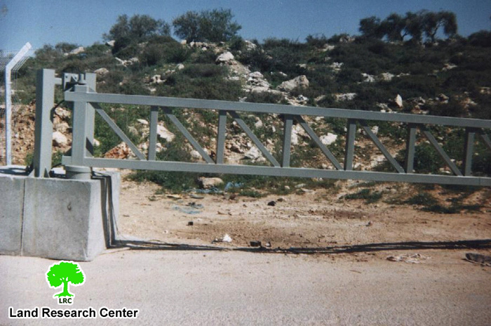
(Photo 1: the western entrance to Marda after fixing the iron gate )
Total land losses
The village of Marda has lost at least 5400 dunums (about 58% of its total land area) for the purposes of building the Ariel settlement, Trans Samaria highway, the Annexation and Expansion Wall and the road barrier – source: Marda village Council-
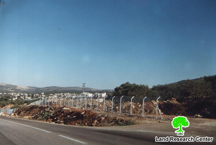
In addition to this, the village will face real obstacles in finding space for future natural growth as no land has been left for the village inhabitants and because the whole village has become under Israeli grip. See Photo 2
A profile of Israeli violations against the village
Ever since the occupation of 1967, the village of Marda has been under successive series of violations targeting humans and lands as followed:
- In 1978, the village exposed to a colonial onslaught during which 400 dunum of lands were forcibly seized to make room for the establishment of Ariel settlement. In successive years, the total of 3660 dunum from the village lands was seized for the expansion of the aforementioned settlement. Moreover, hundreds of additional dunums located in the vicinity of the settlement were spoiled and contaminated by the sewage liquid coming from the settlement creating an ecological disaster for both the lands and the people;
- The Israeli army very often attacks the village with sound bombs, gun fire and tear gas with the aim of terrorizing its inhabitants;
- The prevention of farmers from reaching their agricultural lands, especially during the olive picking seasons;
- The release of dozens of wild pigs in the lands of the village with the aim of destroying agriculture and frightening farmers;
- The confiscation and devastation of about 330 dunums for the construction of Trans Samaria Highway leading to the uprooting of 470 olive tree.
- On July 27th, 2004, four dunums of the village lands were bulldozed under the pretext that stones were thrown from the area at Israeli cars passing the Trans Samaria Highway;
- On August 17th, 2004, Israeli settlers burned 140 olive trees located to the east of the village. A complaint was presented by land owners to the DCO against this action but no response has given yet;
Prepared by
The Land Research Center
LRC