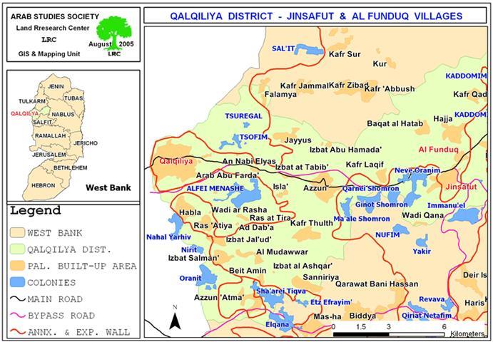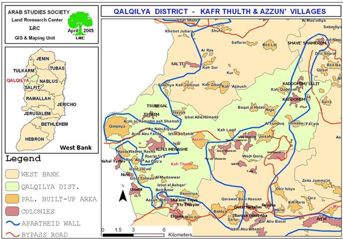
Resumption of Wall constructions in Kafr Thulth and Azzun lands – Qalqiliya governorate
On August 6, 2005, the Israeli army resumed work constructions in the Segregation Wall in Kafr ...
Read moreDetailsOn August 6, 2005, the Israeli army resumed work constructions in the Segregation Wall in Kafr ...
Read moreDetailsAs a continuation of the Israeli repressive actions in Qalqiliya district, , the Israeli occupation forces ...
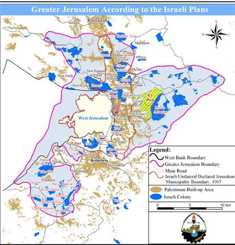
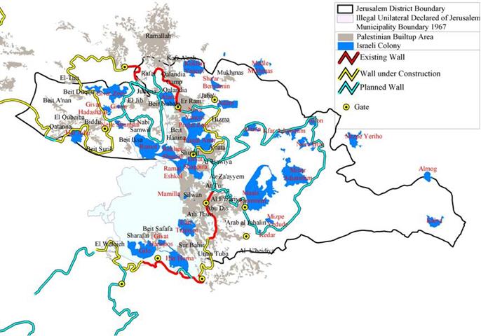
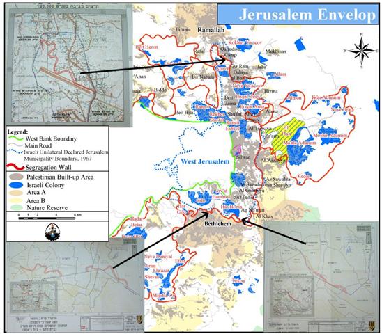
Read moreDetailsIntroduction The Ma39;ale Adumim settlement bloc is the largest settlement bloc established in the Occupied Palestinian ...
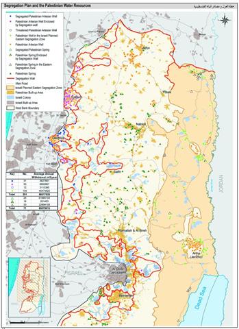
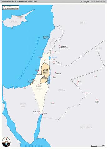
Read moreDetailsIntroduction The Eastern part of the West Bank encompasses the middle and lower parts of the ...
Read moreDetailsيعتبر تجمع معاليه أدوميم من أخطر التجمعات الاستيطانية الموجودة في الضفة الغربية و ...
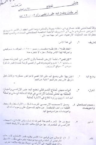
Read moreDetailsIn continuation of the land confiscation process in the West Bank, the Israeli army issued three ...
Read moreDetailsدير البلح: تقع مدينة دير البلح على ساحل البحر الأبيض المتوسط وعلى ...
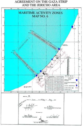
Read moreDetailsقطاع غزة والبحر: يعاني قطاع غزة من نقص شديد في الموارد الاقتصادية، ...
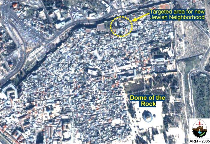
Read moreDetailsIt is not a surprise to hear the new decision of the Israeli Prime Minister, Ariel ...
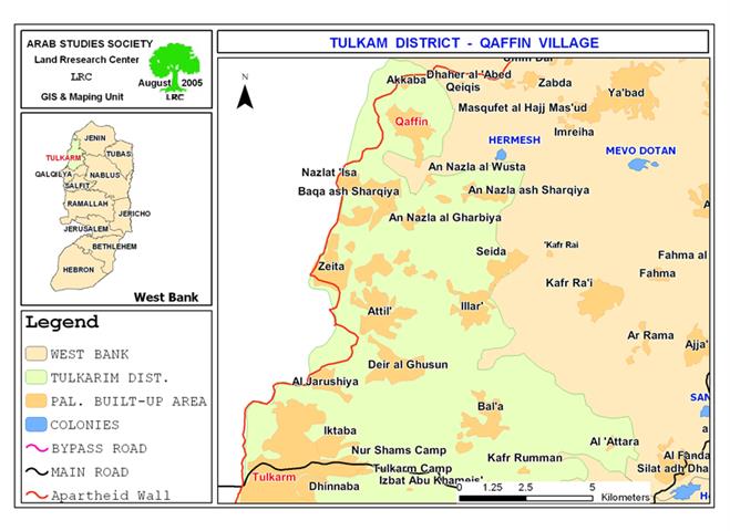
Read moreDetailsLocation, population and area The two villages of Qaffin and Akkaba are located to the north ...
Read moreDetailsالجريان السطحي في قطاع غزة : لا يوجد جريان سطحي ملحوظ و دائم في قطاع غزة ...
Read moreDetailsنشرت صحيفة القدس في عددها الصادر بتاريخ 5/8/2005 إعلانا صادراً عن وزير المالية ...
Read moreDetailsPrelude When the State of Israel came to live in 1948, more than 400 Palestinian villages ...
Read moreDetailsThe Israeli government is completely aware of the Oslo Accord agreement, which specifically prohibit any of ...
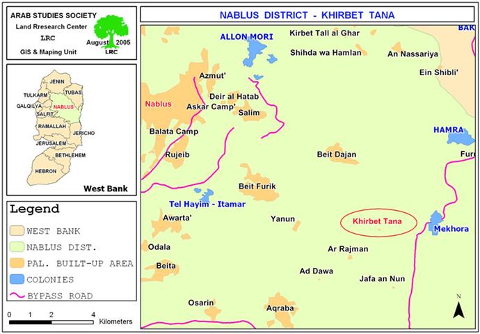
Read moreDetailsLocation and Population Khirbet Tana is located 7 kilometers to the east Beit Furik town in ...
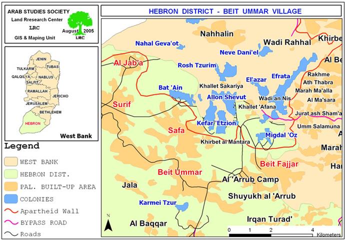
Read moreDetailsThe Israeli army issued new military orders stipulating the confiscation of 578 dunums of lands from ...
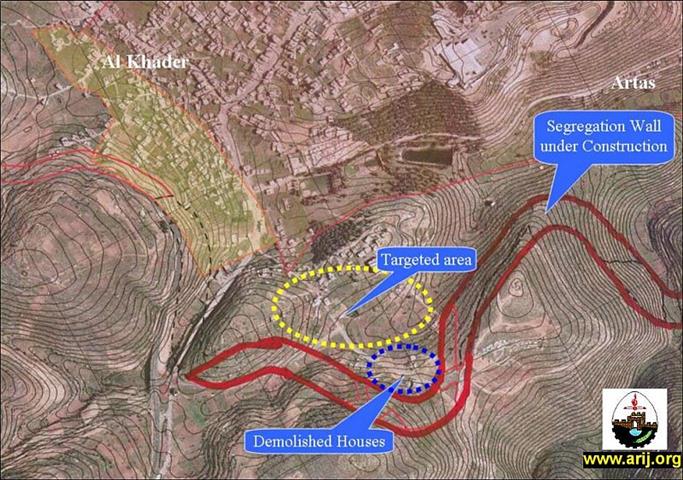
Read moreDetailsBy midday July 27, the Israeli bulldozers came to Um Al-Rukbeh neighborhood in Al-Khader village (southwest ...
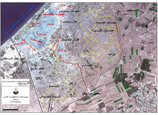
Read moreDetailsالطرق وأهميتها: تعتبر الطرق في قطاع غزة هي الوسيلة الوحيدة للمواصلات في ...
Read moreDetailsقطاع غزة: تبلغ مساحة قطاع غزة 365 كيلومتراً مربعاً، وله حدود مع ...
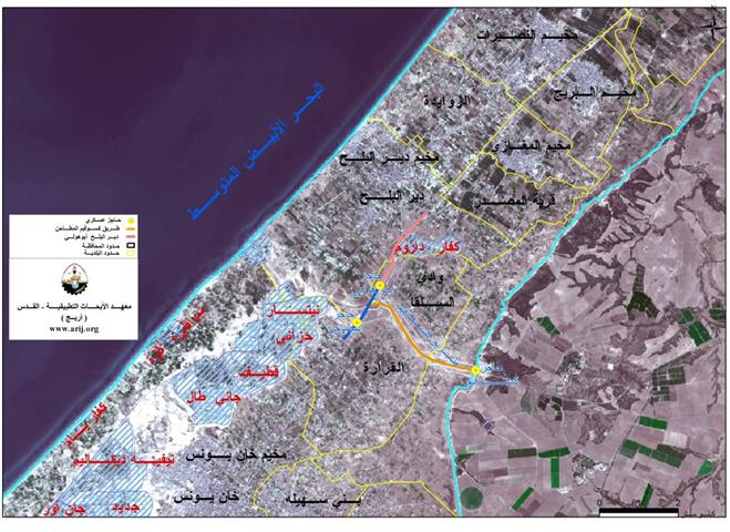
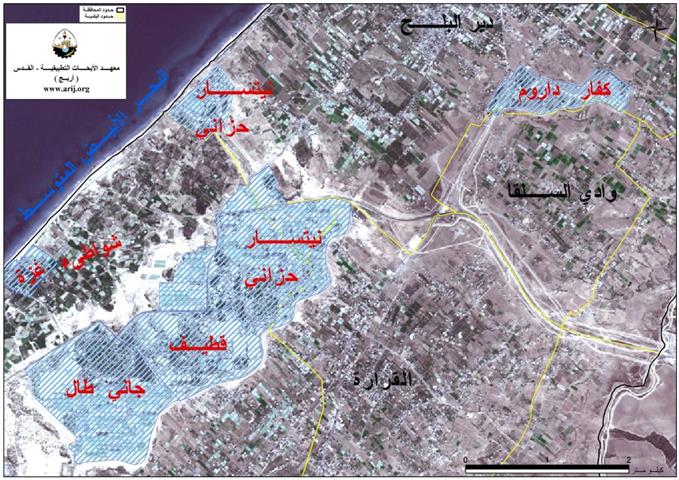
Read moreDetailsقرية وادي السلقا, إحدى التجمعات السكانية في المحافظة الوسطى في قطاع غزة، الواقعة على ...
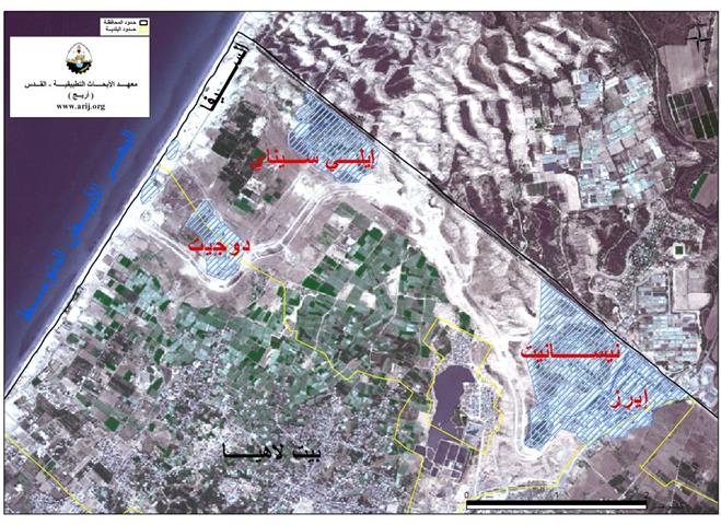
Read moreDetailsمنطقة السيفا: منطقة السيفا جزء من قطاع غزة و تقع في المنطقة الشمالية ...
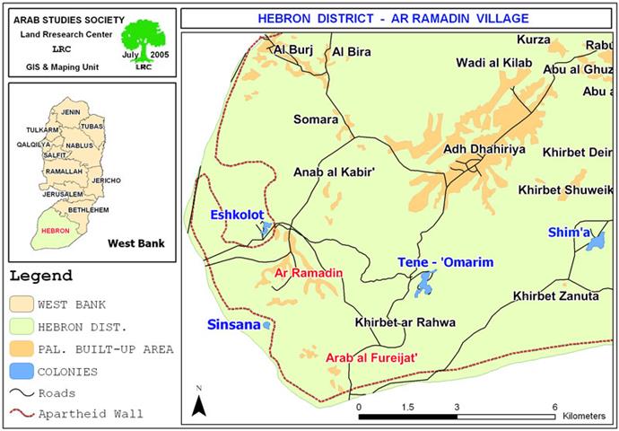
Read moreDetailsA glimpse on Ar Ramadin and Arab Al Fureijat The villages of Ar Ramadin and Arab ...
Read moreDetails