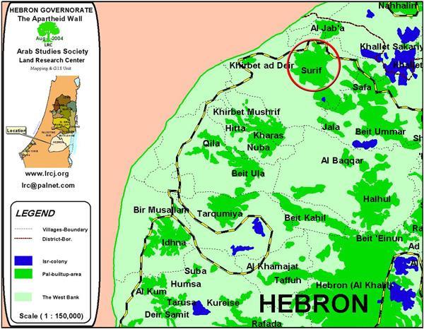
Location and population
The village of As Sikka is located about 20 km to the south west of Hebron city on the green line. Its land which is now under destruction is bordering the green line. As Sikka has a population of 700 inhabitants, mostly working in agriculture.
(Location Map of As Sikka)
As Sikka and the Wall
On the 2nd of September 2004, the Israeli government decided to start work on the Wall in the areas located to the west of Hebron., including the village of As Sikka. In this area, the wall is planned to be built of barbed wires and electrified fences at a depth of 100 meters from the green line inside the Palestinian territories.
In an interview with LRC filed worker, the head of As Sikka village council, Mr. Majid Ahsheish, said that the Israeli bulldozers have destroyed dozens of dunums of agricultural lands, mainly planted with olive trees in Wadi Kharash north of the village. He confirmed that the targeted lands are considered the main source of living for Palestinian families, especially at the time of military closure and restriction of movement. Once work is completed more than 2000 olive trees will be uprooted from As Sikka lands.
Mr. Majid Ahsheish went on to say that in 1948, about 80% of the village lands which were then 1200 dunums were confiscated by Israel. From the remaining area, the total of 80 dunums will be confiscated for the construction of the Wall. Now, the village is strangled by Israeli settlements, bypass roads and the under construction segregation Wall.
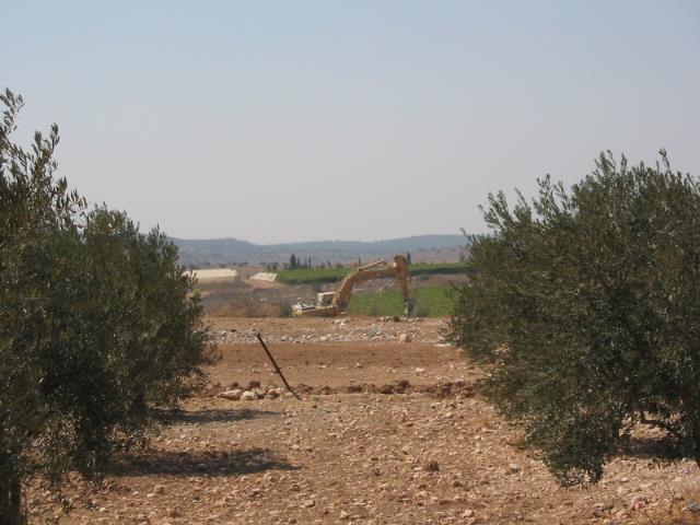
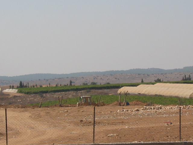
(Picture 2- As Sikka- Hebron: in the foreground is devastated Palestinian land; in the background is Israeli cultivation saved from destruction- Photo courtesy of LRC)
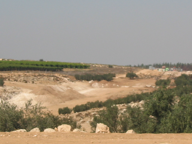
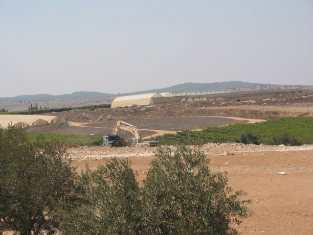
(Pictrue 3- As Sikka- Hebron: an Israeli bulldozer is working on lands to the east of the Kibutz land- Photo courtesy of LRC)
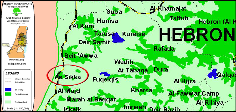
It is worth mentioning that the first stage of the Wall plan in Hebron governorate extends at a distance of 5 km starting from Khirbet Beit Ya'ir north of Beit Awwa town until the southern edge of the village of As Sikka. This section is part of a longer one extending from the village of Surif in the north until Ar Ramadin in the south aiming at expropriating a total of 2220 dunums.
In general, the Israeli disclosed maps of the Wall in Hebron district showed that it will isolate 414.5 thousand dunums of Palestinian land which constitutes 40% of the Governorates' lands, including 92.5 thousand dunum in the western part of the governorate and 322 thousand dunum in its eastern part.
The following is a list of names of affected farmers and land owners from As Sikka:
1. The heirs of Late Abdul Hamid Azeir Ihribat
2. Yusif Mohammed Ahsheish
3. The heirs of Late Mahmud Mohammed Ahsheish
4. The heirs of Late Taha Mohammed Ahsheish
5. Ahamd Mohammed Abu Eid
6. The heirs of Late Khalil Hamdallah Abu Eid
7. 'Iz Eddin Salim Ahmad Ihribat
8. The heirs of Late Sa'id Abdul Jawwad Abu Samra
9. The heirs of Late Salama Khalil Rashid Ihribat
(Pictrue 4- As Sikka- Hebron: Israeli destruction machinery is protected by an army jeep- Photo courtesy of LRC)
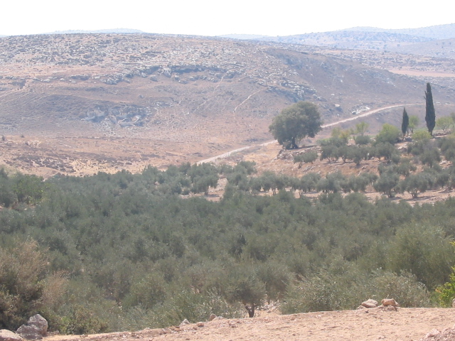
(Pictrue 5- As Sikka- Hebron:an olive orchard targeted for Wall construction- Photo courtesy of LRC)
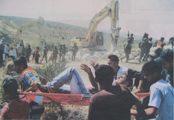
( Pictrue 6- As Sikka- Hebron: scene of confrontations and protests against the Wall construction- Photo courtesy of Al Quds newspaper)
Prepared by
The Land Research Center
LRC