Location and population
Jinsafut village is located 15 km to the east of Qalqilyia city, and bounded by Tulkarem in the north, Nablus in the east and Salfit in the south. It is administratively affiliated to the governorate of Qalqilyia.
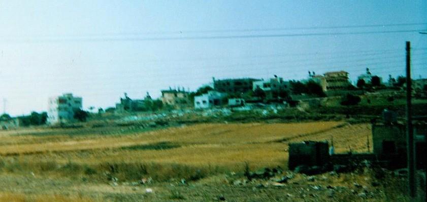
Before the year 1967, Jinsafut housed a population of about 700 people. This number decreased to 550 after the 1967 war as many people fled from the area and became refugees. According to the latest census conducted by the PCBS in 2003, the population of the village reached to 2122. See Photo of Jinsafut
Some houses of the Palestinian village of Jinsafut- Qalqilyia, Photo courtesy of LRC
The population is formed of a number of families, the largest in number, are the families of Eid and Bashir, which form 65 % of the total population. See map of location.
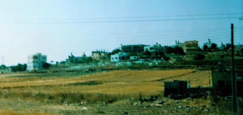
The village of Jinsafut, 2004. Photo Courtesy of LRC.
Up to 1967, about 995 of the labor force in Jinsafut depended on agriculture, particularly grapes and peaches and on animal husbandry as a main source of income, and the remaining 1% depended on civil jobs. During the period of 1967 – 2002, about 91% of Jinsafut villagers depended on agriculture and work inside Israel, the other 3 % depended on commerce and 6 % on governmental jobs. After 2002, more than 93% of the village's labor force became jobless as a result of the Israeli closure exerted on the village.
Jinsafut village area:-
The total area of Jinsafut village is 9,335 dunums, out of which:-
-
484 dunums designed for arable land
-
2971 dunums are used for growing crops.
-
404 dunums designed for Heterogeneous agricultural areas
-
179 dunums used for Shrub and/or herbaceous vegetation associations
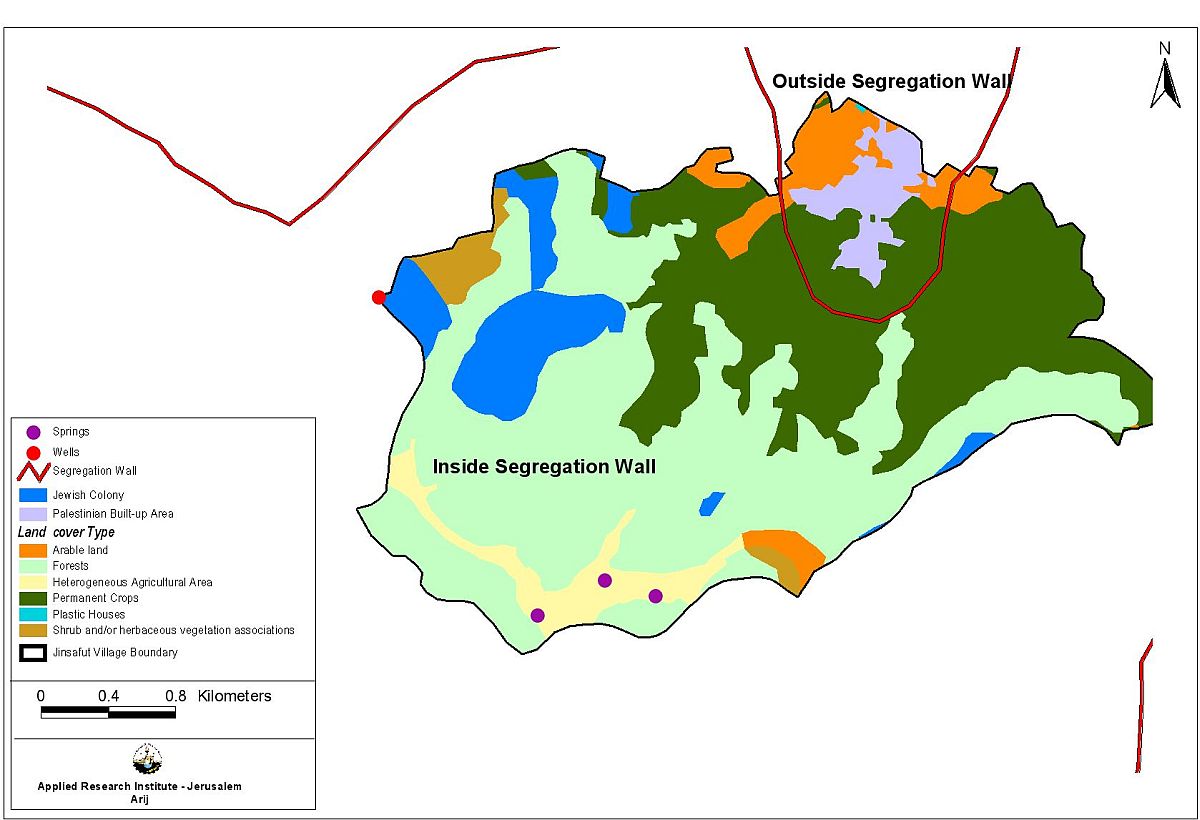
Table 1: Land Use/ Land Cover for Jinsafut village
|
Land Use/land cover |
Area/ Dunum |
Percentage of land cover |
|
Arable land |
484 |
5 % |
|
Forests |
4244 |
45 % |
|
Heterogeneous agricultural areas |
404 |
4 % |
|
Permanent crops |
2971 |
32 % |
|
Plastic Houses |
2 |
0 % |
|
Shrub and/or herbaceous vegetation associations |
179 |
2 % |
|
Israeli settlement |
745 |
8 % |
|
Palestinian Built-up Area |
305 |
3 % |
Israeli settlements
Starting from 1975, Jinsafut lands were exposed to three colonial activities summarized as followed:
1. In 1975, the Israeli government established Karne Shomron settlement to the west, over lands confiscated form the village;
2. In 1980, more than 400 dunums of Jinsafut lands were confiscated to build Emmanuel settlement in the east;
3. At the beginning of 2004, the Israeli government began the expansion process of the Israeli settlement Karne Shomron by expropriating an additional 120 dunums. See Photo 2
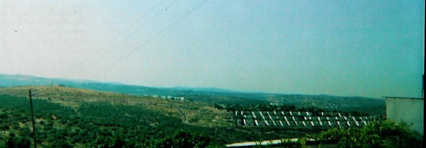
Part of the settlement of Karne Shomron built on lands confiscated from the Palestinian village of Jinsafut, Photo courtesy of LRC
The village and the Segregation Wall
The Wall plan in Jinsafut village aims at surrounding the village from the northwestern side, the southwestern side and eastern side leaving only one passage from the north ( See attached map). The Wall, if built, would have far reaching effects on people and land of Jinsafut as it would block any natural territorial expansion of the village, separate it from its agricultural lands, paralyze the movement of Jinsafut villagers and cause the unemployment rate to increase. Table 2 & Table 3 summarizes the land cover of Jinsafut village inside and outside the Segregation Wall ). The Wall, if built, would have far reaching effects on people and land of Jinsafut as it would block any natural territorial expansion of the village, separate it from its agricultural lands, paralyze the movement of Jinsafut villagers and cause the unemployment rate to increasesummarizes the land cover of Jinsafut village inside and outside the Segregation Wall
Table 2: Land Use/ Land Cover of Jinsafut village Boundary inside Segregation Wall:
|
Land use/land cover |
Area/ Dunums |
Percentage of land cover |
|
Arable land |
484 |
5 % |
|
Forests |
4244 |
45 % |
|
Heterogeneous agricultural areas |
404 |
4 % |
|
Permanent crops |
2303 |
25 % |
|
Shrub and/or herbaceous vegetation associations |
180 |
2 % |
|
Israeli settlement |
745 |
8 % |
Table 3: Land Use/ Land Cover for Jinsafut village Boundary outside Segregation wall:
|
Land Use/land cover |
Area/ Dunums |
Percentage of land cover |
|
Arable land |
249 |
3 % |
|
Permanent crops |
418 |
4 % |
|
Plastic Houses |
2 |
0.02 % |
|
Palestinian Built-up Area |
305 |
3 % |
Direct Expected impacts of Apartheid Segregation Wall on Jinsafut village:-
1. Political Effects:
The Wall is to instigate a Palestinian migration through the transformation of their villages and cities into easily controllable cantons. Settlements of Karne Shomron, Neve Oranim and Immanuel settlements extended throughout the years to surround the village from its eastern and western directions. These three settlements occupied so far 8% of Jinsafut's land.
2. Economical Effects:
The construction of the Segregation Wall will isolate one water well and three springs inside the Wall. Barbed wires are now surrounding the water well from all its directions and no one is allowed to use it, See map. A water-collection tank is usually placed to collect water from the upper and lower springs while the third spring got dry some time ago. Residents of Jinsafut use these springs for drinking and watering their agricultural lands.. A water-collection tank is usually placed to collect water from the upper and lower springs while the third spring got dry some time ago. Residents of Jinsafut use these springs for drinking and watering their agricultural lands.
Jinsafut villagers are now prevented from marketing their goods and agricultural products; which according to Jinsafut villagers causes an economic disaster and increases the poverty level in the village.
3. Health Effects:
The only medical crew who works in the village need to coordinate first with the relevant Israeli authorities in order to be able to enter the village.
4. Social impacts:
The construction of the Wall will cut the social relations between families and relatives living in Jinsafut and the nearby villages.
5. Psychological impact:
The Wall will increase the feeling of despair and fear amongst the village citizens due to closure and isolation of the village from its surrounding environments.
Prepared by
Land Research Center (LRC)

&
The Applied Research Institute – Jerusalem