Location & Population:
Ramin village is located 15 kilometers to the east of Tulkarem city. It houses a population of 1986 according to PCBS population estimates of 2003, and consists of four main families, Salman (30% of the population), Zafer (24%), Hamad (22%) and the family of Zeidan (24%).It is bounded by the villages of Bazaria and Burqa from the north, Beit Leed from the south, Deir Sharaf, Sabastia and Al Naqoora from the east. As from the west, It is bounded by the villages of Anabta, Kufr Al lubd and Bala'a border the village. Click to see map below
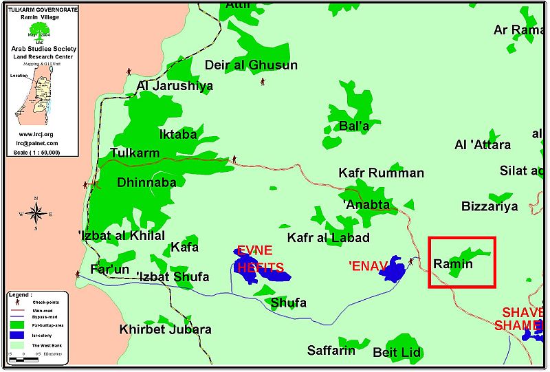
The village of Ramin ( in red quadrangle) to the southeast of Tulkarem city
Area: The total area of the village is almost 10000 dunums (2500 acres), out of which 422 dunums are used for building purposes.
Services Available in the Village:
The village has a water tank beneath and two rooms used as headquarter for the village council. The two rooms are currently used by the villagers as classrooms and the village council is left without headquarter.
There is an elementary school in the village which houses 400 students from both sexes and another secondary school in the village houses 102 students from both sexes. Moreover, Ramin village has an agricultural cooperation society that was established in September 2003, a women society as well as a medical center. Electricity, water and phone networks are installed.
Residents of Ramin village depend largely on working inside Israel and on agriculture as their two main sources of income. Other sources include commerce and governmental jobs.
Settlements in the area:
The settlement of Enav was established in 1981 on lands of Ramin, Kufr Allabad, Anabta and Beit Leed villages. Mr. Mahmoud Ziedan, Ramin's village council leader, estimated that more than 3000 dunums of the village's land were confiscated for the purpose of establishing the aforementioned settlement which is located southeast of the village.
Ramin's Oslo Classification:
According to the Oslo Accords, lands of Ramin village were classified according to the following scheme:
-
Area A: inside the village
-
Area B: north of the village.
-
Area C: south west and east of the village
According to village council's estimates, the west, east and south of the village are threatened by expropriation and isolation for future colonial activities. These planned activities include the expansion of Enav settlement and the construction of a new bypass road in the area that will serve Israeli settlers living in Enav
Israeli Violations:
Throughout the years of Israeli occupation, the village has been subjected to numerous Israeli violations especially during the past three years. Some of these violations include:
-
Land confiscation and the establishment of Enav settlement in the early 80's.
-
The burning of tree-filled lands by settlers of Enav during the second year of the second Intifada. Hundreds of dunums and trees were assaulted that year.
-
The following table lists the names of people affected by the Israeli assaults as provided by Ramin's village council leader.
|
No. |
Name |
Location |
|
1 |
Sami Abdel Aziz Salman |
Hariqat Ibrahim, Al Sahlat, Umm Salameh |
|
2 |
Subhi Ahmad Salman |
Hariqat Ibrahim, Hariqat Al Qar'a, Umm Salameh |
|
3 |
Saleh Sadeq Ibseisah |
Abu Nartein, Hariqat Ibrahim, Ak Sadarah, Umm Al Sharayeh |
|
4 |
Sabri Abdel Aziz |
Al Sadara |
|
5 |
Ibraheem Mustafa Zeidan |
Al Sahlat, Hariqat Al Maghdi, Al Aqda |
|
6 |
Naser Yousef Zeidan |
Al Sahlat |
|
7 |
Ibrahim Mahmoud Salman |
Al Sahlat – Haroqat Ibrahim |
|
8 |
Mahmoud Mustafa Sinjuq |
Al Sahlat |
|
9 |
Suleiman Ahmad Th'afer |
Al Sahlat |
|
10 |
Abdel Qader Mustafa Sinjuq |
Al Sahlat |
|
11 |
Awad Saleh Hamad |
Khalet Bin Saleh |
|
12 |
Husein Sa'eed Ghanem |
Khilat Bin Saleh, Wad Ghanim, Wad Salameh |
|
13 |
Ahmad Mahmoud Musa Salman |
Khilat Bin Saleh |
|
14 |
Sameeh As'ad Abdel Rahman |
Al Naqqar, Hariqat Al Maghdi, Al Aqda |
|
15 |
Fayez Rasheed Hamad |
Al Naqqar |
|
16 |
Ibrahim Rasheed Hamad |
Al Naqqar |
|
17 |
Mohammad Rasheed Hamad |
Al Naqqar |
|
18 |
Abdel Kareem (Fares) Rasheed Hamad |
Al Naqqar |
|
19 |
Mahmoud Ahmad Jadallah |
Hariqat Al Maghdi |
|
20 |
Asma Hasan Th'afer |
Hariqat Al Maghdi |
|
21 |
Mohammad Hamdan Awad |
Hariqat Al Maghdi, Al Jazeera, Wad Diab |
|
22 |
Abbas Muhammad Barham |
Al Jazeera |
|
23 |
Suleiman Yousef Zeidan |
Wad Diab, Hariqat Al Maghdi |
|
24 |
Mahmoud Saleh Sunjuq |
Hariqat Eid |
|
25 |
Abdel Kareem Sa'eed Salman |
Hariqat Eid, Wad Salameh, Hariqat Al Maghdi |
|
26 |
Asa'ad Ghanem Hamad |
Wad Salameh |
|
27 |
Al Awqaf |
Wad Salameh |
|
28 |
Muhammad Abdel Qader Mansour |
Al Aqda |
|
29 |
Abdullah Suleiman Salman |
Al Aqda |
|
30 |
Fahmi Mustafa Tha'fer |
Jabal Beit Leed |
|
31 |
Rajeh Mustafa Tha'fer |
Jabal Beit Leed |
|
32 |
Nasr Ahmad Salman |
Al Aqda |
|
33 |
Naser Ahmad Salman |
Al Aqda |
|
34 |
Wajeeh Saleh Salman |
Al Aqda |
|
35 |
Muhammad Masoud Salman |
Al Aqda |
|
36 |
Muhammad Ahmad Salman |
Al Aqda |
|
37 |
Ahmad Hamdan Zeidan |
Al Aqda |
|
38 |
Hafez Awad Zeidan |
Al Aqda |
|
39 |
Fares Kamel Hamad |
Umm Salameh |
|
40 |
Abdullah Muhammad Salman |
Umm Salameh |
|
41 |
Awad Tawfeeq Ibseisah |
Umm Salameh, Abu Martein |
|
42 |
Ali Muhammad Abdel Rahman |
Umm Salameh |
|
43 |
Mahmoud Ahmad Ibraheem |
Aby Martein, Wad Diab, Ghars Al Sharika |
|
44 |
Tawfeeq Muhammad Sunjuq |
Abu Martien |
|
45 |
Ibraheem Ahmad Ibsaisi |
Wad Diab, Ghars Al Shirka |
|
46 |
Hamed Ahmad Th'afer |
Abu Martien |
|
47 |
Abdel Ghani Rasheed Yaqoub |
Al Aqda |
|
48 |
Ghaleb Masoud Zeidan |
Al Sahlat |
|
49 |
Ahmad Suleiman Hasan |
Abu Shabraq |
|
50 |
Mohammad Taher Zeidan |
Abu Martien, Abu Shabraq |
|
51 |
Mohammad Masoud Ghanem |
Wad Salameh |
|
52 |
Yousef Ahmad Ibsaisi |
Wad Diab, Ghurs Al Sharika |
|
53 |
Haza'a Masoud Ghanem |
Wad Salameh |
|
54 |
Shareefa Samarah |
Khilat Bin Saleh |
|
55 |
Ahmad Al Haj Abed |
Ras Abu Hamad |
|
56 |
Jameel Barham |
Al Safha |
|
57 |
Hadia Hasan Tha'fer |
Hariqat Al Maghdy |
|
58 |
Rasheed Ahmad Tha'fer |
Abu Martien |
-
Land bulldozing and leveling of a number of locations inside the village.
-
The establishment of bypass roads that caused the loss of hundreds of dunums.
-
The closure of the village's main entry points until the time of this research:
1. The main eastern gateway, which connects the village with Nablus-Tulkarm main road.
2. The western gateway which also connects the village with Nubles-Tulkarm main road. See Photo 1 and Photo 2 and
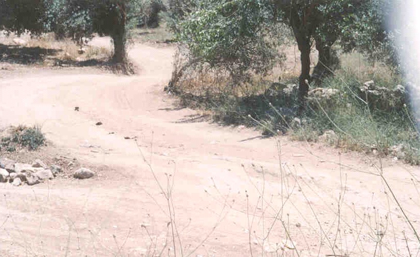
Ramin- Tulkarem: Alternative sandy roads used by Palestinians Photos courtesy of LRC
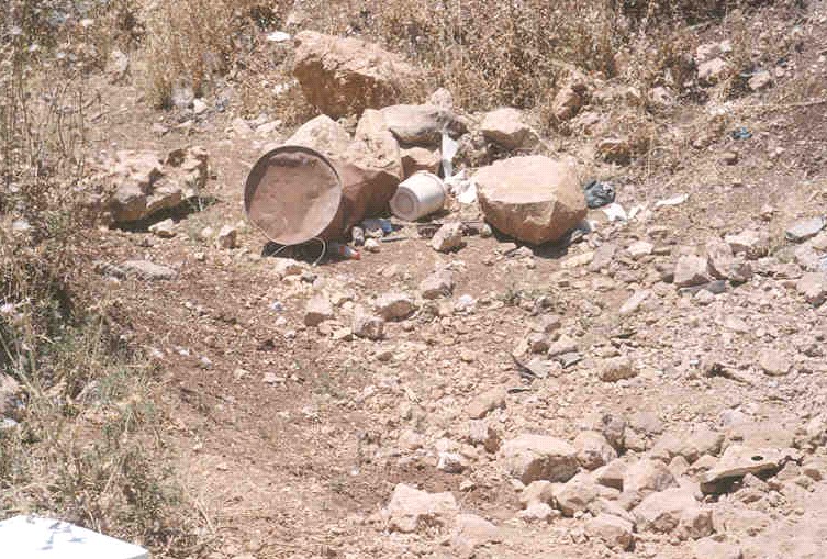
As a result of such closures, the village council opened up sandy roads to make transportation possible. Yet, even those roads were targeted by the Israeli Occupation Forces who worked on blocking one of the sandy roads in March 7, 2004 which forced Ramin's villagers to appeal to all human rights organizations to stress on the Israeli forces to re-open the road.
Ramin's farmers were prohibited from accessing their agricultural lands which are located close to the settlement of Enav. Accesing such lands has become a life-threatening hazard due to the repeated settlers and Army's attacks. Ramin's village council leader reported that preventing land owners from accessing their lands has been a common practice since the beginning of the second Intifada in late September 2000. The area of such lands is estimated at more than 1,000 dunums with the feared that those lands would be annexed at favor of expanding the nearby Israeli settlement.
Hardship Faced by villagers due to violations:
Economical:
-
Land confiscation and leveling, especially those close to Enav settlement, has resulted in monetary devastation for a number of farmers.
-
A large number of villagers (about 300) depended on work inside Israel as their main source of income. Nowadays, they are unemployed.
-
The escalation of financial burdens on families' breadwinners and students due to the increase of transportation costs. Employees also face the same problem as taxi drivers are obliged to use alternative, long and dusty roads to reach their destinations. See Photo 3
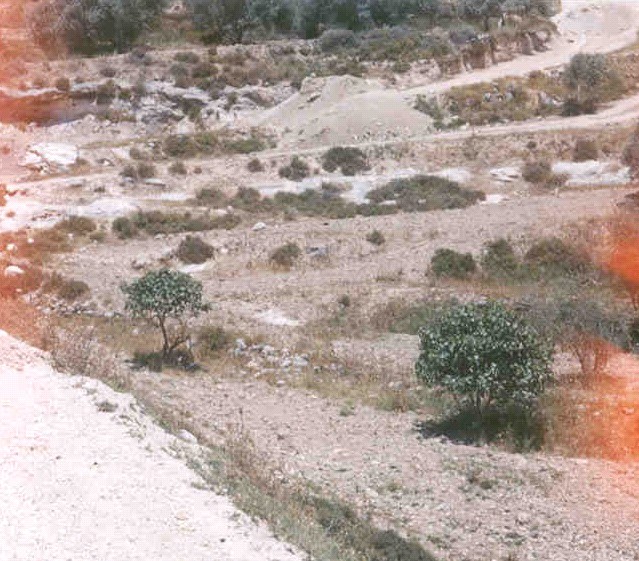
Ramin – Bazariya road is targeted by the Israeli occupation forces. Photo courtesy of LRC
Social:
The confiscation of lands, the inability to reach work places inside the Green Line, the increase in travel costs in addition to the siege under which the village has been residing has led to a number of social ills. Such ills include unemployment, frustration, academic weaknesses and social isolation from relatives living in nearby Palestinian comminutes.
Security:
Farmers and shepherds are facing a continuous campaign of shooting and physical beatings to prevent them from reaching their lands especially those located next to Enav settlement. Moreover, Farmers face similar dangers when they try to work in their lands located on Nablus-Tulkarm main road due to the continuous movement of settlers and army's vehicles on that road. See Photo 4 & Photo 5
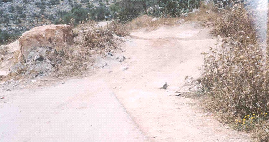
Ramin- Tulkarem: Two examples of uneven, humpy and dirty surfaces of alternative sandy roads which, Photos courtesy of LRC
Prepared by
The Land Research Center
LRC