The town of Beit Jala is located to the west of Bethlehem city and to the southwest Jerusalem district borders. It has a population of 15,000 inhabitants of whom the majority is Palestinians Christians.
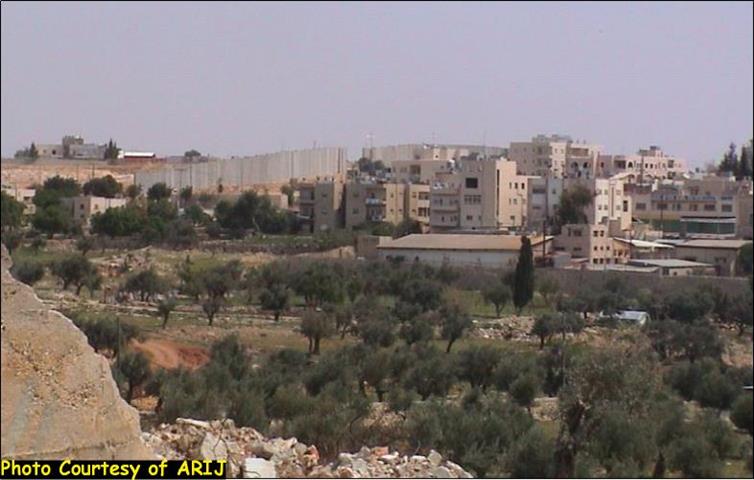
The town residents' as most Palestinians fear the destructive sequences of the Segregation Wall, which is being erected on their lands. In November 2002, Beit Jala's resident's worst nightmare came into reality when they witnessed the Israeli Army installing parts of the military fence along 1.1 Km, in addition to a concrete watchtower-cylindrical shape. See Photo 1 & Photo 2 &
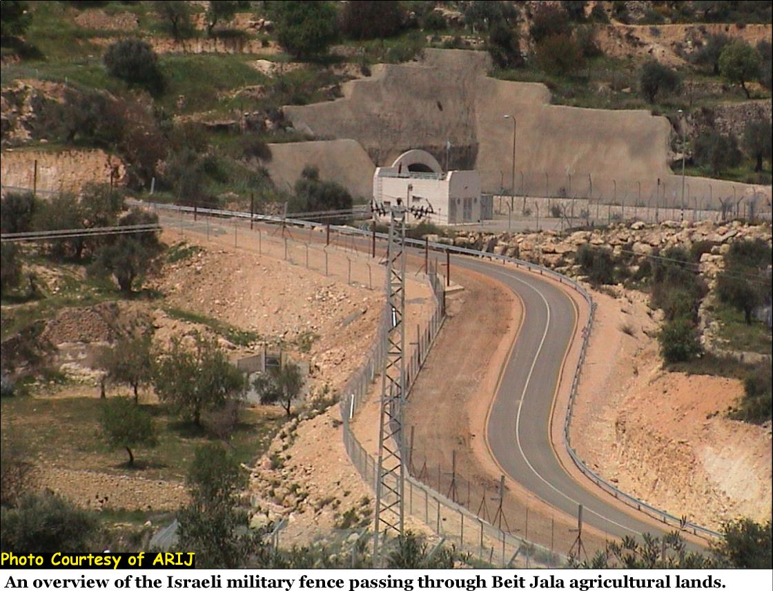
In late February 2004, the Segregation Wall in Beit Jala was commenced when the Israeli Army started to rig, the 10 meters (33 feet) high concrete partitions along the northeastern parts of Beit Jala borders. The Segregation Wall will extend on the entire northern borders of Beit Jala, along a stretch of 3 Km where the route of the wall will come-on 180 Dunums of land. The segregation barrier as a physical structure varies in its formation between 8 meters high concrete partitions and a wall with a metal electrified fence supplied with cameras, while the width of the barrier varies between 40-60 meters. See Photo 3 & Photo 4 &


The area where the concrete partitions segment of the Segregation Wall runs in Beit Jala is only part of the overall Segregation Wall, which stretches along 50 Km in length around the northern, western and southern borders of Bethlehem district.
The Segregation Wall ropes-in Beit Jala as well as Bethlehem city and the nearby villages and cuts them off from their agricultural lands. This segment, which is part of the Segregation Wall named by Israel as the Jerusalem Envelope will cut the umbilical cord between the two holy cities Bethlehem and Jerusalem.
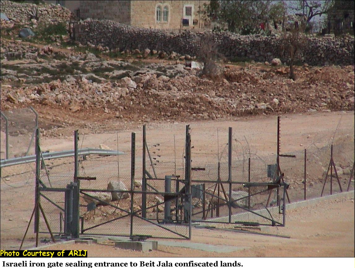
The Israeli plan aims to close in the East Jerusalem (north in Ramallah & east from Abu Dis) and cuts it off from the Palestinians in the West Bank. The route of the concrete partitions of the Segregation Wall in northern Beit Jala will connect to similar partition rigged along the northern entrance of Bethlehem city.It runs in close distance of Palestinian residential houses – virtually meters (yards) away – and cuts them off from their fields. See photo 5 & Photo 6 &

During the olive harvest season (October-November 2003), the Israeli army denied access to Farmers from Beit Jala to utilize their lands and thus thousands of tons of olive trees crops were not harvested and resulted in a considerable financial loss to Farmers and putrefy of the crops.
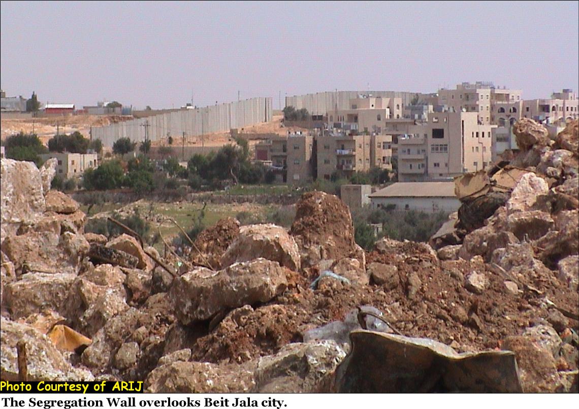
The Segregation Wall / military fence as a physical structure will run along 3 Km (180 Dunums) but will actually segregate approximately 10,000 Dunums of Beit Jala's land behind the Wall / military fence including the expropriated lands where the two Israeli settlements: Gilo (built 1971) and Har-Gilo (built 1972) stand today. See Photo 7

The following table illustrates the areas in Beit Jala, which fall under segregation threat by the Wall in the event the Wall is rigged.
Table 1: Areas that full under Segregation Threat.
|
Areas in Beit Jala Vicinity Under Segregation Threat |
||
|
# |
Name |
Area/Dunum |
|
1 |
Al-Sharafeh + Oqdet Al'Ain |
305.65 |
|
2 |
Al-Makhrour |
616.2 |
|
3 |
Al-Qsair |
510.5 |
|
4 |
Ein Kibrian/Shib Muqaddam Isaac |
214 |
|
5 |
Bassa |
268 |
|
6 |
Wadi Battir |
428.5 |
|
7 |
Wadi Albeer |
41.9 |
|
8 |
Khallet Alsmati |
51.4 |
|
9 |
Khallet Sima'an |
39.35 |
|
10 |
Wadi Ahmad |
324 |
|
1121 |
Shiab Al-Ghneimat |
21.2 |
|
13 |
Batin Elbeer |
44.4 |
|
14 |
Qubaide |
172.3 |
|
15 |
Shi'b Al'ain |
30 |
|
16 |
Ein Hantash |
238.27 |
|
17 |
Batin Gharbi |
21.75 |
|
18 |
Qasayer |
43 |
|
18 |
Khirbet Najjar |
81 |
|
19 |
Shib Masarin |
56.383 |
|
20 |
Habayel Ruhban |
97.7 |
|
21 |
Al-Ras |
532.8 |
|
22 |
Bir El-Diwan |
44.5 |
|
23 |
Jarmaleh -Natural Block 4 |
976.8 |
|
24 |
Cremizan – Natural Block 3 |
692 |
|
25 |
Al-Shafa |
763 |
|
Total |
6,614 |
|
|
Israeli Settlements Area on Beit Jalaâ??s Lands |
|
|
|
1 |
Gilo (1971) |
2900 |
|
2 |
Har Gilo (1972) |
385 |
|
Total |
3,285 |
|
|
Grand Total |
9,899 |
|
See Map of the Segregation Wall in Beit Jala city

The segregation wall; once its completed will deny the Palestinian residents in Beit Jala their natural territorial expansion areas and cut them off from considerable cultivated lands on the western side of the town. The man-made new boundaries of Beit Jala by the Israelis will undoubtedly create an over-density of land population in-correlation with population natural growth and consequently causing housing problems for future generations.
Prepared by:
The Applied Research Institute – Jerusalem


