Location and Population:
The Tulkarem Neighborhood of Irtah is located exactly at the Green Line which qualified it to be a strategic trade point between the Governerate of Tulkarem and Israel. Its population before 1967 was about 2500 while the latest statistics of the year 2002 indicated that the population grew to become 4500 most of whom belong to the families of Alia, Al T'neib, Abu Rabee, Abu Shanab, Fakhoury and Khawlah. See Map of Location
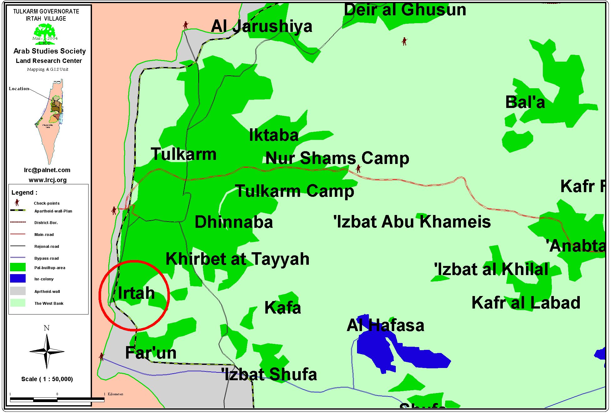
The neighbor hood of Irtah ( in Red circle)
It is worth mentioning that before the year 1948 the lands of Irtah reached as far as the Mediterranean Sea. Yet, the 1948 War led to the control of Israel of more than 80% of Irtah lands (almost 16,000 dunums) which were used for the establishment of Israeli settlements and farms.
Other statistics indicate that between the year 1967 and 2000 about 65% of the Palestinian population depended on working inside Israel as a source of income, 16% depended on agriculture, 11% on trade and handicrafts and 8% depended on governmental and private jobs. As a result of the 2000 Uprising, 84% of the total work force of Irtah became jobless.
Area:-
Currently, the total area of the Irtah Neighborhood is about 4000 dunums, 1500 of which are reserved for building purposes, 50 dunums are used for agricultural produce that grows in plastic houses while the rest of the land is used for growing vegetables and citrus trees.
Israeli Apartheid Segregation Wall:-
The Wall has led to the confiscation of about 450 dunums of the Neighborhood, 7 dunums of which were used for plastic houses while the rest were fertile soil for grown vegetables and fruits. At the present time the Wall suffocates the Neighborhood from the west, the south and the southeast directions. As a result of this choking encirclement, most of the population was prevented from accessing Israel, as well as decreasing to a great degree Palestinian land used for building purposes to face the natural growth of the population.
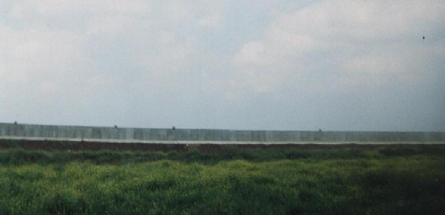
Irtah- Tulkarem: A section of the cement built Wall on Irtah land, Photo courtesy of LRC
Effects of the Establishment of the Apartheid Segregation Wall
A) Economic Effects:
-
The establishment of the Wall led to the confiscation of 450 dunums of the Neighborhood as well as the uprooting of 200 trees.
-
The Israeli Army seized at the beginning of the year 2004 an additional 81 dunums as pre-step for its confiscation. Consequently, the remaining main source of income of some Palestinian farmers was expropriated.
-
The complete destruction of water and irrigation networks causing losses in thousands of Jordanian Dinars.
-
The complete isolation of Irtah from Israel proper caused an unemployment rate of 85% and the virtual termination of trade with Israel.
B) Social Effects:
-
The establishment of the Wall led to the abrupt severing of social relations and family ties between the Irtah Neighborhood (and Tulkarem in general) and the Palestinian community living beyond the Green Line. See Photo 2

Irtah- Tulkarem: The road linking between Irtah and 1948 borders currently blocked by the Wall, Photo courtesy of LRC
-
Israeli forces have distributed agricultural land confiscation order at the beginning of the year 2004. The targeted lands houses 6 homes in which 12 families are living. The fate of the residents of these homes is unknown at this point in time as their movement has been severely restricted and their ability to build and/or renovate has been seriously hampered.
Irtah- Tulkarem: the threatened houses and land separated behind the Wall path, Photo courtesy of LRC
C) Psychological Effects:
The proximity of the Irtah Neighborhood to the Green Line has made it an ideal friction point between Palestinian resistance movements and the Israeli occupation army. Such a fact has led to a state of fear and horror for the residents of the Neighborhood especially if we take into consideration the daily Israeli measures of house searches and humiliation. Moreover, the mere existence of the Wall in front of the eyes of the residents of the Neighborhood is a source for continuous depression and heartbreaking.
Tour of LRC's Field Worker in Irtah:
LRC's fieldworker met with a number of landowners who have lost their lands in favor of the Wall. Some of those landowners included:
-
Mr. Abu Naser Qozah who mentioned that he received earlier this year a confiscation order of his land despite the fact that he lives in a house built atop that land.
-
Mr. Khaled Al Jayousi and his brothers who mentioned that they have lost 120 dunums due to the Wall which left them without a viable income source.
General Description of the Wall in Irtah:
The length of the Israeli Segregation Wall in Irtahs' lands is about 2 kilometers as it surrounds the Neighborhood from its western, southern and east-of-south directions. The Wall is composed of 5 meter-high cement blocks over an extended distance of 1.5 kilometers in addition to barbwires, checkpoints, electrical fences extended over the remaining 0.5 kilometers.
Anti-Wall Activities in Irtah:
-
Holding a multi-national demonstration against the Wall in Irtah.
-
Organizing visits by foreign dignitaries and solidarity teams as well as members of the Israeli Knesset and the Palestinian Legislative Council.
-
Hiring a number of lawyers to file legal procedures on the hope of regaining the confiscated lands. See Photo 4
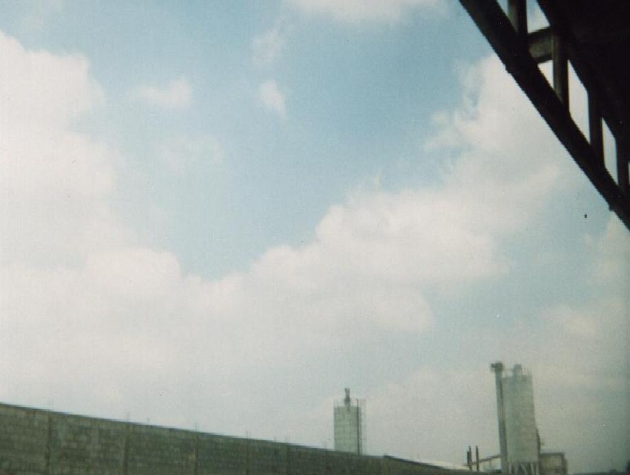
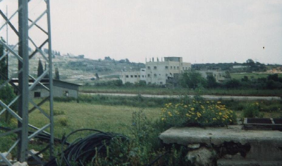
Irtah- Tulkarem: The Israeli Gishuri Gas Factory built earlier on land confiscated from Irtah, Photo courtesy of LRC
Such activities are ongoing yet to no avail as the Israeli Apartheid Segregation Wall snakes its way in the West Bank and suffocating life in the Palestinian cities, towns and villages while the rest of the World is watching.
Prepared by
The Land Research Center
LRC