The enlargement of Trans – Samaria Highway at the Expense of the lands of Kafl Haris Village- Salfit governorate
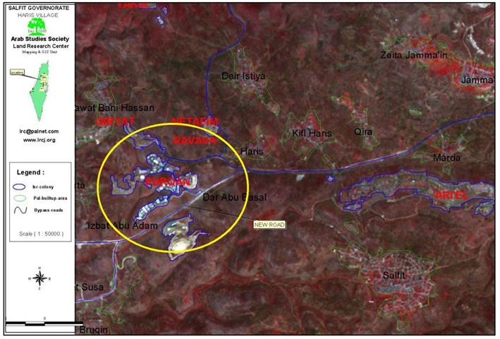
Governorate: Salfit Village: Kifl Haris Location: The village of Kafl Haris is located 6 kilometers to ...
Read moreDetailsGovernorate: Salfit Village: Kifl Haris Location: The village of Kafl Haris is located 6 kilometers to ...
Read moreDetailsOctober - December 2003 This report highlights the chronology of events concerning colonizing activities in ...
Read moreDetailsPrepared by Jad Isaac, Nael Salman, Nader Hrimat, Khaldoun Rishmawi, Majed Abu Kubi, Iyad Abu ...
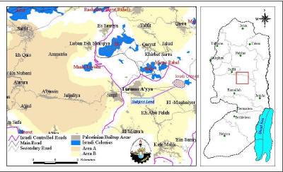
Read moreDetailsLocation: Turmus 'Aya village is located 15.7 km to the northeast of Ramallah district and a ...
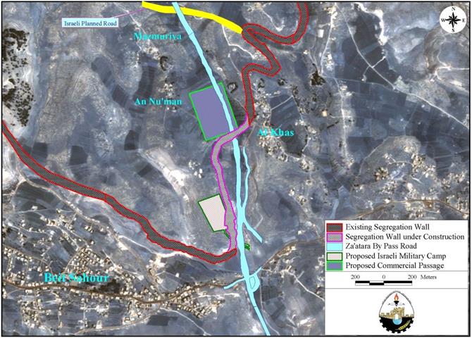
Read moreDetailsLocation and historical background Mazmuria is a small village located on a hill to the ...
Read moreDetailsThroughout the years of the Israeli occupation and the day-after-day Israeli colonization activities in the ...
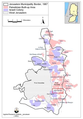
Read moreDetailsThe Israeli forces are planning to begin a new Settlement project in Jabal al-Mukabbir to the ...
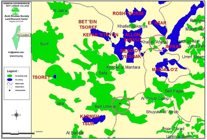
Read moreDetailsLocation: Beit Ummer village is located 12 km to the north of Hebron city. It has ...
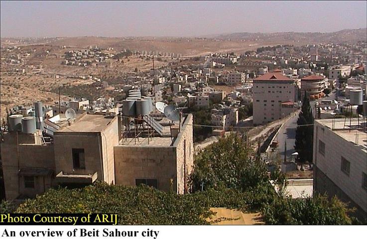
Read moreDetailsThe town of Beit Sahour,''the house of vigilanc'' lies on the northern edge of Bethlehem. It ...
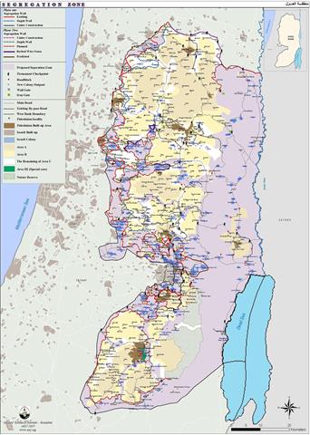
Read moreDetailsThe Segregation Wall which Israel claims necessary to stop Palestinians from entering Israel, runs along the ...
Read moreDetailsOn the 23 June 2002, the Israeli government endorsed a plan to build the so-called 'Security ...
Read moreDetailsThis report highlights the chronology of events concerning colonizing activities in the West Bank, ...
Read moreDetailsPrepared by Jad Isaac, Nael Salman, Nader Hrimat, Khaldoun Rishmawi, Majed Abu Kubi, Iyad Abu ...
Read moreDetails