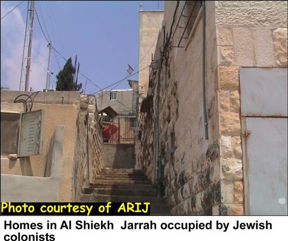
The continuous Israeli actions that strangulate the district of Bethlehem slice more lands to construct by-pass roads, expand existing settlements and erect a part of the Segregation wall. The fence is expanding daily and frequently the Israeli Occupation Forces-IOF- decide to adjust or modify the path of military fenced road. Each adjustment costs the Palestinians a high price; either by loss of land or house demolition or sometimes both. Today, the IOF is offering a new 'gift' to the people of Beit Sahour attached with a new military order that increases the lands under the Israeli security zone in Bethlehem district.
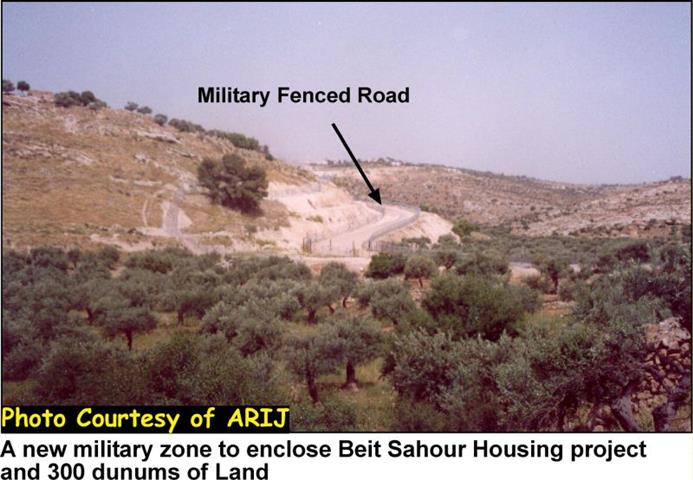
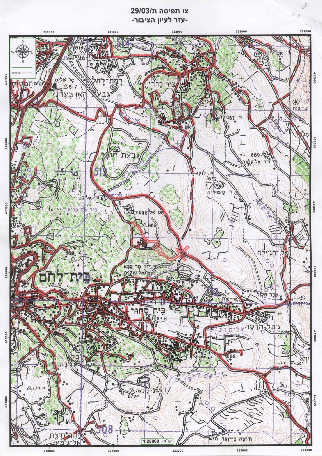
In the year 2002, the Israeli Authorities decided to demolish the Orthodox housing project located in the city of Beit Sahour. This attempt wasn't successful and the decision was frozen through juridical procedures, through international pressure on the Israeli Authorities. On the 3rd of May 2003, the IOF came to Beit Sahour and hanged on the Olive trees a new military order near the orthodox housing complex showing a new military zone in the area that will enclose the housing project and 300 dunums of land. See Photo 1 & Photo 2

 c
c
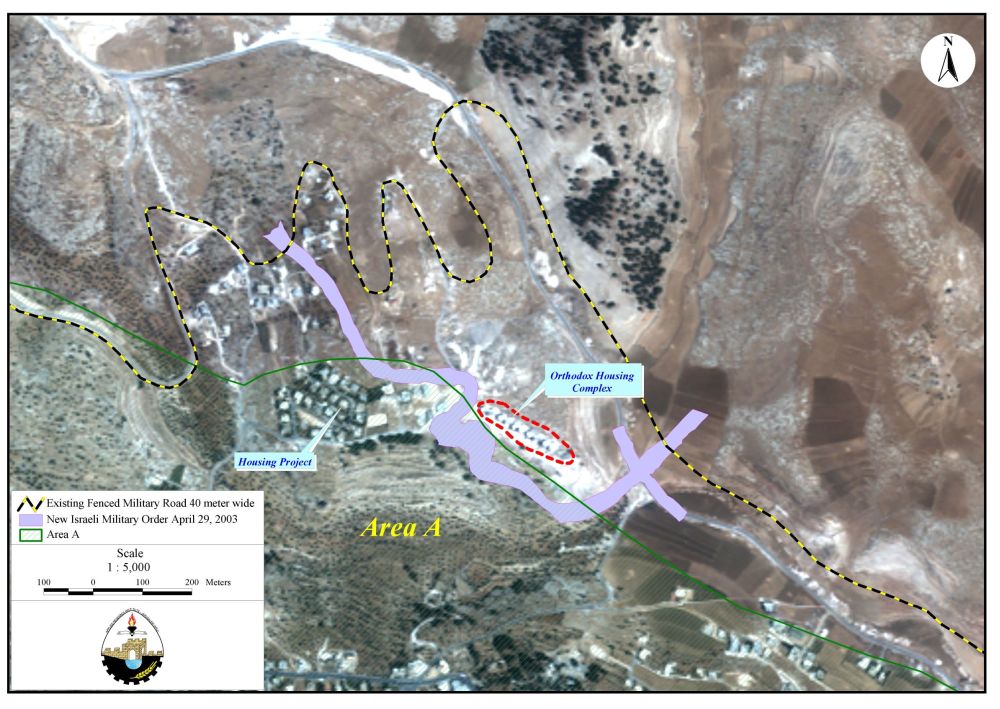
Around 30 dunums of these lands are located in area ''A' under full Palestinian control according to Oslo II agreement signed in 1995. See military order & map provided by the Israelis.
See also Photo 3
The New military order is going to create new facts on the ground:
1- A new security zone of 300 dunums near Beit Sahour, located between the military fenced road and the new one.
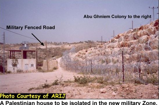
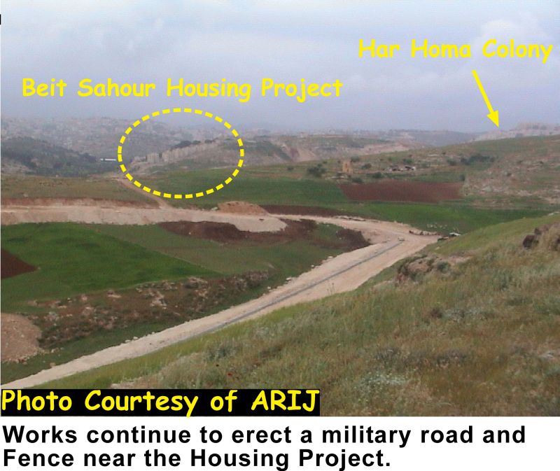
2- More than 20 houses will be isolated in this security zone in addition to the Housing project that is composed of 8 buildings with an area of 1071 square meters each, inhabited by 20 families. See map of location, , Photo 4
Facts about the new military order:
|
Road length |
1300 meters |
|
Road width |
18- 68 meters |
|
Total area seized as mentioned in the military order |
19.7 dunums |
|
Total area seized as calculated by the GIS unit |
50.0 dunums |
|
Total area 'A' seized |
30 dunums |
|
Total area enclosed between the military fenced road and the new road |
300 dunums |
|
1 dunum = 1000 square meters |
|
Source: ARIJ GIS UNIT data base 2003
It can be noticed from table 1, that the area of the new military belt mentioned in the military order is only 19.7 dunums, while the spatial analysis of ARIJ GIS unit shows that the total area of the road is 50 dunums according to the IOF map signed by the Chief Military commandant of the West Bank Mosheh Kaplenski.
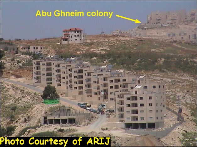
The above mentioned area, called 'Jabal al-Deik mountain', has always faced problems during the last year, due to the fact that the Har Homa settlement (Abu Ghneim Mountain) was established close to this place. As a result, the Israeli Authorities need a security zone for the settlement's future expansion and also to create an enlarged buffer zone between the municipality borders of Jerusalem that are under Israeli De Facto control and Bethlehem District that is under the Palestinian Authority control. See photo 5
All these practices make provocations to the Palestinian side and do not show any kind of commitment to the Road Map and to the peace process. If the Israeli government is really concerned about peace making, more facilities should be shown to the Palestinians in their daily life instead of all the complications added daily by the Checkpoints, roadblocks and the construction of by-pass roads and other colonizing activities.
Related links
Prepared by:
The Applied Research Institute – Jerusalem