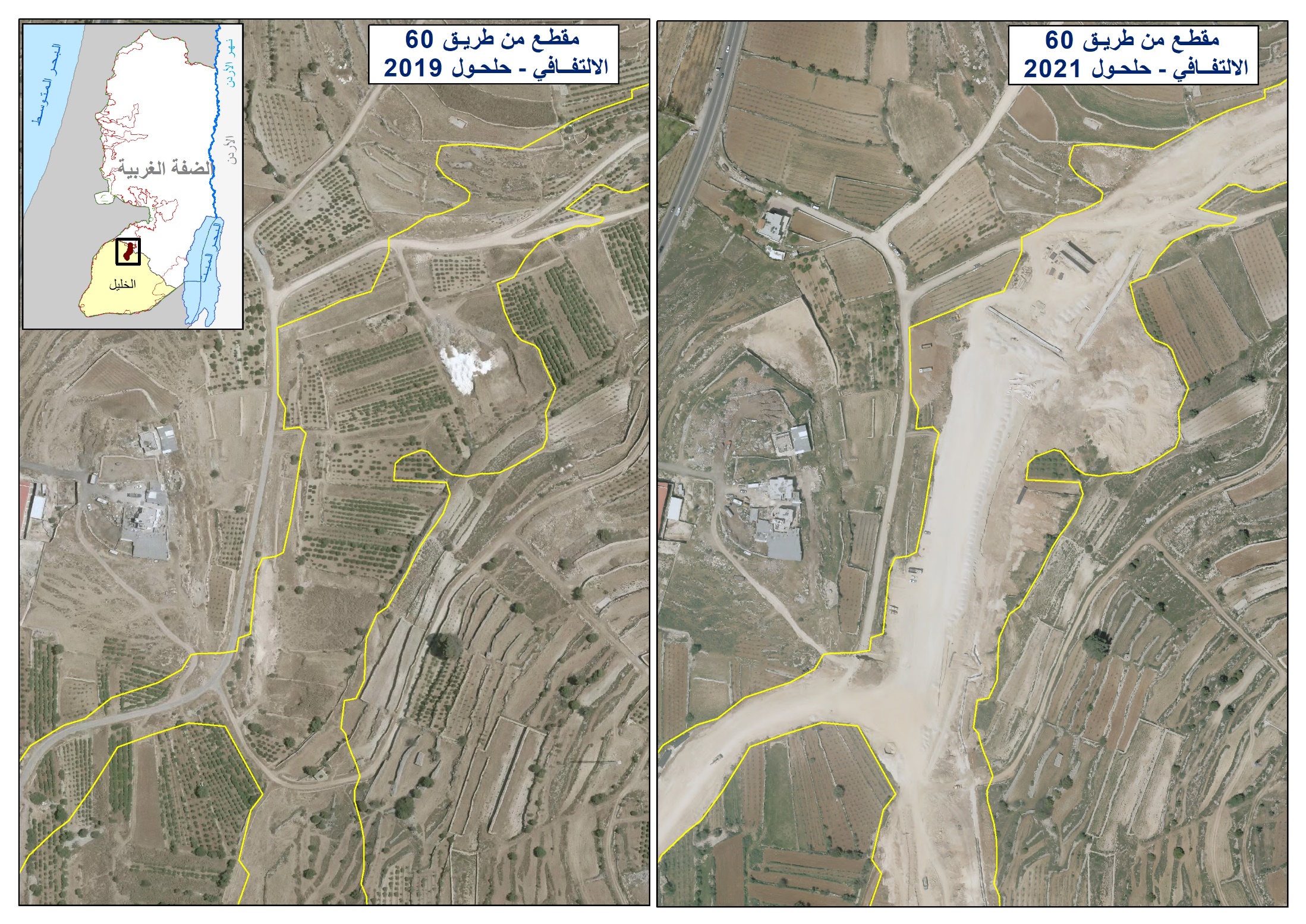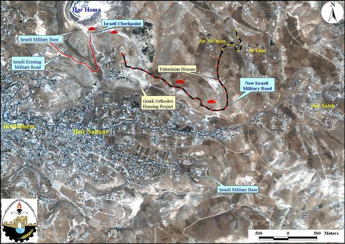
The political dimension of the Israeli voracious expansionist policies was behind Israel's erection of the Har Homa colony back in 1997. This has obviously become clear when observing the ongoing expropriation of lands surrounding the vicinity of the new settlement. Israeli bulldozers, guarded by tanks, have recently begun their first stage-work towards opening a new military road, which consequently will cause the destruction of 9Km2 of agricultural land. Israel, by constructing this road, is further expanding the illegal boundaries of Jerusalem, annexed after the 1967 war. see satellite map.
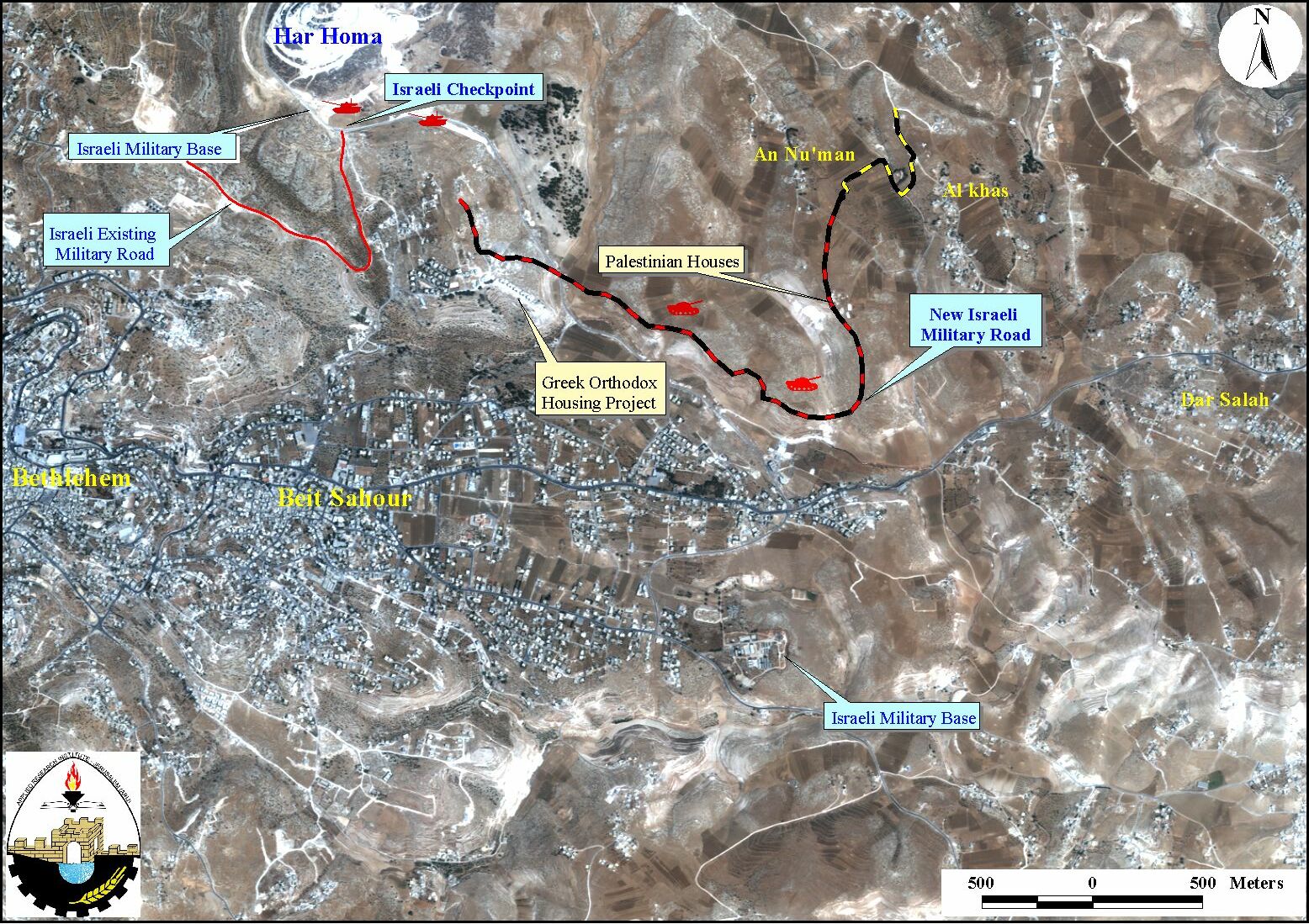
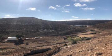
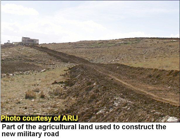
This military road, with a 3.2Km length and 30m width will strangulate as well as encroach on the Palestinian villages of Al-Khas and No'man located in the eastern part of Bethlehem district, thus, annexing them within the illegal borders of Jerusalem, ee photo 1
This will certainly lead to further expansion of Har homa settlement in its southern borders as well as finalize the unilateral separation zone between Israel and the Palestinian territories. These separation plans have become more evident through the successive Israeli actions in pursuit of illegally obtaining the maximum of Palestinian lands before any final-status talks be initiated. ARIJ field workers are tracking the construction of the road and the following points illustrate the menace of such violation. The construction of this road will lead to:
-
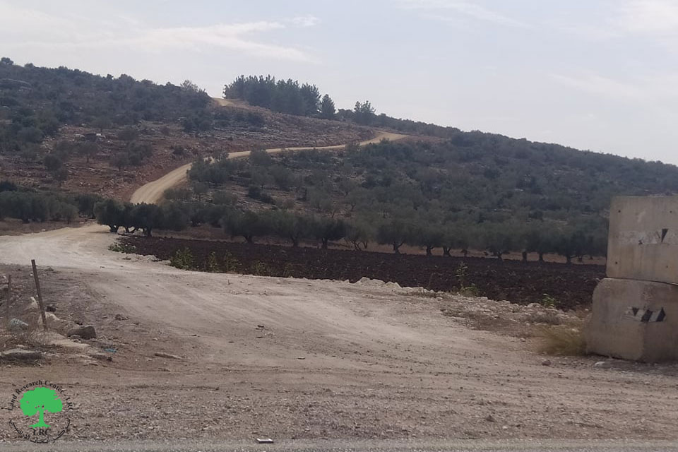
The restriction of Palestinian construction in the area and the obstruction of social continuity of these two villages with the town of Beit Sahour and with the western areas in general, see photo 2

-
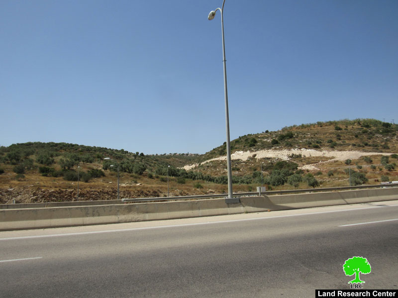
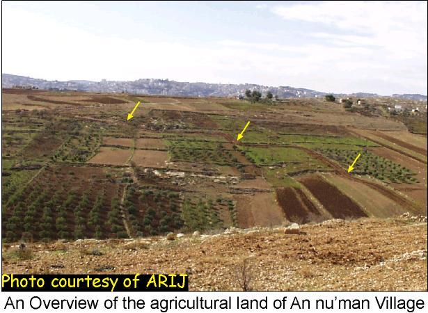
The confiscation and destruction of more than 480 dunums (48hectars) of agricultural land, in addition to the already established 75m of security buffer zone on both sides of the road. see photo 3
-
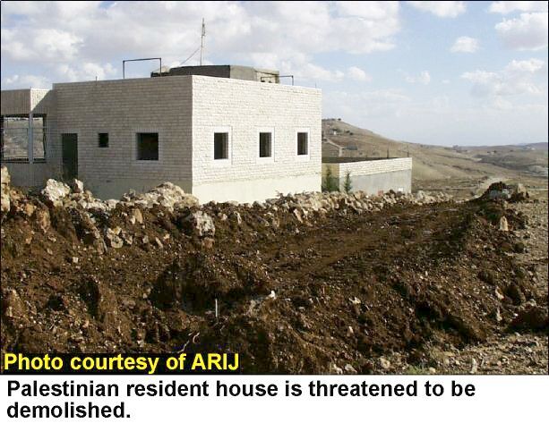
The threats of demolishing many Palestinian residence houses located alongside the road. see photo 4
-
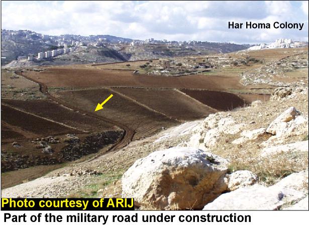
The expansion of Har homa settlement, see photo 5

-
Giving the jurisdiction to the illegal expansion of Jerusalem boundary adopted by the Israeli government after the war of 1967.
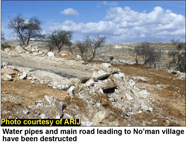
The ongoing construction of this road has also damaged the water supplies making the two villages short of water, see photo 6 .
It is worth mentioning here that the areas taken for the road construction are located in area C according to the Oslo Agreement. This shows how Israel prevaricates the spirit of the agreements reached and how it is using the agreements to legalize its further occupation of Palestinian lands. Such facts on the ground created by Israel are pursued to safeguard Israel's political interests before any final-status talks are launched.
Delegations from Beit Sahour municipality as well as international land and human rights associations have inspected the area and raised an immediate appeal to the international community to stop these illegal and provocative actions. Colonization activities have been one of the core obstacles against the peace process. One of the main goals of the Palestinian struggle has always been the freezing of settlements' expansion and the further expropriation of Palestinian land.
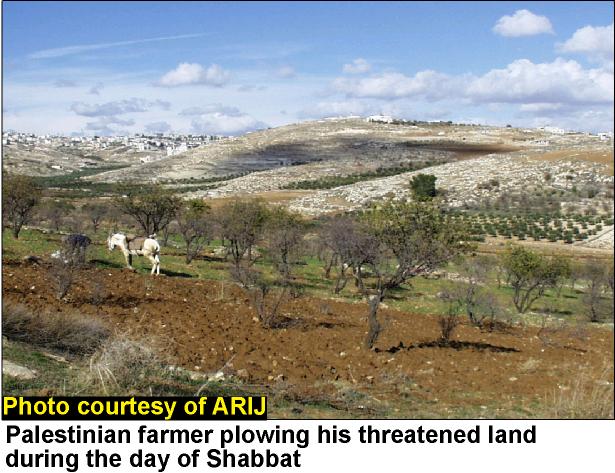
Despite the fact that the Israeli bulldozers will continue their digging after the resting day of Shabbat, the Palestinian farmer shown below is still determined to plow his threatened land and thus continues his duties towards it, see photo 7 .
Prepared by:
The Applied Research Institute – Jerusalem