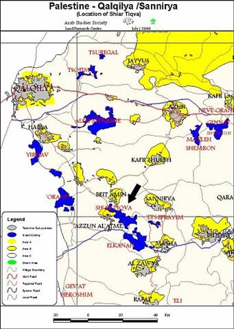
Azzoun Alatmah at a Glance:
Azzoun Alatmah is located 15 km to the west of Salfit City (Salfit Governorate). Its population is about 1,500 most of them are working in agriculture, particularly olive trees raising. Its land is located near the Greenline (1948 armistice line). This fact led to the loose of thousands of donums from the village land for establishing the Israeli colonies.
She'ari Tekva Settlement:
Location:
The settlement is located to the north of Azzoun Alatmah village and on its land. The buildings of the settlement are creeping toward the village buildings. They are just 50 m away from each other in some locations and 150 m in others.
Date of Establishment:
She'ari Tekva settlement was established in 1982 after confiscating vast areas from farmers land near the village of Azzoun Alatmah. The area was estimated to be about 1000 donum at that time. The number of buildings are estimated to be 300 built on the land owned by all of the village families.
The number of buildings under construction currently are 4 inside the borders of the settlement starting construction on January, 2000.
Violations Resulted from the Presence of this settlement:
- The flow of brackish and wastewater from the settlement to the farmers land and adjacent to the main road of the village.
- The extension of settlement construction sites to the primary school of Azzoun Alatmah village. The distance between the school and the nearest building is about 50 m.
- Preventing the inhabitants of the village from building in the direction of the settlement while allowing the colonialists to build in the direction of the village.
Summary:
- As a result of establishing colonial buildings near the primary school, a terrible psychological sphere and hard feelings were created among the students, which has an adverse effect on the percentage and level of education in the village.
- Preventing the natural expansion of the village from the east and north. This led to the evacuation of the village from some families due the fact that they don't have land to build on inside the village.
- Increasing the environmental pollution and associated health problems in the village due to the flow of brackish and untreated wastewater from the settlement.
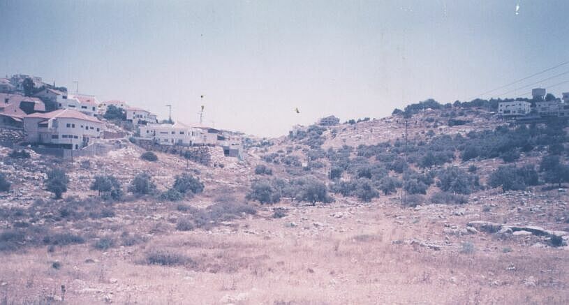
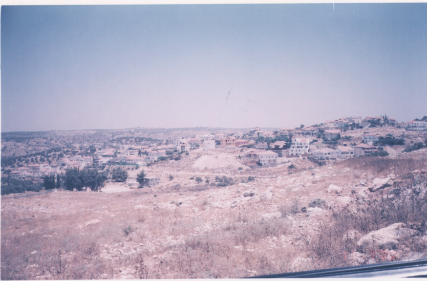
Notice that Azzoun Alatmah is located on the right hill, the nuclei of She'ari Tekva settlement started on the left hill. It is obvious that the settlement is expanding toward the village while the inhabitants of the village are not allowed to expand in any direction. Notice also the water reservoir in the middle of the village, the people of the village have not been able to get away from the center of the village for years.
Any observer can notice from the opposite angle, how the settlement buildings diffused until sieging the only primary school in the village in the middle of the coniferous trees on the left of the photo.
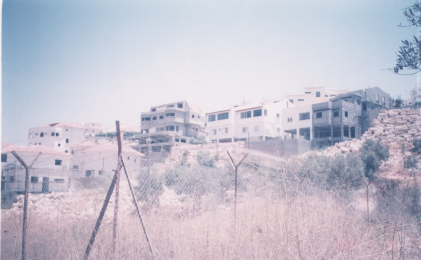
In addition to the horizontal expansion, please notice the amount of internal building inside the settlement.
Prepared by
The Land Research Center
LRC