February – April 2000
This report highlights the events concerning colonizing activities in the West Bank and Gaza Strip that occurred between the months of February and April. The report describes and evaluates those events and their effects on the Palestinian community. The report also tries to predict the repercussions expected in the future as a result of those events.
Background
The Madrid Peace Conference of October 29, 1991 was a major turning point in the status of the West Bank and Gaza Strip after the 1967 war. For the first time, the representatives of the Palestinian Territories were invited to a meeting addressing the Middle East conflict. Although it was not on an equal basis, it was a start. This conference provided the legitimacy and the framework for future rounds of peace negotiations and agreements. The direct outcome of the Madrid Conference was the birth of two separate negotiating tracks: the bilateral and multilateral talks. Soon after, separate bilateral negotiations were initiated between Israel from one side and the Palestinians, Lebanon, Jordan, and Syria on the other. Multilateral talks on key regional issues have been frequently held as well. Negotiations between Israel and the Palestinians on the interim period started in Washington, D.C. The composition of the Palestinian negotiating team was restricted at that time to members who were residents of the West Bank and Gaza Strip only.
The lack of progress in the bilateral negotiations led to secret meetings arranged and hosted by the Norwegians. These meetings led to the adoption of a two-stage solution. The first stage was an interim period of five years during which Palestinians would be permitted limited autonomy in the West Bank and Gaza Strip. The critical issues of water allocation control over resources, East Jerusalem, refugees, and the Israeli settlements were to be negotiated during the permanent status negotiations, which were scheduled to start on May 1, 1996. The behind-the-scenes negotiations, which took place in Oslo, Norway, achieved a major breakthrough in the Palestinian-Israeli relations, and brought the Palestine Liberation Organization (PLO) and Israel to sign the 'Declaration of Principles' (DOP) in September, 1993.
The DOP contained mutually agreed upon, general principles for the interim period. It requested Israel to turn its authority over civil issues in the West Bank to the Palestinian Authority. During the interim period, Israel would continue to control security of borders and Israeli settlers in the West Bank and Gaza Strip. In order to elaborate on the practical application of the DOP, the 'Agreement on the Gaza Strip and the Jericho Area', was signed in May 1994. That agreement, which later became known as Oslo I, resulted in the withdrawal of the Israeli forces from approximately 78% of the Gaza Strip and 6,130 hectares in the Jericho area. The 22% of the Gaza Strip which remained under Israeli control included 'yellow areas,' Israeli settlements, and an Israeli security zone.
The Israeli-Palestinian Interim Agreement on the West Bank and the Gaza Strip (commonly known as 'Oslo II') was initiated in Washington, D.C. on the 28th of September 1995. Oslo II set out a policy for election of the Palestinian Council and defined its authority, established Palestinian self-government in the West Bank, and set a schedule for redeployment of the Israeli army from populated Palestinian areas. The agreement also focused on security arrangements between Israel and the Palestinian Authority. As of today, Israel has not fulfilled a large segment of the Oslo II Agreement.
The Interim agreements have divided the lands of the West Bank into three classifications: areas A, B, and C while leaving the status of Jerusalem for the final negotiations. The Israeli military withdrew from lands classified as area A, and complete autonomy over administrative and security issues was assumed by the Palestinian Authority. Area A, according to the Oslo II agreement, covered the main cities of the West Bank, except for Hebron which had a special agreement. The city of Hebron was divided into areas of different control called H1 and H2. Area H1 is defined as area A and area H2, which houses 400 settlers, remains under Israeli control.
In areas B, the Palestinians have full control over civil affairs while Israel continues to have overriding responsibility for security. These areas comprise most of the Palestinian towns and villages. Areas C, covering almost 74.3% of the West Bank, is under Israeli control. Areas C covers the area, which falls outside areas A and B. In this area, the Palestinian Authority provides civil services; however, Israel retains full control over land, security, people, and natural resources. The majority of Palestinian agricultural land lies in these areas.
In the summer of 1996, there was a change of government in Israel and Benjamin Netanyahu, the Likud party leader, rose to power. His agenda concerning the occupied territories diverged from that of his predecessors and the peace process plunged into a series of crises. Not only that, but there was also an upsurge in the colonizing activities to the extent that Israeli officials publicly called upon the settlers to grab as many hilltops as they can. That 'land grab' policy resulted in the establishment of over 40 outposts during the three years that Likud held power.
Furthermore, Netanyahu was reluctant to honor the agreements signed by predecessors thus he placed the peace talks in a stalemate. Consequently, on the 23rd of October 1998 the Wye River Memorandum was signed to 'facilitate implementation' of the Interim agreement between the Palestinians and Israel. The memorandum stipulated further redeployments that would give the Palestinians control over about 40% of the West Bank (Table 1). The redeployments were to be conducted in three stages and it was projected that after completion of the third stage, area A would be approximately 18.2% of the West Bank, area B would be 21.8%, and the remaining areas would continue to be area C (Wye River Memorandum, 1998). The first stage was put into effect on November 20, 1998, two weeks after the agreed timeline and the following two stages were stalled. On December 15, 1998, the Israeli government announced its decision to stop further redeployment, and froze the implementation of the Wye agreement indefinitely. Table 1: The redeployments as mentioned in the Wye River Memorandum.
|
|
Total Area A |
Total Area B |
Total Area C |
Notes |
|
Stage I |
10.1% |
18.9% |
71.0% |
|
|
Stage II |
10.1% |
23.9% |
66.0% |
not implemented |
|
Stage III |
18.2% |
21.8% |
60.0% |
not implemented |
Source: adapted from The Wye River Memorandum, October 23, 1998
Since the Wye River Memo encountered obstacles in implementation, it needed a new agreement in order to see it through. So on the fourth of September 1999, the Sharm El-Sheikh Memorandum was signed. In general, this memo reiterated each party's commitment to uphold its previous obligations yet with a bit of detailing on certain issues. The Permanent Status talks were to resume in an accelerated manner and a deadline was set (September 2000) for their conclusion. The memo also contained clauses detailing the release of prisoners, the operation of the Gaza Port, the Safe Passage Route, and modifications in the stages of redeployment. The first and second stages were implemented (albeit after delays) while the third stage, which was scheduled for the 20th of January 2000, has not been implemented (Table 2): Redeployments as mentioned in the Sharm El-Sheikh Memorandum.
|
|
Total Area A |
Total Area B |
Total Area C |
Notes |
|
Stage I |
10.1% |
25.9% |
64.0% |
|
|
Stage II |
12.1% |
26.9% |
61.0% |
Implemented after delay in January 2000. |
|
Stage III |
18.2% |
21.8% |
60.0% |
Implemented after delay in March 2000. |
Source: adapted from The Sharm El-SheikhMemorandum, September 4, 1999.
The final status negotiations, which were supposed to commence in May 1996 and end 1999, were officially started in early September 1999. Before the launching of those talks, however, the Israeli side should have redeployed from all Palestinian territories except the issues of the final status (i.e. Jerusalem and the settlements). But in fact, Israel still retains full control over 60% of the West Bank and 24% of the Gaza Strip. In the meantime, successive Israeli governments have not stopped their unilateral practices in the West Bank and Gaza strip by which they created de facto realities on the ground. These de facto realities are clearly prejudicing the outcome of negotiations on the final status of the Occupied Territories to Israel's favor. Such activities are in total violation of United Nations' resolutions, particularly 298 and 242, as well as standing Palestinian-Israeli agreements.
The West Bank (excluding Jerusalem district)
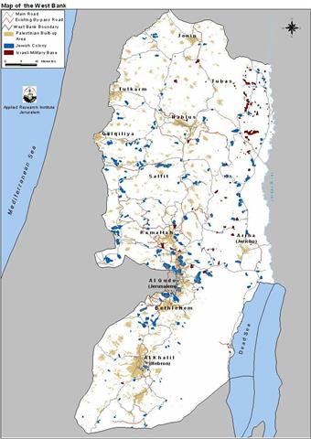
The West Bank is a landlocked geographic entity created as a consequence of the 1948 war (see map). The borders demarcating the West Bank are those appearing in the maps of the 1949 Armistice agreement signed by the Arab states and Israel. In 1967, Israel occupied the West Bank annexing East Jerusalem while treating the rest as 'Administered Territories'. The international community, however, did not (and until now does not) recognize Israel's annexation and refers to the West Bank (including East Jerusalem) as the Occupied Territories. The area of the West Bank is 5822 km2 and its Palestinian population in 1997 was 1,873,476 (PCBS, 1998). It includes 642 Palestinian built-up areas comprising 359 km2 (GIS database, ARIJ, 1998). In addition, there are eighteen refugee camps scattered throughout.
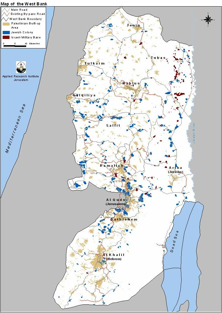
However there are over 250 Israeli built up areas (civilian and military) in the West Bank covering an area of 147 km2 (GIS database, ARIJ, 1998). Yet, Israel recognizes only 124 as independent municipal bodies. Currently the settlers number around 340,000 of which 170,000 are in East Jerusalem alone.
As is apparent from the map, the Jewish settlements in the West Bank are scattered all over (see map). However successive Israeli governments have encouraged the development of specific blocks more than others have. Notably, the focus has been on the following areas:
-
the Jerusalem area to create demographic barricades in front of any Arab claims to it,
-
Along the West Bank's western edges so as to make the return to the 1967 borders practically impossible,
-
The Jordan valley for its presumed importance to Israel's security as well as for its agricultural resources (abundant water and fertile soil).
Furthermore, the growth of settlements is mainly geared to the formation of blocks; i.e. they grow outwards and towards each other. The end result of such a growth is the grouping of Palestinian towns and villages into three or four cantons. Indeed, the Israeli intention is to make the contiguity of any Palestinian State in the future practically unattainable.
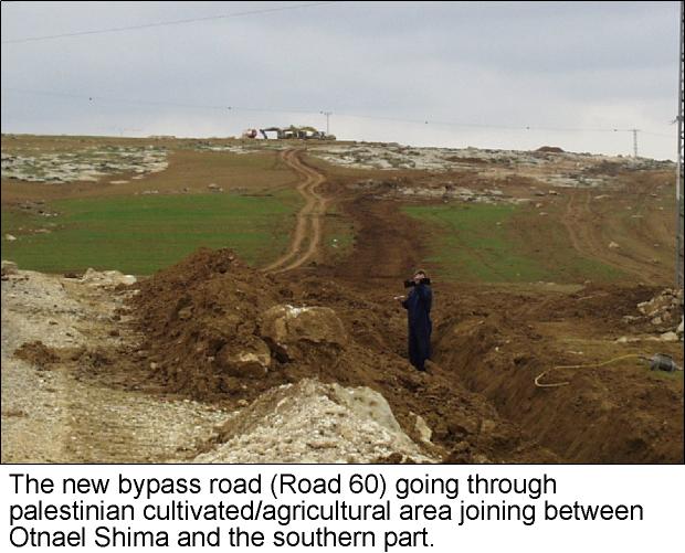
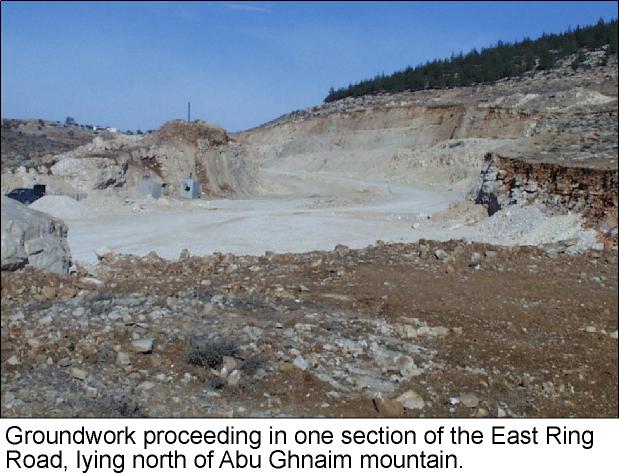
In addition, Israel builds by-pass roads to link settlements with each other and with Israel proper (see map). This designation came with the advent of the Oslo Accords and was not present before. In the agreements they are called 'Lateral Roads' but people usually call them 'bypass' roads because they are meant to circumvent (i.e. bypass) Palestinian built up areas. These roads are of course under Israeli control and entail a 50 to 75 meter buffer zone on each side of the road in which no Palestinian construction is allowed. In effect, these roads carve up the Palestinian areas into isolated ghettos and deprive Palestinians of vital agricultural land. Moreover, these roads become political boundaries since most of them are inaccessible to Palestinians from the West Bank (photo1, photo2 ).
To achieve its schemes of settlement expansion and by-pass road construction, Israel utilizes a variety of policies. From issuing military orders, to land confiscation, to house demolition, and uprooting trees, Israel continues to transform the West Bank every day. The Israeli violations that were reported between the months of February till April are listed in the following table:
Table 3: Israeli Violations in the West Bank from February to April 2000
|
Date |
Violation |
Location |
Violators |
|
02-Feb-00 |
O – Prohibition of the villagers from entering their lands. |
Ramallah – Al Mughayyir & Jalud villages |
The settlers of Shvut Rahel with the Israeli army |
|
03-Feb-00 |
E – Expanding an Israeli quarry by 60 dunums on lands belonging to over five Palestinian families. |
Qalqilia – Jayous al Gharbiyah |
Israeli quarry 'Leader Company' |
|
05-Feb-00 |
D – A demolition order was issued to a Palestinian house |
Ramallah – Kharbatha Bani Harith |
The Israeli government with the army |
|
06-Feb-00 |
S – Seizing a 200-dunums piece of land |
Nablus – Qariot |
Settlers from the settlement of Rahel |
|
07-Feb-00 |
O – An attempt to expand Shvut Rahel settlement |
Ramallah – Al-Mughayyir &Turmus'ayya |
The settlers of Shvut Rahel |
|
08-Feb-00 |
S – Destroying 150 dunums of fertile land, in an attempt to expand Shvut Rahel |
Ramallah – Al-Mughayyir &Turmus'ayya |
The settlers of Shvut Rahel with the army |
|
11-Feb-00 |
O – Closing off huge tracks of land for 'Military Practices' |
Tubas – Bardellah, Tayaseer |
Israeli Army Forces |
|
11-Feb-00 |
U – Uprooting of 100 fully-grown olive trees. |
Hebron – Khallet Ribei' village |
The settlers of Maon |
|
15-Feb-00 |
R- A new and fixed army roadblock has been erected. Click for more |
Hebron – Susiya settlement |
The Israeli government |
|
17-Feb-00 |
S – A settler from Shvut Rahel grazed his cattle in a Palestinian land planted with almond and olive trees. |
Ramallah – Al-Mughayyir &Turmus'ayya |
The settlers with the army |
|
19-Feb-00 |
S – Two pieces of land have been registered (in the tabo), and estimated at 3900 dunums. |
Bethlehem – Nahalin & Sourif villages |
The Israeli company 'Himona' related to Kiren Kemet establishment |
|
20-Feb-00 |
D – Dispatching ultimatums to demolish 23 Palestinian homes, under the pretext of being located in an area under full Israeli control. Click for more. |
Hebron – Yatta village |
The Israeli government |
|
22-Feb-00 |
R – Announcement for constructing nine by-pass roads. |
West Bank |
The Israeli occupation authorities |
|
23-Feb-00 |
S – Confiscation of 30 dunums of land. |
Hebron – Beit Ummar village |
The settlers of Gush Etzion |
|
26-Feb-00 |
U – Uprooting of 17 olive trees |
Hebron – Tel Rumeida settlement |
The settlers of Tel Rumeida |
|
27-Feb-00 |
E – Building a 30-kilometer pipeline between Alfe Menashe and Kedumim settlements |
Qalqilia – Azzoon and Jinsafout |
Israeli authorities |
|
28-Feb-00 |
S – Expelling of 19 Palestinian families from their homes, under the pretext of being too close to Jewish settlements and military camps. Click for more. |
Hebron – Yatta village. |
A troop of Israeli soldiers |
|
28-Feb-00 |
D – Demolishing retaining wallsbelonging to Ratib Al Na'san |
Ramallah – Al-Mughayyir village |
The settlers & the army |
|
28-Feb-00 |
E – Expanding Shavee Shomron settlement by 40 dunums. |
Nablus – Sabastia |
The settlers. |
|
28-Feb-00 |
U – Uprooting more than 700 olive nurslings |
Ramallah – Al-Mughayyir village |
The settlers & the army |
|
01-Mar-00 |
P – Endorsement of a plan to construct an industrial zone on 200 dunums of land, and a new female university. |
Bethlehem – Gush Etzion settlement |
The Israeli Civil Administration |
|
03-Mar-00 |
R – Expropriation of 100 dunums and groundwork on Enav settlement bypass road started. |
Tulkarem – Safareen and Al Boqaia. |
The Israeli government |
|
03-Mar-00 |
P – The area of the industrial zone project would be built over 5268 dunums of land expropriated from the three Arab villages of Al Khader, Beit Fajjar, and Beit Ummar |
Bethlehem – Gush Etzion settlement |
The Israeli government |
|
05-Mar-00 |
E – Bulldozing 300 dunums of land between Enav and Avne Hefetz settlements. |
Tulkarem – Safareen, Kafr al Labd, Shoufa. |
Israeli authorities |
|
10-Mar-00 |
P – An attempt to build a new settlement neighborhood, by constructing 2000 housing units over 253 dunums of land. |
Bethlehem – Gilo Tunnel |
Extremist Jewish Associations |
|
12-Mar-00 |
S – Eviction orders to Palestinian citizens |
Hebron – Yatta + Idhna villages |
The Israeli authorities |
|
18-Mar-00 |
U – Uprooting 25 olive trees. |
Nablus – Jaloud |
Settlers from the settlement of Shvut Rahe |
|
18-Mar-00 |
E – Construction of a new settlement carrying the name of Tul al Taal on 4000 dunums. |
Qalqilia – Al Aslah |
The Israeli authorities |
|
19-Mar-00 |
P – Planning to build some 5,000 housing units on a land estimated at 1,200 dunums. |
Bethlehem – Walajeh |
Jewish investors |
|
20-Mar-00 |
C – Adding three mobile caravans to Shvut Rahel settlement. |
Nablus – Jaloud and Qariot |
Settlers |
|
21-Mar-00 |
E – Shvut Rahel settlers closed off 20 planted dunums of land. |
Nablus – Jaloud and Qariot |
Settlers |
|
23-Mar-00 |
S – Seizure of Palestinian lands, to open a settlement by-pass road. Click for more. |
Ramallah -Dura Al Qar'. |
The Israeli Civil Administration |
|
24-Mar-00 |
E – Razing 60 dunums of land as a military training ground. |
Tubas |
Israeli Army Forces |
|
25-Mar-00 |
E – Bulldozing lands to install a wastewater pipeline for the settlements. |
Salfit – Deir Estia |
Israeli authorities |
|
26-Mar-00 |
P – Planning to build 1600 housing units |
Ramallah – Mod'in settlement |
The Israeli Housing Ministry |
|
27-Mar-00 |
C – 200 housing units are under construction. See (photo1, photo2). |
Bethlehem – Beit Jala |
Jewish settlers |
|
27-Mar-00 |
C -Construction of 100 housing units |
Bethlehem – Daniel settlement |
Jewish settlers |
|
29-Mar-00 |
C – Erection of two tents. |
Hebron – Yatta |
Jewish settlers |
|
03-Apr-00 |
S – Destroying hundreds of dunums of fertile land. |
Hebron – As Simiya hamlet, near As Sam' village |
Jewish army bulldozers |
|
04-Apr-00 |
C – Installing ten mobile homes |
Bethlehem – Kisan village |
A troop of settlers |
|
05-Apr-00 |
S – A number of eviction orders have been issued against the Palestinian cave dwellers, just after a week of the Supreme Court decision that allowed them to return to their homes. Click for more. |
Hebron -Yatta |
The Israeli Civil Administration |
|
05-Apr-00 |
O -Several military orders to halt construction were issued |
Hebron district |
The Israeli military forces |
|
05-Apr-00 |
S -Seizure of 50 dunums of land |
Hebron -Hebron city |
The Israeli authorities |
|
07-Apr-00 |
P – A plan has been ratified to construct a new tourist center on 150 dunums of seized land |
Bethlehem – Etzion Block |
The Israeli government |
|
08-Apr-00 |
D – Delivering demolition order to a Palestinian citizen's house, under the pretext of being built without a permit. |
Hebron – Yatta village |
The Israeli authorities |
|
10-Apr-00 |
P -Giving the green light for the construction of 12 new by-pass roads, which will be completed by the end of this year. |
West Bank |
PM Barak |
|
11-Apr-00 |
C -Construction of 350 housing units on 400 dunums of land. |
Bethlehem – Efrat settlement |
Jewish settlers |
|
11-Apr-00 |
D -Delivering notification orders to demolish eight Palestinian houses, under the pretext of being built without permits. Click for more. |
Hebron – Beit Ummar village |
The Israeli Civil Administration |
|
12-Apr-00 |
C -Destroying large areas of land estimated at 265 dunums, in an attempt to construct 200 housing units to expand Har Gilo settlement. |
Bethlehem – El Walajeh village |
The Israeli military bulldozers |
|
14-Apr-00 |
O – Damaging crops after holding military training on the land. |
Tubas district |
Israeli Army Forces |
|
16-Apr-00 |
S – Dispatching eviction orders to Palestinian citizens |
Hebron – Edna village |
The Israeli authorities |
|
17-Apr-00 |
U – Uprooting several trees |
Ramallah – Kafr Malik |
BEZEQ, Israel's National Telecommunications Company |
|
17-Apr-00 |
C –Ongoing construction in Har Homa settlement. |
Bethlehem – Abu Ghneim Mountain |
The Israeli authorities |
|
19-Apr-00 |
U – Uprooting 211 olive trees |
Nablus – Ta'anak village |
The Israeli authorities |
|
19-Apr-00 |
U – Uprooting 50 olive trees |
Ramallah – Jalud & Turmus'ayya villages |
The settlers of Shilo |
|
21-Apr-00 |
O – Two Palestinian inhabitants were wounded while defending their land |
Hebron – Beit Ula village |
The Israeli authorities |
|
24-Apr-00 |
E – Leveling of lands to expand Migdalim settlement. |
Nablus – Qisra |
The Israeli authorities |
|
29-Apr-00 |
S – An attempt to seize a piece of land. |
Hebron – Tel Rumeida settlement |
The settlers |
Source: compiled from local newspapers, interviews and field surveys by ARIJ & LRC.
S = Seizure; i.e. confiscation, eviction, occupation and any sort of asset grabbing
E = Expansion; i.e. any increase in land occupied by Israelis.
C = Construction; i.e. any increase in Israeli built-up areas.
R = Roads; i.e. any increase in the road network.
D = Demolition; i.e. any destruction of Palestinian assets.
U = Uprooting trees.
P = Plans
O = Other.
Jerusalem District
In 1967, Israel expanded the borders of East Jerusalem from 6.5 to over 70 km² to include vacant lands from many West Bank villages, while excluding populated areas. Later, in 1980, Israel formally annexed the extended East Jerusalem as part of Israel, and placed the Palestinian part of the city, including the Old City, under the legal jurisdiction of Israel and the Israeli Municipality of Jerusalem.
The state of the Palestinians' human rights in Jerusalem is deteriorating at an accelerating rate. The Israeli occupation is trying to build more facts on the ground to Israelize the Holy City; to make it, as they claim, the eternal capital of Israel. The following is a list of the results of the Israeli policies:
-
Palestinian Jerusalemites are prevented from using more than 86% of their land upon which Israeli occupation built more than 15 settlements. The remaining land is kept as a strategic reserve for the expansion of the settlements.
-
The number of Jewish settlers in occupied Jerusalem is about 170,000 settlers. Their number in 1967 was zero.
-
More than 2000 houses were demolished since 1967, more than 350 of which were demolished under the pretext of building without permit.
-
Because Israel restricts the release of building permits, about one third of the Palestinian houses in Jerusalem are built without permits and are thus threatened with demolition.
-
More than 100 homes were seized in addition to two neighborhoods inside and outside the Old City.
-
The military closure of the city since the 30th of March 1993 has caused devastation on the economical, social, and political levels.
The occupied City of Jerusalem has been witnessing an increasingly aggressive campaign by the occupation forces aimed at Judizing the city and at erecting stumbling blocks in the face of the peace process. Tools used to achieve such goals and to create more facts on the ground include house demolishing, land confiscation, by-pass roads, among other devices. All such activities are taking place under the rein of an Israeli government that claims to be ever so committed to the peace process. Yet, on the ground, one can find that this government is approving more and more master plans for the settlements surrounding Jerusalem in addition to issuing calls for tenders for new housing units in such settlements. That is in addition to the restrictions and complications imposed upon Palestinian Jerusalemites aimed at isolating Arab villages and preventing its natural expansion and development.
Field workers documented the following violations in the Jerusalem area between the months of February till April 2000:
-
The Israeli government continued working on a road designed to encircle the city from the east. The initial work on this road led to the expropriation of a large number of land tracks owned by Palestinians from the villages of Sur Baher, Jabal Al Mukabber, Al Tur, Al Essawiyah, and Shu'afat.
-
The authorization in February of the establishment of a train station connecting between East and West Jerusalem. Groundwork has already begun and is expected to be concluded by February 2001. The railway is planned to start at the settlement of Kiryat Yofeil, located five kilometers away from the center of the city. The line would then proceed through Jaffa road, Damascus Gate, criss-crossing Road No. 1 through a tunnel under the Notredame Church, reaching the northern part of East Jerusalem to Sheikh Jarrah and Shua'fat, to end at the Palace of King Hussain next to the intersection of Road No. 12.
-
The authorization of the groundwork on Road No. 12. The road is planned to connect between Shu'afat and the settlements of Neve Yacoov and Pisgat Ze'ev. The Road would lead to the eventual isolation of the Arab neighborhood nearby and to the prevention of their future eand development. That is due to the fact that the width of the Road is about 80 meters and the no-construction zone associated with it is 150 meters on each side of the road. This means that Palestinian residents wanting to build on or plant the land would not be able to obtain the necessary permits to do so.
-
The Israeli government approved the construction of 3000 housing units in the settlement of Pisgat Ze'ev in addition to the expansion of the settlement of Gilo by approving the building of 500 housing units there.
-
Israeli authorities expropriated 2500 dunums of land belonging to the villages of Al Essawiyah, Al Tor, Anata, and Shu'afat. The declared goal behind the expropriation is to build an industrial zone, a train station, and a Jewish settlement. This move took place at the same time that Palestinian houses are being demolished under the pretext that they were constructed on 'Green Lands.'
-
An authorization has been issued to begin the construction of five huge hotels behind the UN Headquarters in Jabal Al Mukabber. The plan calls also for declaring the lands surrounding the proposed hotels to become Nature Reserves.
-
The authorization of building a new Jewish neighborhood on the lands of the village of Lifta in West Jerusalem. This neighborhood is specially designed to host a resort for wealthy Jews from the United States. The blue print of the neighborhood calls for the construction of 230 villas in addition to a resort, a mall, and a museum. Note that the village has more than 200 old-styled houses vacated by Palestinians as a result of Jewish terrorism during and in the aftermath of the 1948 war. For an in-depth analysis and further details about the planned resort in Lifta please refer to Israel destroys Lifta Artifacts to Build a Resort for wealthy Jewish Immigrants.
-
Israeli authorities continued the process of demolishing Palestinian houses in the village of Al Essawiyah. Please refer back to the case study concerning this topic at Israeli Occupation Forces Demolishes Three Houses in Al Essawiyah Village.
-
The expropriation of 1070 dunums of lands belonging to Palestinians living in Sur Baher, Al Sawahreh Al Sharqiya, Al Tor, Abu Deis, and Al Aizeriyah. An additional 12,500 dunums are expected to be expropriated to establish upon it 3000 hotel rooms in addition to 3500 housing units for Jewish settlers.
-
The demolishing of historical artifacts and ruins in Al Essawiyah while continuing the groundwork for the eastern tunnel located on the lands of the village.
-
The killing of Mr. Murad Al Zaro on the 30th of March 2000 while on his way back to his house in Shu'afat. He was killed on the hands of the Israeli Special Forces.
-
Starting the groundwork for the establishment of Road 16 that begins at the tunnel opening in the Mount of Olives. This start was possible after the destruction of the 150-years-old Al Shahabi Palace.
-
The Israeli government attempted to seize a Palestinian land in Beit Iksa village on 13-Feb-2000.
-
Several Housing units in Pisgat Zeev were sold 1-Mar-2000. The housing units are currently under construction and are 300 in number.
-
The settlers opened a by-pass road around Givat Hadasha settlement on 7-Mar-2000. The lands pertain to the Palestinian villages of Al Jib, Biddu & Beit Ijza.
-
The Israeli government demolished six houses on 12-Mar-2000 in Qatanna village under the pretext of being built without permits. It also destroyed three roads, water networks, electric poles & a telephone line under the pretext of being built in the 'No Man's land'.
-
In order to expand Pisgat Zeev settlement, the settlers along with the Israeli army destroyed a piece of land in Al Jib village on 23-Mar-2000.
The Gaza Strip
Gaza Strip is a narrow strip of land located across the southern western side of Palestine (see map). The Strip is 45 km long and it is between 6 to 12 km wide. The total area of the Strip is 363.8 km squared. The population of Gaza Strip is about 1 million. With such data, Gaza Strip is considered one of the most over crowded areas in the world with a rate of 3018 person per km squared (in the case of discounting the area under Israeli occupation). Finally, the percentage of young people under the age of 15 is about 50%. Agriculture is the main economic activity in the Strip. Main agricultural products include palm and citrus trees in addition to different types of vegetables. The Strip also has a large labor force. Yet, the Israeli occupation has deployed a number of policies that has affected the economic activity in the Strip in a negative way. Such policies include:
-
Confiscation and seizure of agricultural lands,
-
Seizure of water sources including over pumping of these sources to supply it to the Israeli settlements. This action has led to the increase of both the pollution and the salt concentration of the water (saline water intrusion to the groundwater aquifer.)
-
The isolation of the Strip from Palestinian and other markets which caused a great damage to the agricultural potential.
-
As a result, there is an increase in the number of unemployed in Gaza Strip.

Despite the small area of the Strip and the fact that there exists a great number of Palestinian refugee camps (their total areas are about 110,000 dunums), Israeli colonizing activity led to the seizure of about 59,000 dunumsof Palestinian land in the Strip. That is about 16.3% of the total area of the Strip. The usage of these dunumsis divided as follows:
-
43,000 dunums were used to build 20 settlements atop of them,
-
775 dunumswere declared closed military areas and used exclusively for the usage of the Israeli occupation forces.
-
15,000 dunums were used as security zones for the protection of Israeli settlers.
The geographical distribution of the Israeli settlements in Gaza Strip was designed to accomplish two goals:
1. To isolate, as much as possible, Palestinian centers from reaching the Mediterranean Sea. This goal has been achieved through the establishment of 16 settlements parallel to the Mediterranean Sea in the south of the Strip.
2. To control the main road that divides the Strip into three distinct areas, which allows for their easy isolation. This goal has been achieved through the establishment of the 3 settlements of Erez in the north, Kfar Darom in the middle, and Morag in the south of the Strip.
Moreover, the Israeli authorities established settlements in Gaza Strip mainly to serve the occupation. These settlements include military ones that aim at achieving complete military and security control over the Strip and its coastal area in addition to the Egyptian borders. They also include agricultural settlements to which vast areas of land were annexed and used as farms by the settlers in order to achieve three goals:
1. Controlling vast areas of Palestinian land;
2. Controlling sources of underground water in the Strip;
3. Using the Gaza Strip land and water for cultivating special kinds of vegetation like flowers and citrus fruits (economic reason).
The Israeli occupation authorities also set up a number of industrial settlements with the aim of utilizing cheap labor from Gaza Strip to produce Israeli products for local and international markets.
A large network of roads was built to serve Israeli settlements. It comprises two categories:
1. Internal roads connecting settlements to each other and connecting settlements with main roads;
2. Main roads that connect the three settler blocks in the south, north and center of the occupied land with Israel proper.
Although a number of these roads pass by areas under the Palestinian sovereignty according to Oslo accords, the Israelis are still having security control over these roads supported by permanent and random checkpoints. Often, the Israeli army and settlers prevent Palestinian from using these roads, especially those roads leading to Netzarim and Kfar Darom settlements where Palestinians face arbitrary checks and are not allowed to travel on these roads individually, but in commune (more than one person in a car).
In accordance with the policies of the Barak government, the Gaza Strip has witnessed an increased number ofviolations of the signed accords and the very basic of human rights. Field workers documented the following violations in the Gaza Strip between the months of February till April:
-
The intentional spilling of Gush Qatif's sewage waters into the bordering Palestinian lands which caused the spoilage of crops and the poisoning of cows. That is in addition to health hazards caused by such effluent to human health and to the surrounding environment.
-
Israeli occupation forces expanded the area surrounding the Zu'arab military camp located next to the Egyptian borders. The forces created roads 20 meters wide all along the border with the intention of building a cement wall to surround the camp. This incident, which took place on the 25th of May 2000, prevented villagers to reach and care for their crops, as the area became semi-military.
-
Three new housing units were added inside the settlement of Gush Qatif on the 9th of April 2000. That is in addition to the establishment of a number of agricultural plastic houses on the lands of Mawasi Al Qarara in Khan Yunis. It is worth mentioning that Israeli settlers forcefully took control of more than 1000 dunums in the area of Mawasi Al Qarara in the past two years.
-
On the 28th of April 2000 Mr. Mohammad Al Astal of Khan Yunis received a military order to stop using a sandy road that he uses to reach his planted land. The road is about 400 meters long and is located close to the 1000 dunums ceased by the settlers earlier. Meanwhile, Israeli forces prevented Mr. Ahmad Ayesh Al Sha'aer from planting 30-dunum piece of land under the context that it was close to the same ceased land.
-
On April 29th, 2000, Israeli military forces notified both Mr. Tayseer and Nofel Abu Eidah with the intention of demolishing their homes. The declared reason behind such a decision was due to their close proximity to the settlement of Neve Dakaliem located to south of Khan Yunis refugee camp.
-
Netzarim settlers seized a ten-dunum piece of land. The intention of the settlers was to use the seized land to enlarge the settlement. The incident took place on the 1st of May 2000 as the settler planted trees on the specified piece of land.
-
Israeli forces annexed and leveled off lands on both the eastern and western sides of the settlement of Aslaw in Mawasi Rafah. The area of the annexed land was about 25 dunums.
In Depth Analysis of Key Events
Colonial Outposts since the Wye River Memo
As mentioned in the 'Quarterly Report on Israeli Colonizing Activities (September -November 1999)', Barak's government revised the status of 42 colonial outposts established after the signing of the Wye River Memo (actually the number of outposts erected since the Wye Memo is 46). Of those 42 outposts, eight are supposed to be evacuated but ARIJ & LRC field workers have confirmed only two had been evacuated. (see map).

Table 4: Survey of settlement Outposts 1996 -1999
|
# |
Mother settlement |
Outpost |
To Be Evacuated? |
Photo |
|
1 |
Allon Shevut |
Givat Ha'hish |
NO |
|
|
2 |
Avnei Hefetz |
Avnei Hefetz Eastern Caravans |
NO |
|
|
3 |
Bat Ayin |
Bat Ayin B |
NO |
|
|
4 |
Beracha |
Beracha A |
NO |
|
|
5 |
Beracha |
Sneh Ya'akov |
NO |
|
|
6 |
Efrat |
Efrat North 1 |
NO |
|
|
7 |
Eli |
Nof Harim |
NO |
|
|
8 |
Eli |
Mizpe Shuna |
YES |
|
|
9 |
Eli |
Ha'yovel Neighborhood |
NO |
|
|
10 |
Elkana |
Magen Dan |
NO |
|
|
11 |
Elon More |
Har Kabir |
NO |
|
|
12 |
Halamish |
Zofit Farm |
NO |
|
|
13 |
Itamar |
Gidonim |
NO |
|
|
14 |
Itamar |
Gidonim A (Hill 851) |
NO |
|
|
15 |
Itamar |
Hill 782 |
NO |
|
|
16 |
Itamar |
Gvaot Olamn (Avri Ran's Farm) |
NO |
|
|
17 |
Itamar |
Hil Neighborhood (Hill 777) |
YES |
|
|
18 |
Karnei Shomron |
Nof Kane Farm |
NO |
|
|
19 |
Kedumim |
Har Hemed |
NO |
|
|
20 |
Kefar David |
Sdeh Bar Farm |
NO |
|
|
21 |
Kefar Tapuah |
Kefar Tapuah Hill 660 |
NO |
|
|
22 |
Kochav Ha'shachar |
Mizpe Keramim |
YES |
|
|
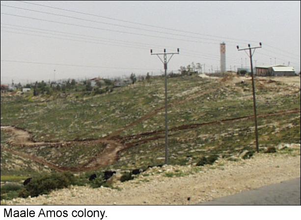
23 |
Ma'ale Amos |
Ivei Ha'nachal |
NO |
|
|
24 |
Ma'ale Michmash |
Mizpe Dani |
NO |
|
|
25 |
Ma'ale Michmash |
Mizpe Hagit |
YES |
|
|
26 |
Ma'ale Michmash |
Neve Erez |
YES |
|
|
27 |
Maon |
Maon Farm |
YES |
|
|
28 |
Maon |
Misgav Dov Neighborhood |
NO |
|
|
29 |
Metzadot Yehuda |
Nof Nesher |
NO |
|
|
30 |
Ofra |
Amona |
NO |
|
|
31 |
Shevut Rachel |
Ahiya (Hill D) |
NO |
|
|
32 |
Shevut Rachel |
Adi Ad (Hill F, Hill 799) |
NO |
|
|
33 |
Shevut Rachel |
Shevut Rachel Hill 804 |
NO |
|
|
34 |
Shevut Rachel |
Shevut Rachel Hill 827 |
YES |
|
|
35 |
Shillo |
Shillo East 1 |
NO |
|
|
36 |
Shillo |
Shillo East 2 |
NO |
|
|
37 |
Shilo |
Givat Harel (Hill 740) |
NO |
|
|
38 |
Suseya |
Magen David Farm |
YES |
|
|
39 |
Talmon North |
Haresha |
NO |
|
|
40 |
Talmon North |
Horesh Yaron |
NO |
|
|
41 |
Talmon North |
Zayit Ra'anan |
NO |
|
|
42 |
Talmon South |
Talmon Eastern Caravans |
NO |
|
|
43 |
Tene Omarim |
Tene Omarim SE Caravans |
NO |
|
|
44 |
Tene Omarim |
Tene Omarim N Caravans |
NO |
|
|
45 |
Yitzhar |
Yitzhar Eastern Hill |
NO |
|
|
46 |
Yitzhar |
Ahuzat Shalhevet |
NO |
|
Source: Data compiled from Survey of Illegal Outposts 1996-1999, Peace Now,
October 1999 and Settlement Outposts Established During The Likud Party ,
Arab Studies Society, 1999 and ARIJ field work verification.
Palestinian Localities Still in Area C after March 2000
After the latest redeployment of Israeli forces from the West Bank in March 2000, certain Palestinian localities remained completely or partially within Area C; i.e. under full Israeli control. The following table details the number of villages still lying in area C in each district:
Table 5: Palestinian Localities Still in Area C after March 2000
|
District |
Total Number of Localities |
Completely in Area A or B |
Partially in Area C |
Completely in Area C |
|||
|
# |
% |
# |
% |
# |
% |
||
|
Jenin |
77 |
65 |
84% |
0 |
0% |
12 |
16% |
|
Tulkarem |
58 |
15 |
26% |
32 |
55% |
11 |
19% |
|
Nablus |
117 |
51 |
44% |
55 |
47% |
11 |
9% |
|
Ramallah |
74 |
24 |
32% |
46 |
62% |
4 |
5% |
|
Jericho |
8 |
6 |
75% |
2 |
25% |
0 |
0% |
|
Jerusalem |
36 |
4 |
11% |
23 |
64% |
9 |
25% |
|
Bethlehem |
67 |
26 |
39% |
26 |
39% |
15 |
22% |
|
Hebron |
153 |
78 |
51% |
32 |
21% |
43 |
28% |
|
Total |
590 |
269 |
46% |
216 |
37% |
105 |
18% |
Source: Database of the Applied Research Institute -Jerusalem (ARIJ).
-
There are 105 Palestinian villages that are still completely within area C and 216 that have parts in area C.
-
No Palestinian lives more than 6.5 km from Area C.
-
The Jerusalem and Hebron Districts are the two districts having over a quarter of their localities completely in area C.
-
At the same time, the Jerusalem district has only 11% of its localities completely in area A or B.
The Current Political Situation
The Palestinian-Israeli peace accords came at a time when the Palestinian people had high hopes for their emancipation and national liberation. That feeling of optimism carried on despite several setbacks to the peace process. Yet, and as political events unveiled, the dream started to go sour. From Oslo II, to the Hebron agreement, to the Wye River Memo, to the Sharm El-Sheikh Memo, Palestinians got less and less while Israel was able to regress on its commitments.
According to Oslo II:
- The final status negotiations, which were supposed to commence in May 1996 and end by 1999, were officially started in early September 1999. The Israelis should have withdrawn from all of the West Bank and Gaza Strip excluding the issues of the permanent status negotiations (i.e. Jerusalem and the settlements). That amounts to about 90% of the West Bank and Gaza.
- No issues of the interim period should have been deferred to the final status negotiations (paragraph 6 of the preamble, Israeli-Palestinian Interim Agreement on the West Bank and The Gaza Strip). The Sharm El-Sheikh Memorandum rescheduled the final redeployments of the interim period to be concurrent with the final status talks.
- The release of prisoners was delayed so much that many ended up being released just a few weeks before the end of their prison sentence. In fact the Israelis even tried to bargain the release of some criminal convicts rather than political prisoners.
- All the agreements reaffirm that, in one way or another, both sides should refrain from unilateral steps that prejudice the status of the West Bank and Gaza. Yet Jewish settlement expansion, land confiscation, house demolition, and tree uprooting continued at an unprecedented pace.
Conclusion
Barak's government came to power with the promise of achieving peace. At first glance the actions of that government give the impression of working for peace. However, the government's policies were not whole-hearted nor were they free of any illusions. Even the modest terms of the Sharm El-Sheikh Memo have not been met. Bewithdrawals, incomplete release of prisoners, and the procrastination of the final status negotiations indicate an Israeli disposition to delay as much as possible the fulfilling of its contractual obligations. Indeed, Israel is stealthily speeding up its colonial activities while, at the same time, skillfully averting international attention. The accelerated rate of housing units' approval as compared to the previous government attest that.
Israel continues to violate Palestinian rights (be it political, financial, civil, or human) as the last thirty-three years of killing, arrest, colonizing, and house demolishing stand witness to. Up to today, Palestinians in the West Bank are suffering from the discriminatory and brutal policies practiced by the successive Israeli governments. This is the situation despite the fact that it has been almost seven years since the start of the peace process in Madrid and seven years since the signing of the Declaration of Principals.
Prepared by:
The Applied Research Institute – Jerusalem

&


