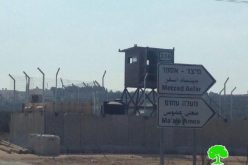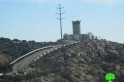
The Israeli occupation army began early this month to add new military fortifications and closure measures at Beit Iba checkpoint to the north west of Nablus city, including barbed wires, watch towers and trenches.
The Beit Iba checkpoint is located on the main road linking between the city of Nablus and the northern and western governorates of Jenin, Tulkarem and Qalqiliya. It stood about 4 km to the north west of the city on the land of Beit Iba and Deir Sharaf villages, close to the junction leading to Jenin governorate in the north of the West Bank. Immediately after the outbreak of the Intifada in the year 2000 the Israeli army closed all the roads to Nablus, including this road with earth mounds, rocks and cement blocks. In August, 2003, the army began to set up flying and permanent checkpoints. Then, it was developed into an almost international border terminal equipped with watch towers, checkpoints, magnetic gates, rolling gates, surveillance cameras and car parks.
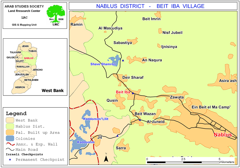
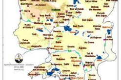
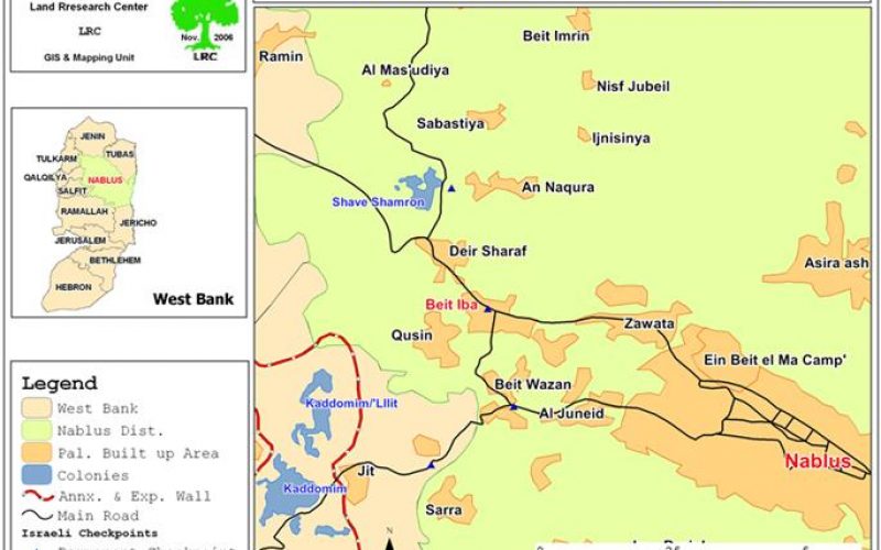
(map 1: location of Beit Iba checkpoint)
The new additions include the fixing of a barbed wire fence at the distance ranging from 200-300 meters under the pretext of stopping pedestrian infiltration from behind the checkpoint. More watch towers were, also, added on the hilltops surrounding the checkpoint, especially on the land that belongs to the village of Qusin.
In related development, the Israeli occupation army decided last September to close the checkpoint every day at 7:30 PM under baseless security claims, increasing the suffering of local people and putting more obstacles on the way of Palestinian trade and merchandise in and out of the city. In other words, the city has become a big prison that is closed every evening.
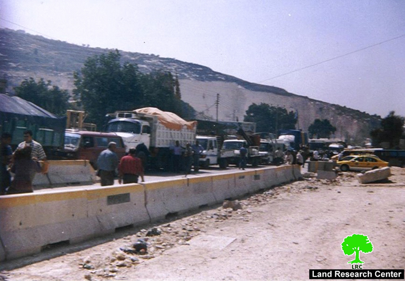
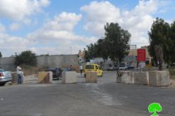
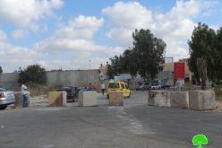
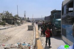
photo 1: Palestinian cars and people waiting in long queue
in front of Beit Iba checkpoint, Nablus
Nablus in the Intifada
The city of Nablus assumes a prominent role in the Palestinian economy because of its geographical location and vast human, natural and commercial resources. It is the biggest city in terms of population. It is a linking point between the Mediterranean and Jordan valley, between northern and southern parts of the West Bank.
Since the outbreak of the current Intifada, the Israeli army has repeatedly attacked the city of Nablus, destroying its infrastructure and cutting it off from the West Bank.
Impacts of Beit Iba checkpoint on Palestinian general life
The detention and delaying of people for long hours under summer heat and winter cold, including the elderly , children, women, sick and students and send back many of them. According to the statistics of the Palestinian ministry of health, quite many people died at this checkpoint, either inside ambulances or in private cars whilst en route to hospitals in the city .
The detention of commercial, private and international humanitarian vehicles and forcing them to get passing permits from the Israeli military before coming to the checkpoint.
Very often, Israeli soldiers manning the checkpoint resort to inhumane practices such as slowing the checking procedures or indefinitely stopping the whole process for whatever reason.
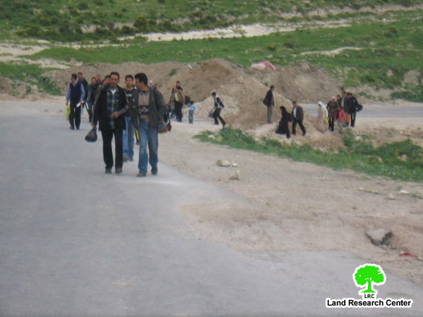
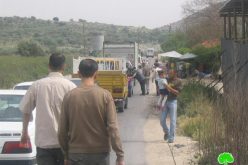
(Photo 2: a group of Palestinians crossing on foot the Wadi
Al Bathan trenched road between Nablus and Jordan valley)
Other checkpoints
The Israeli closure measures include, among many others, setting up of sporadic and flying checkpoints, closing villages' entrances with earth mounds, iron gates and cement blocks, digging of roads and closing of alternative roads. Amongst the worst permanent checkpoints are the following:
-
Al Kafriyat at the southern entrance to Tulkarem city;
-
Anabta checkpoint on the road between Nablus and Tulkarem;
-
Beit Iba at the north western entrance to Nablus city;
-
Sahvei Shomron ( Deir Sharaf) checkpoint on the main road between Nablus and Jenin;
-
Asira Ash Shamailiya between Nablus and Jenin;
-
Huwwara on the main road between Nablus and Ramallah;
-
Awarta checkpoint between Nablus and Ramallha;
-
Za'tara (Tabbuh) checkpoint between Nablus and Ramallah.
-
At Tur ( Mount Gerezim) checkpopint between Nablus and Ramallah;
-
Beit Furik checkpoint between Nablus and Beit Furik.
-
Jit Checkpoint which connects Nablus with Tulkarem and Qalqiliya.
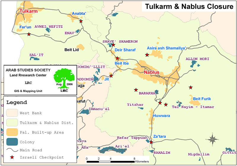
Map 2: Permanent checkpoints in Tulkarem and Nablus
Prepared by
The Land Research Center
LRC