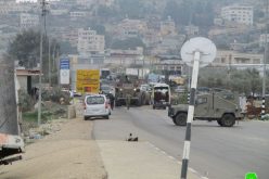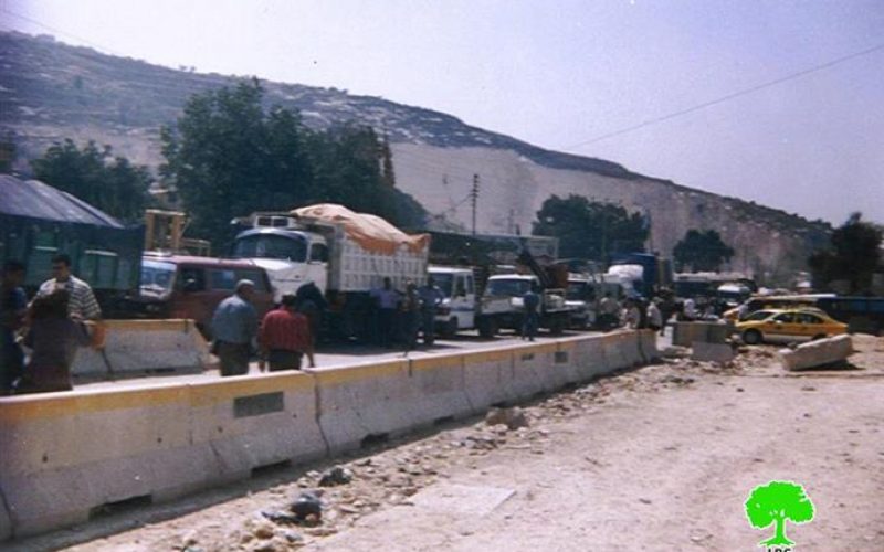
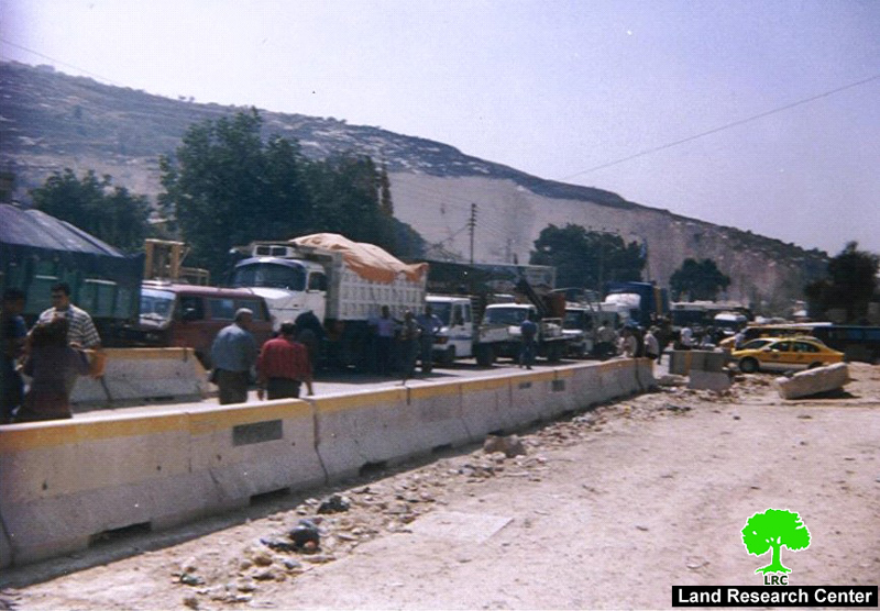
Photo 1: Palestinian vehicles queuing at Beit Iba checkpoint to the west of Nablus
The Israeli Occupation forces (IOF) continue to tighten their closure measures on the northern West Bank governorates of Nablus, Tulkarem, Tubas, Jenin, Salfit and Qalqiliya. This report focuses on the governorates of Nablus and Tulkarem.
The closure campaign coincides with the ongoing Israeli military onslaught which encompasses military break ins, killing, injury and detention of people, as well as confiscation of lands, building of the Wall, expansion of the colonies, destruction of infrastructure and collective economic punishment.
The Israeli closure measures include, among many others, detaining, delaying and returning people on checkpoints. Other measures, also, include setting up of sporadic and flying checkpoints, closing villages' entrances with earth mounds, iron gates and cement blocks, digging of roads and closing of alternative roads. Amongst the worst permanent checkpoints are the following:
1. Al Kafriyat at the southern entrance to Tulkarem city;
2. Anabta checkpoint on the road between Nablus and Tulkarem;
3. Beit Iba at the north western entrance to Nablus city;
4. Sahvei Shomron ( Deir Sharaf) checkpoint on the main road between Nablus and Jenin;
5. Asira Ash Shamailiya between Nablus and Jenin;
6. Huwwara on the main road between Nablus and Ramallah;
7. Awarta checkpoint between Nablus and Ramallha;
8. Za'tara (Tabbuh) checkpoint between Nablus and Ramallah.
9. At Tur ( Mount Gerezim) checkpopint between Nablus and Ramallah;
10. Beit Furik checkpoint between Nablus and Beit Furik.
11. Jit Checkpoint which connects Nablus with Tulkarem and Qalqiliya.
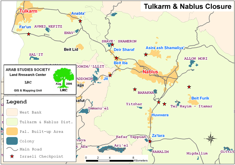
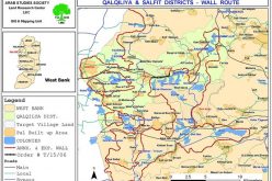
(Map 1: Permanent checkpoints in Tulkarem and Nablus )
Everyday, a big number of people from all walks of life are detained for long hours at these two checkpoints before they are asked to go back from where they came from.
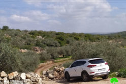
Closing of Ramin alternative road
As a result of erecting a permanent checkpoint on the main Nablus �¢?? Jenin road near Shavei Shomron settlement close to Deir Sharaf village, Palestinians have been obliged to use the alternative road through Ramin village (see the attached map) to reach Jenin. Recently, the IOF closed this alternative road through Deir Sharaf village with earth mounds and rocks and erected a military watch tower at the scene to prevent any Palestinian crossing.
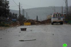
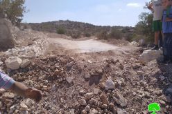
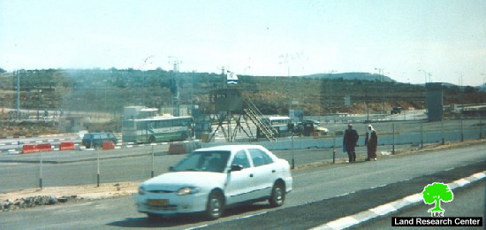
Closure of Al Bathan road
On the other hand, on April 1st, 2006, the Israeli army's bulldozers cut off the Wadi Al Bathan road linking between Nablus and the northern districts of Jenin and Tubas with earth and rock mounds. The Wadi Al Bathan road, also, connects Nablus with Al Jiftlik area in the Jordan valley rift where the West Bank food basket is located.
(Photo 2: Al Bathan road dug up by Israeli army's bulldozers)
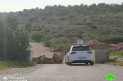
Erection of an iron gate
At the beginning of August, 2006, the IOF started to expand the checkpoint near Anabta town on the main road between Nablus and Tulkarem. A military tower, an iron gate and more cement blocks were added to this checkpoint. The newly erected iron gate is now opened at the whims of Israeli soldiers manning the checkpoint. If they close it the whole Palestinian movement is paralyzed at this vital road.
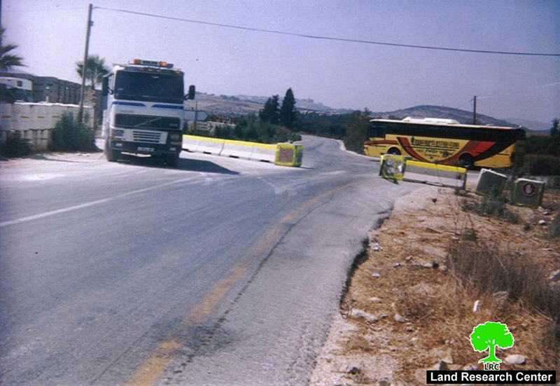
(Photo 3: Anabta checkpoint after fortifications)
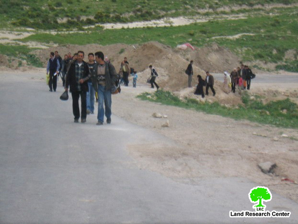
Za'tara (Tabuh ) checkpoint
It is one of the most difficult checkpoints in the area. It is located 9 km to the south of the city of Nablus on main road number 60. It has been established over lands confiscated from the village of Hawara, Nablus district and the village of Iskaka, Salfit district. The Za'tara junction is a linking point between the northern governorates of Jenin, Tulkarem and Nablus, on one hand, and the southern governorates of Ramallah, Jerusalem, Bethlehem and Hebron, on the other hand ( road number 60). It, also, links between the western governorates of Qalqiliya and Salfit and the eastern governorates of Jericho and the Jordan valley region ( Trans Samaria high way number 505). Therefore, it occupies a strategic location in the heart of the West Bank.
(photo 4: A Palestinian man and his lady walking at Za'tara permanent checkpoint)
From the beginning of the year 2004 until the end of October, 2005, the checkpoint had been functioning for Palestinian traffic, but only upon valid passing permits from the Israeli military for cars and passengers.
Checkpoint impact on Palestinians
1. Separating between Palestinian populated areas in the governorates of Tulakerm and Nablus, on one hand, and between them and other governorates of the West Bank, on the other hand.
2. Creating big traffic jams at these checkpoints;
3. Inaccessibility to work places;
4. Insulting, beating and detaining people for many hours;
5. Paralyzing economic and social life in the area;
6. Increasing the feeling of depression and frustration amongst Palestinians.
Prepared by
The Land Research Center