Inside:-
- Bethlehem Governorate
- Bethlehem Governorate under the Oslo Accord
- Israeli Colonization Activities in Bethlehem Governorate
- Israeli expansion plans in Bethlehem Governorate
- Bethlehem Governorate and the Israeli Western Segregation Wall
- Of the Israeli Eastern Segregation Zone in Bethlehem Governorate
- Israeli Checkpoints (obstructions) in Bethlehem Governorate
- Terminals in Bethlehem Governorate
-
To recap
Bethlehem Governorate
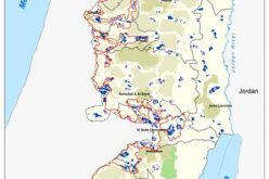
Bethlehem Governorate lies in the southern part of the West Bank south of Jerusalem. It has an area of 608 Km2 and is home to 176,235 Palestinian inhabitants (PCBS, 2007). It has been targeted by the Israeli occupation since 1967 when 18.1 Km2 from its lands were unilaterally annexed by Israel to the illegally declared new municipal boundary of Jerusalem. However, since 1967, the owners of the “annexed areas” continued to access their land until the Segregation Wall plan came to existence.
Bethlehem Governorate under the Oslo Accord
Under the signed Oslo Accord, Bethlehem Governorate was classified to areas “A”, “B” and “C” as a part of withdrawal process to be completed before the end of 1999 prior to the instigation of negotiation over the final status issues. Table 1 illustrates the areas distribution and existing population for each:
|
Table 1: The Geopolitical Divisions of Bethlehem Governorate |
||||
|
Area |
Area in Km2 |
% |
Population |
% |
|
Area A |
47.64 |
7.8 |
96,754 |
54.9 |
|
Area B |
33.85 |
5.5 |
57,981 |
32.9 |
|
Area C |
423.98 |
69.7 |
21,500 |
12.2 |
|
Nature Reserves |
102.40 |
17 |
—– |
—- |
|
TOTAL |
607.87 |
100 |
176,235 |
100 |
Source: ARIJ GIS Unit- 2009
The table shows that almost 88% of the population inhabiting Bethlehem Governorate live in areas “A” and “B”, which’s total area; constitute 13.3 % (81.49 Km2) of the Governorate area, where the population density reaches 1899 person per 1Km2,, while the remaining population live within area “C” which constitutes 69.7% (423.98 Km2), where the bulk of the Governorate’s agricultural lands and the open space and future development areas exist and where the Israeli Army still enjoy full control and administrative jurisdiction over the land.
Israeli Colonization Activities in Bethlehem Governorate
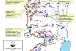
Israeli settlement activities in Bethlehem commenced following the 1967 war when Israel captured the Palestinian territory. Kfar Etzion was the first Israeli settlement established after the June 1967 war, followed by a propagation wave of Israeli settlements in the Governorate. Today, there are 20 Israeli settlements accommodating nearly 83,000 Israeli settlers infringed on the Palestinians’ lands in Bethlehem Governorate. These settlements are built on a total area of 19,151 Dunums (19.1 Km2), which constitutes 3.1 % of the Governorate’s area. Furthermore, in the years between 1996 and 2005, the Israeli settlers in Bethlehem Governorate established 19 locations, which came to known as settlements’ outposts.
Projected Israeli Plans in Bethlehem Governorate
-
Two neighborhoods added to Har Homa settlement
The Master Plan set by the Israeli municipality of Jerusalem (Master plan Jerusalem 2000) indicates the presence of two new neighborhoods added to Har Homa settlement located north of Bethlehem Governorate, one to its southeast and the other to its northwest. These new neighborhoods will have an approximate area of 1080 dunums. The Master Plan also indicates that the residential area of Har Homa is planned to inflate to 1410 dunums that is an increase by 350% than its current seize of 400 dunums. Har Homa and the additional neighborhoods are to set on an overall 2500 dunums of land.
-
Giv'at Yael Settlement
In June 2004, private initiatives made by the Israeli Municipality of Jerusalem (status unrecognized) to illegally build a new Israeli settlement on 2000 Dunums (According to Israeli sources) of agricultural lands that belong to Al-Walajeh, Battier and Beit Jala residents west of Bethlehem Governorate. However, the total land area threatened to be confiscated to construct this settlement project is 4111 dunums; out of which, 1766 dunums are located within Jerusalem illegal boundaries and 2345 dunums from Beit Jala, Battier and Al-Walajeh lands. The new initiative intends to create an Israeli settlements chain between Jerusalem and Gush Etzion settlements Bloc (southwest of Bethlehem Governorate)
as a part of the ''Jerusalem Envelope'' plan to encompass as much land as possible and to increase the number of Jews within Jerusalem illegal boundaries to create facts on the ground to alter the demographic status of the city and influence the outcome of future negotiations regarding Jerusalem as stated by Jerusalem Deputy Mayor Yehoshua Polak ('We want as many Jews as possible in Jerusalem to influence the demographic situation').
The new Israeli settlement to be; will hold the name of ''Giv’at Yael'' is set to include some 20,000 housing units and accommodates more than 55,000 Jewish settlers.
This settlement will physically complete the ring of settlements that separate Jerusalem and encircle Bethlehem starting at Har Homa extending to Gilo and Har Gilo, linking with the planned Giv’at Yael and continuing to “Gush Etzion” bloc in the southwest.
Bethlehem Governorate and the Israeli Western Segregation Wall
In Bethlehem Governorate, the Segregation Wall extends across 78 kilometers starting at the eastern rural area north of Al-Khas village and runs south to reach Um Al-Qassies village; it then extends towards the west, bypasses the southern part of Abu Ghniem mountain north of Beit Sahour, before it continues northwest of Bethlehem and Beit Jala cities and westward to run along bypass road #60 south of Al-Khader village, it then runs southeast towards Wad Al-Nis to encompass Efrat settlement.
After which, the route of the Segregation Wall moves further south and southwest to isolate and Segregate the western rural area of Bethlehem Governorate along with what is known as the Gush Etzion settlements Bloc, which also include 8 Palestinian communities (population exceeding 22,000 Palestinians) within the western Segregation Zone that will effectively become inaccessible to other Palestinians who are not residents of these communities.
Another Palestinian village stands to face total isolation but not included with the western rural area, is Al-Walajeh village, which will be enclosed and cut off by the Segregation Wall from all of its sides with a single but guarded and monitored exit to access Bethlehem.
Table 2 details the Segregation Wall status in Bethlehem Governorate. In Bethlehem Governorate 160,647 dunums (160.6 km²) of lands will be segregated behind the Wall. Also, the Segregation Wall confines the western rural villages of Battir, Husan, Nahalin, Wadi Fukin, Al Jab'a, Khallet 'Afaneh, Khallet Beit Sakaria and Khallet Al Ballutah in a large canton, in addition to placing the village of Al Walajeh in an isolated canton by sealing it off with a wall from three directions, east, west and north while sealing it off with a protection road from its southern direction, that will run along bypass road number 436, and will be protected from both sides with barbed wires and ditches.
|
Table 2: Status of the Israeli Segregation Wall in Bethlehem Governorate |
|
|
Wall Status |
Length (Km) |
|
Existing Sections |
26 (Km) |
|
Planned Sections |
45 (Km) |
|
Under Construction Sections |
7 (Km) |
|
Total Wall Length |
78 (Km) |
|
Of total Wall length runs on the Green Line = 3.2 (Km) |
|
Source: ARIJ GIS Database – 2009
Any movement from or to these villages (isolated cantons) will be controlled completely by the Israeli occupation forces. These residents (population 22000+) will be segregated from their lands, livelihood, and vital social services that are only found in the city centers east of the Wall such as hospitals, schools and universities.
Of the isolated lands in Bethlehem Governorate, 20,575 dunums are agricultural lands in addition to 2900 dunums of forests, as most of the agricultural lands in the cities of Beit Jala and Al Khader and the only recreational forest will be segregated. Entrance to the isolated agricultural lands will only be for farmers who are able to prove landownership through a credited Israeli organization (most likely to be the Israeli civil administration) and only the owners whose names listed in the ownership deeds (usually the eldest of the families) will receive permits. Furthermore, the Israeli civil administration will only issue permits on seasonal basis. Hence the owners will find a hard time to manage the cultivated lands on their own especially that the permits do not include additional labor or equipments.
Of the Israeli Eastern Segregation Zone in Bethlehem Governorate
The eastern part of Bethlehem Governorate lies within the West Bank’s eastern Segregation Zone. This area extends from Bethlehem’s eastern slopes to the western shores of the Dead Sea. This sparsely populated eastern section covers a total area of 299 Km², (49% of the total Governorate area). The reason for this small population is that the vast majority of the land was declared closed military area/ or nature reserve area by the Israeli Government since 1967. Accordingly, the Israeli Army prohibited any kind of development to that area, utterly became inaccessible to Palestinians.
Israeli Checkpoints (obstructions) in Bethlehem Governorate
Bethlehem Governorate is no different from any other Palestinian governorate. It is chained with all sorts of Israeli checkpoints or obstructions to indicate all forms used by the Israeli Army to restrict the Palestinian’s movement, which include: cubical cement roadblocks, earth mounds, manned checkpoints and agricultural gates, tunnels, secondary roads iron gates, etc. Prior to the year 2000, Bethlehem Governorate had only 2 permanent checkpoints located at the outskirts of the Governorate, on the entry points to Jerusalem. The obstructions multiplied over the past 8 years to reach a record of 59 different forms of obstructions in the year 2005, and today in 2009, it stands at 48 different kinds of checkpoints.
Table 3 lists the number and various types of obstructions established by the Israeli Army to restrict and confine the movement of 176,000+ Palestinian residents of Bethlehem Governorate. The consequences of these actions on the economy of Bethlehem have been devastating; businesses have been forced to close and unemployment has increased to unprecedented levels, particularly the tourism sector, which is a major source of livelihood for many of Bethlehem’s residents, which stands literally paralyzed, thus affected the economic aspect, causing wide spread frustration.
|
Table 3:Israeli Checkpoints in Bethlehem Governorate |
|
|
Type of Checkpoint |
No. of Checkpoints |
|
Agriculture Gate |
4 |
|
Checkpoint |
7 |
|
Earth mound |
15 |
|
Observation Tower |
8 |
|
Road Block |
2 |
|
Road Gate |
2 |
|
Tunnel |
7 |
|
Planned Tunnel |
2 |
|
Partial Checkpoint |
1 |
|
Total |
48 |
Source: ARIJ GIS Database – 2009
Terminals in Bethlehem Governorate
In Bethlehem Governorate, the Israeli planted 6 terminals on the outskirts, their main function is to control movement of residents and commercial activities to and from Israel. 2 commercial terminals and 4 crossing terminals exist, 3 of which under construction (Mazmuria trade passage east of Beit Sahour town, Al-Khader passage west of Bethlehem city, Um Salamuna passage south of Bethlehem city), 2 of them are in the planning stage (Al-Walajeh Passage northwest of Bethlehem City, Al-Jab’a trade passage southwest of Jerusalem city) and Rachel (Gilo 300) at Bethlehem Northern Entrance of Bethlehem is already operational. Table 4 lists the terminals, location, status and their functions.
|
Table 4: The Israeli controlled Terminals in Bethlehem Governorate |
|||
|
Terminal’s Name |
Function |
Location |
Status |
|
Umm Salamouna |
Commercial |
South of Bethlehem |
Under Construction |
|
Rachel-Gilo 300 |
Crossing |
North of Bethlehem |
Operational |
|
Mazmurya |
Commercial |
East of Bethlehem |
Under Construction |
|
Al Walajeh |
Crossing |
North of Bethlehem |
Planned |
|
Al Khader |
Crossing |
West of Bethlehem |
Under Construction |
|
Al Jab'a |
Commercial |
Southwest of Bethlehem |
Planned |
To recap
The Israeli Segregation Wall acts as the final chapter and the sum up of the Israeli colonization activities during the past 4 decades of the Israeli occupation. It will leave Bethlehem Governorate in devastation and crippled with limited potential for development of the Governorate’s built-up area or for any other purpose. Overall, the Israeli Segregation Wall will effectively exclude some 12% of Bethlehem Governorate’s lands within the Western Segregation Zone (between the Wall and the Green Line) and even much larger area; some 49% within the Eastern Segregation Zone, which as stated earlier already declared by the Israeli Army as closed military area since 1967. Along with the nature reserve area; Bethlehem governorate stands to lose in total some 87% of its land area if the Israeli plans goes through.
The Israeli unilateral colonial activities in the Bethlehem Governorate constitute a belligerent acts against the Palestinians population. The encroachment of the Israeli Segregation Wall on Bethlehem lands is a growing danger that threatens the development, the sustainability, and the very existence of the Palestinian people as in throughout the occupied Palestinian territory. It does not only deprive the Palestinians from their valuable agricultural and grazing lands; but it also puts physical barriers to their natural growth and disconnects them from each other.
Despite international denunciation, Israel is proceeding with its unilateral plans to build the Segregation Wall, isolating and confiscating large tracts of Bethlehem Governorate’s lands. Eventually, Bethlehem will lose more than the physical link it has (or once had) with Jerusalem, but spiritually as well. Table 5 shows Bethlehem Governorate in the aftermath of the Israeli scheme.
|
Table 5, shows a look on what to become of Bethlehem Governorate under Israeli Unilateral activities to inflict facts on the ground. |
|||
|
Bethlehem |
Area 608 Km2 |
100% |
Remarks |
|
Palestinian control |
48 |
8 |
This include area “A” where Palestinians have comprehensive control |
|
Palestinian Semi- control |
30 |
5 |
This includes area “B” where Palestinians have administrative control. It also exclude 4Km2 located within the Segregated Zone |
|
Nature Reserve Area |
102 |
17 |
Under Sharm Esh Sheikh Memorandum (Phase Three of March 2000, the area was set to go under Palestinian control. However, Israel still maintain control on it to this day |
|
Israeli Segregation Zone |
73 |
12 |
Palestinian land isolated behind the Israeli Segregation Wall in the north, south, and western sectors of Bethlehem Governorate. It include 4Km2 of area “B” |
|
Israeli Declared Closed Military Area |
299 |
49 |
The area is located at the eastern terrains of Bethlehem Governorate |
|
Area “C” |
56 |
9 |
Area under Israeli control located east of the Israeli Segregated Zone and the west of the Nature Reserve Area and the Closed Military Area. Most likely to be negotiated to turn over to Palestinian control at the time the negotiation between the Palestinians and Israeli side in resumed |
|
|
|||
|
Total |
608 |
100 |
|
:::::::::::::::::
[1] settlements’ outposts, is a technique improvised by Israeli officials in cooperation with the Israeli settlers; under which the latter seize hilltops and certain locations in close proximity to existing settlements in order to annex the location to the settlement –if it exist within the master plan area of the settlements – all of which under the direct protection of the Israeli Army
Prepared by:
The Applied Research Institute – Jerusalem