Segregation

إلى قبر راحيل…طريق معبد بمعاناة الفلسطينيين
لم يكن القرار الصادر عن محكمة العدل العليا الإسرائيلية بتاريخ 3/2/2005 برد الالتماس المقدم من بلديتي بيت جالا و بيت لحم و سكان محيط قبر راحيل (مسجد بلال
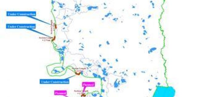
New sections of the Segregation Wall are being erected in Salfit …
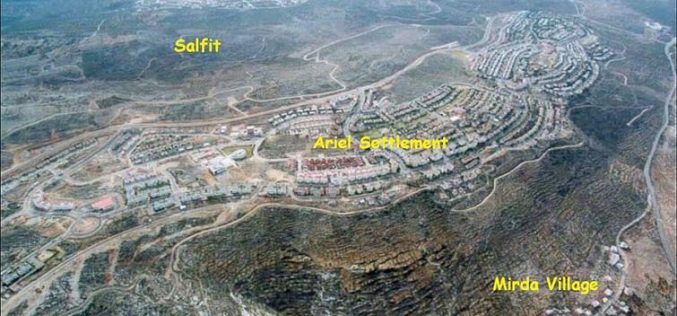
Salfit governorate lies in the northwestern part of the West Bank. It is surrounded by Qalqiliya Governorate from the north, Ramallah Governorate from the south, Nablus Governorate from the east
New disaster in Qalqiliya district …
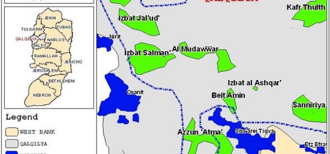
“The Striking effects of the Segregation Wall on Qalqiliya District”
Heavy rains that have fallen in Qalqiliya district during the past few days caused floods and marshes, destroyed almost 500 dunums of agricultural lands and dozens of Palestinian houses
Unveiling the real drive behind the Segregation Plan
'Delineating the borders of the Palestinian state' At last, Israel unveiled its true intentions of the Segregation Wall built along the West Bank western border and of the entire
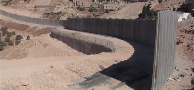
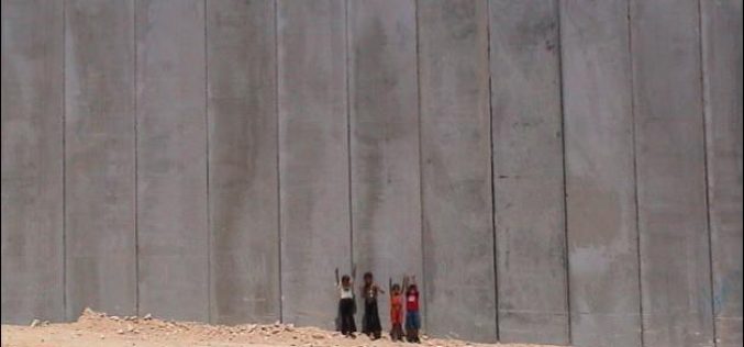
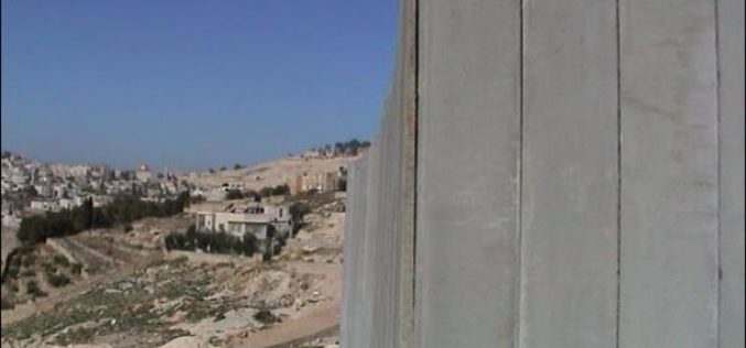
The Segregation Wall: Grave impacts and violation of Palestinians’ Rights
'A Live tragedy and endless Suffering ' In June 2002, the Israeli government began to build a Segregation Wall on the Palestinian lands in the West Bank and Gaza
Israel Misinforms the World with A New Plan for the Segregation Wall
In a surprising statement from Israeli official sources regarding the undergoing Segregation Wall built in occupied West Bank, a new route plan for the Segregation Wall have been put foreword
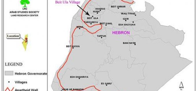
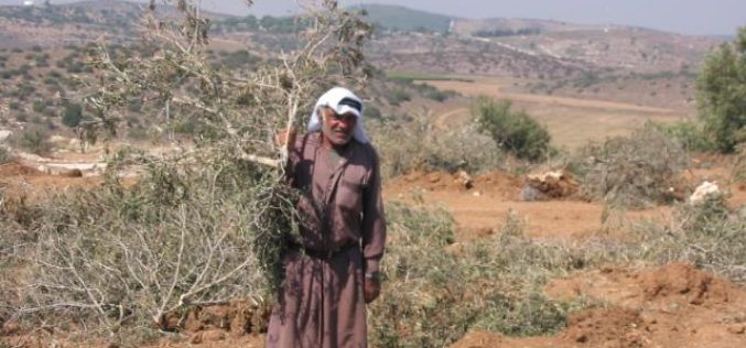
The Segregation Wall grabs agricultural lands of Beit Ula town
General introduction:- In case the Wall, with all its three stages, is erected it will transform the West Bank into three, unconnected cantons an area of which does
New Israeli Segregation Plans in Beit Sahour
Beit Sahour (The Shepherd's Field) Beit Sahour is a Palestinian town located 1 km east of Bethlehem and is the biblical location of the Shepherd's Field. The town, which was
Israel Isolates the Northeastern Sector of the West Bank
The Israeli Army closed-off the northeastern zone of the West Bank for no apparent reason and declared it as ''Military Zone'' where no one can enter or leave the area
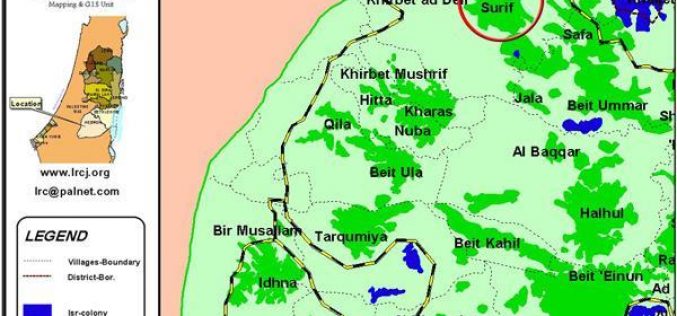
The Segregation Separation Wall hits the lands of Surif and Khibet Ad Deir- Hebron district
Location and population The village of Surif is located 16 km to the north west of Hebron city and about 6 km from the green line. It has
As Sikka village falls under Wall plan
Location and population The village of As Sikka is located about 20 km to the south west of Hebron city on the green line. Its land which is now
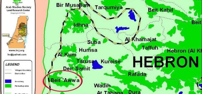
The Segregation wall in Beit ‘Awwa town- Hebron governorate
Beit 'Awwa is located near the green line to the south west of Hebron city in the West Bank. Its lands extend as far as the
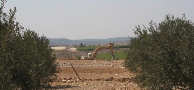
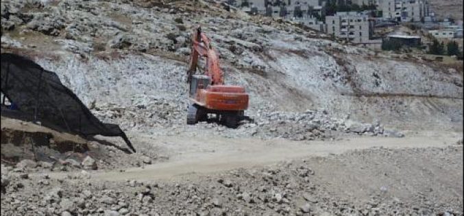
Constructing the Segregation Wall are in Deir Samit village – Hebron
The Israeli bulldozers and big hammers are working day and night in the construction of the Segregation Wall to the west of the village of Deir Samit in Hebron
Captives of the Israeli Segregation Wall……Western Rural Villages of Bethlehem District
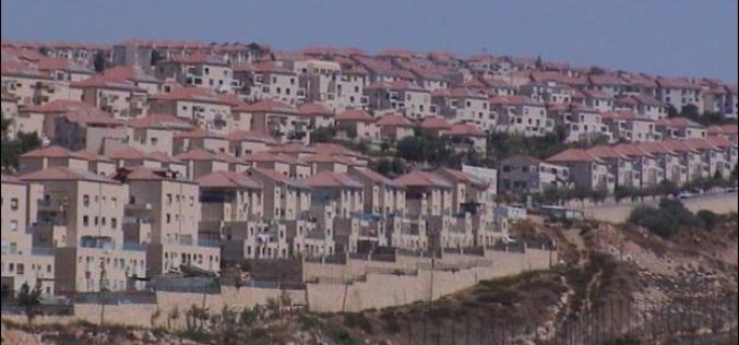
Following the 1967 war, Israel initiated its settlement program in the occupied Palestinian territories in spite of the fact that such program constituted a major violation to the international law,
الجدار الفاصل في محافظة بيت لحم
مقدمة: بيت لحم , مدينة فلسطينية عريقة ذات أهمية تاريخية و دينية لكافة الأديان السماوية, تعيش حالة من التفكك و الحصار نتيجة الاحتلال الإسرائيلي الذي عمل على عزل المحافظة
Hizma Eclipsed by the Segregation Wall
On the northeastern outskirts, approximately 4.5 miles from Jerusalem city, lays Hizma village on 10,400 Dunums (Arij GIS Unit) of land. Hizma is surrounded by five Palestinian villages; Anata,
Ar Ram: a Palestinian town facing the threat of the Segregation Wall
Ar Ram, a Palestinian town in east Jerusalem, located approximately 7 kilometers north of East Jerusalem city center. During the Roman period, this town was known as Al Ramah and
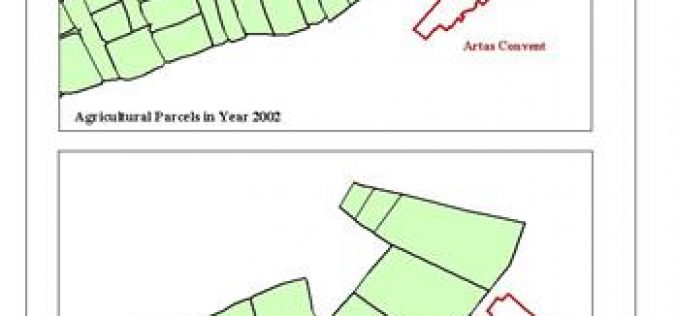
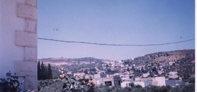
The Palestinian Village Artas Falls in the Vortex of the Segregation Wall
Artas village is an agricultural community situated 2.5 miles at the southwest entrance of Bethlehem district with a population of 3000 people, most of whom are farmers. The Word Artas
The remaining lands of Attayba village threatened by the Segregation Wall constructions
Location and population The border village of Attayba is located 16 km to the north west of Jenin city. In 1967, it had a population of 450 people.
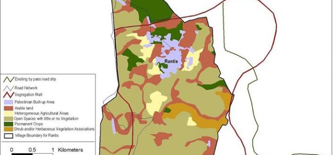
The Segregation Wall threatens the practice of territorial expansion in Rantis village
Rantis, is a small Palestinian village located to the northwest of Ramallah district in the Palestinian West Bank. It has a total population of 2688 inhabitants and a built up
Israeli Hoax of Barriers removal
During the second week of June 2004, the Israeli Army command declared that it removed some forty barriers throughout the Occupied Palestinian West Bank. According to the Israeli Army source,
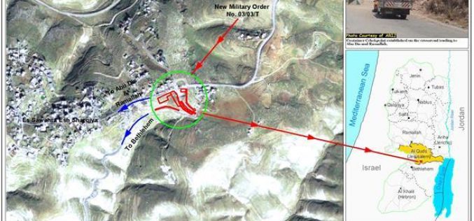
New crossing point on lands of As Sawahra As Sharqiya
During the past three and a half years, Israel has constructed more than 750 barriers in the West Bank dividing it into small cantons. All main and secondary roads connecting
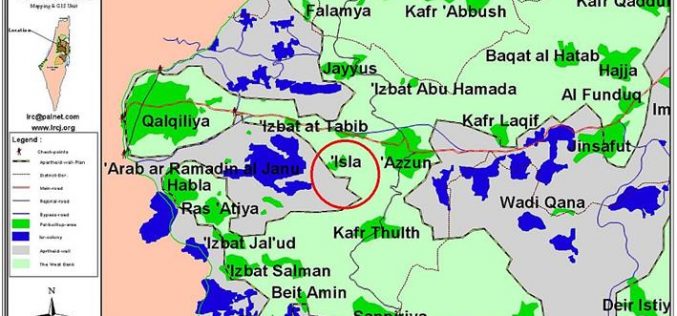
The Wall to strangulate Isla village
'Eighty percent of the land of Isla village has been confiscated or separated by the Wall construction' Location and Population The village of Isla is located 9 kilometers
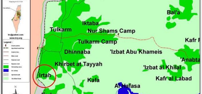
Irtah: a new border paralyzed by the Wall
Location and Population: The Tulkarem Neighborhood of Irtah is located exactly at the Green Line which qualified it to be a strategic trade point between the Governerate of
Barbed wires to Encircle Husan Village
On the dawn of Thursdays April 15, 2004, residents of Husan village were awakening by the thunderous blast of the Israeli Army bulldozers at the eastern side of the
