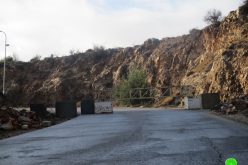
The Israeli occupation army issued a new military order converting the Wall gate number 753 – the main entrance to Jubara village, Tulkarem district – into an agricultural seasonal gate that opens only at specific times of the year. All the users of this gate were referred to At Tayba crossing terminal number 407. This decision affects the whole population of Khirbet Jubara as well as all the farmers from the nearby villages of Faro'un, ar Ras and Kafr Sur who own land inside the Segregation Wall. ( Photo 1)
Location, population and area
Khirbet Jubara is located 5 km to the south west of Tulkarem city and east of at Taybah town inside the green line. It's population mounts to 390, 90 % of them belongs to the nearby ar Ras village and the remaining 10 % to at Taybah town. Jubara'a total surface land is 3253 dunums of which 171 are built up area 80 % of which is registered in the name of ar Ras village (source: GIS department at LRC). After the establishment of the Segregation Wall in 2003, the village was completely isolated from its surroundings. In addition, the lands of the nearby Faro'un, ar Ras and Kafr Sur villages were also isolated.
Khirbet Jubara and its struggle against the Wall
The Wall tragedy in Khirbet Jubara started in April, 2002 when the Israeli occupation army (IOA) issued the first version of the military order number T/90/04 and started to bulldoze 500 dunums of land to set up the Wall around the Khirbet without including it inside the Wall. After destroying the 500 dunums mentioned above, the IOA changed their plan and decided to get the whole Khirbet inside the Wall. To do so, another 300 dunums were bulldozed and the older path dismantled inflicting heavy losses in lands and property which transformed the Khirbet into a disastrous one.
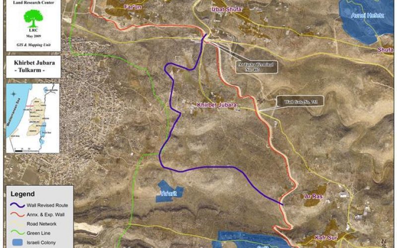
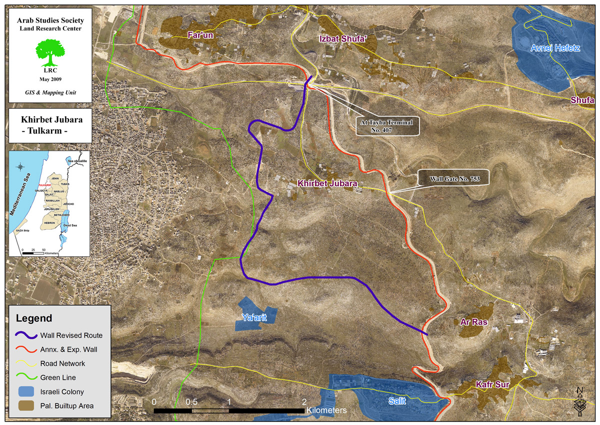
At the end of 2002, the Khirbet's local council levied a case to the Israeli high court demanding a removal of the Wall or a retreat to 1967 borders. In 2004 a response came from the Israeli side according to which a new Wall path was marked near the homes of the Khirbet separating behind almost all the lands of the Khirbet. This modification was objected again by the local council at the Israeli high court who decided in June, 2006 to withdraw the Wall path towards the green line, but still, 70% of the Khirbet's land is targeted for separation behind it (see the Wall revised route in the above picture-map in violet color). However, This Wall revision hasn't been implemented yet and the whole Khirbet is still inside a big enclave.
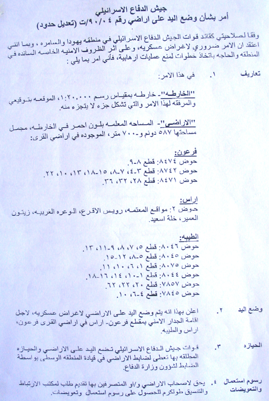
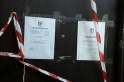
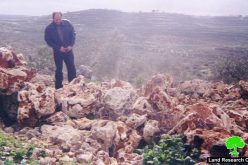
( Photo 2: copy of the military order on the Wall revision in Khirbet Jubara dating back to 2006)
Details of the latest repressive move
The latest move in this series came at the beginning of April, 2009, when the Israeli high court surprised the people of Khirbet Jubara and the nearby villages of Faro'un, ar Ras and Kafr Sur by asking them to use the crossing terminal of at Tayba number 407 instead of the Wall agricultural gate number 753. The heads of the local village councils were informed, through Israeli 'legal' institutions and lawyers, of the decision of the high court without giving any reasonable justifications. The court considered it a formal decision that will come into practice at the begging of May, 2009. The people who used to pass through Gate 753 will convert their path to Al-Tayba crossing which is a commercial and human one mainly used by Palestinian laborers crossing on daily bases to their workplaces inside the green line.
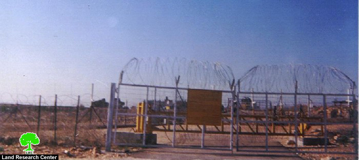
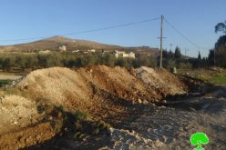
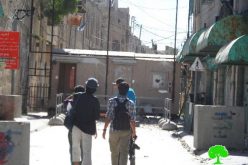
( photo 3: Wall gate number 753)
Mr. A'id Yassin, the head of ar Ras local council and his brothers own 120 dunums of land inside the Wall cultivated with olives and vegetables. In an interview with LRC field researcher he said the following: ' This decision is unfair and unjust to me and to all the farmers in the four villages. The distance between my Village and our isolated lands through gate 735 is only 2 Km in compare to 9 km through at Tayba crossing terminal according to the new decision. This situation will increase the suffering and the hardship of the farmers of ar Ras and of Kafr Sur villages. Kafr Sur is 4km far from the Wall gate number 753 while the distance through at Tayba crossing terminal into the village land will be more than 16km. When the Israeli occupation built the Segregation Wall on the land of Kafr Sur Village they didn’t fix any agricultural gates in that section. To reach their land the people of Kafr Sur are now obliged to make this 16 km long circle going north and then south into their land which is actually located few meter from the village houses'.
This latest development will increase the constraints and the daily suffering of the people. It will impose a new reality on the ground which will make the contact between the farmers and their lands very difficult. This step, eventually, will lead to a further step of total land confiscation and annexation.
The affected village councils aim to submit an objection to the Israeli high court responsible for issuing this oppressive decision, however, no big results are expected by the victims.
Related case studies
1. Wall episode in Khirbet Jubara: Continuous land destruction 25,July,2006;
2. Jubara: A Prototype Aftermath of the Israeli Segregation Wall 09, November,2005;
3. The impacts of the Segregation Wall on Khirbet Jubara, Tulkarem 01,March,2005.
4. The Re-Routing of the Israeli Racist Isolation Wall Devours More Land of Jabara village
5. A new Israeli master plan for Khirbet Jubara confines Palestinian construction
Prepared by:
The Land Research Center
LRC